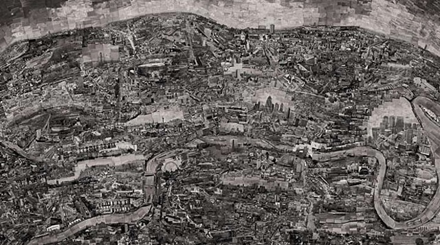
Japanese photographer Sohei Nishino created these wonderful pieces of art by actually using individual pictures of landmarks and locations to map out the city. Nishino walks around each city for months and takes the photographs himself. It’s a map that shows you the actual city, not just an outline.
The Diorama Maps are made from Nishino’s experience of travelling around a city. He sketches a rough outline of the city’s layout and then cuts up pictures and glues them into a map. It’s not going to be completely accurate, but you can definitely see the shape and more importantly the soul of the city come to life with his maps.
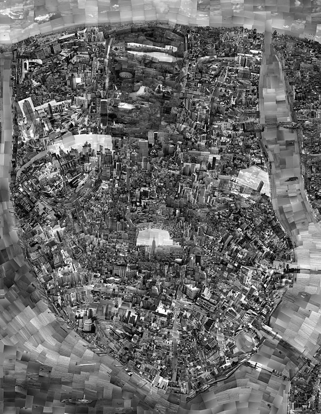
New York, New York
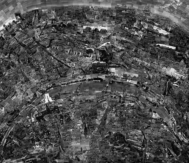
Paris
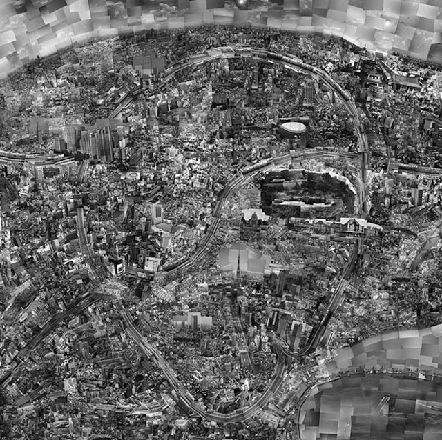
Tokyo
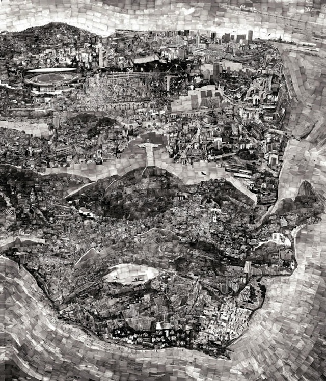
Rio de Janeiro
[Sohei Nishino via PetaPixel]