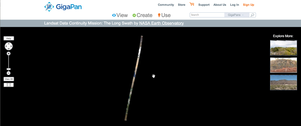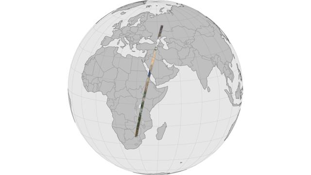
In April NASA’s Landsat Data Continuity Mission took a huge panorama. From 705km above the Earth, the satellite shot a 10,000km-long, 200km-wide strip of planet from Russia to South Africa. It is aptly named ‘The Long Swath.’ Oh and it’s 19.06 gigapixels.
Since the Landsat moves at 27,000km an hour it only took about 20 minutes to shoot the whole thing. That means that unlike satellite images on Google Earth or elsewhere that are taken over time and patched together, the swatch is actually pretty representative of what was happening at basically the same moment everywhere along a 10km path. It’s amazing to see the different geographic conditions along the route, from icy rivers to lush forests to desert.
NASA Earth Observatory put the data together in a number of different ways, so you can explore it however you want. There’s an accessible tour (complete with culturally sensitive music), a 15-minute version, an interactive option on Gigapan, and a way to load it in Google Earth. Go nuts! [NASA Earth Observatory via PetaPixel]