Here’s the thing about the emissions which cause global warming: You can’t see them. Picarro wants to use a Google Streetview-like fleet of vehicles loaded with the company’s technology to drive around cities measuring emissions so that the gasses can be plotted onto detailed 3-D maps.
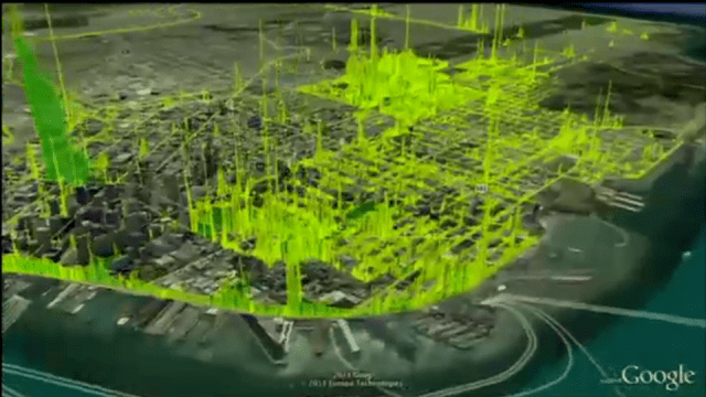
It turns out that while we have data about emissions at the atmospheric scale, measuring them at a small scale is actually really hard. That’s where Picarro’s CRDS analyzer comes in, reports TreeHugger. The CRDS analyzer is basically an infrared sensor that can “see” the emissions from a particular source. Take for example, the above visualisation of emissions in San Francisco. As the emissions-sniffing cars drive around a city, analyzer on board, they beam information back via satellite. This information can then be used to make crazy maps that show the way emissions are ejected from sources over time.
To test the technology — and show it off to the world — Picarro launched the City Carbon Project last month at the World Economic Forum by measuring the impact of the event itself. The surprise? Emissions in Davos actually went down during the forum. [Picaro via TreeHugger]