mapping
-

Why Does The U.S. Defence Department Need A Huge Underground Facility By Friday?

Darpa is often described as the “mad science” wing of the U.S. Defence Department. They’re the ones who have a history of working on cutting edge technology for the military like virtual fences, disaster relief robots, and the invention of the internet itself. They even tried to build Skynet in the 1980s.

-
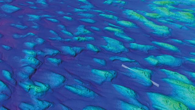
Stunning New Atlas Shows The Polar Seafloor Like We’ve Never Seen It

An unprecedented collaboration involving 20 countries, 75 institutions and over 250 marine geologists has yielded a new atlas that’s providing our best glimpse yet of the seafloor at both polar regions of the planet. The images are of significant scientific value, but they’re also quite beautiful.
-
Uber Is Creating Its Own Maps Service

One of the major elements to Uber is maps, and the transport app currently utilises a mix off mapping technologies, including Google Maps. One of those technologies is now its own, with Uber rolling out its own mapping cars to develop more tailored functionality for drivers and passengers.
-
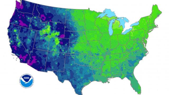
The Fascinating Reason Why The Coldest Days Of The Year Vary So Wildly In The US
Statistically, the coldest days of the year should be a pretty simple thing to map. So why does this map look so splotchy?