Weather geeks went wild last week when the US National Weather Service announced that the Carr Fire near Redding, California had spawned the equivalent of an EF-3 tornado on July 26. And for good reason: Fire tornados are among the rarest weather phenomena on Earth and this vortex had the added distinction of possibly being the strongest tornado-like thing in California’s history.
But more interesting than what we know about the wild-sounding event is what we don’t. Arizona State University fire historian Stephen Pyne told Earther there have been references to fire tornados since the 19th century, but only one other such event has been well-documented to date. Consequently, we have only a basic understanding of how and why fire tornadoes form.
We know a lot more about their garden-variety cousins, fire whirls, which form by the dozens on wildfire fronts. (A rather spectacular one was captured by firefighters battling a blaze near Derbyshire, England on Tuesday.) Similar to dust devils, these whirls develop when turbulent, rotating air gets stretched vertically by an updraft.
They only last a few minutes and top out at about 45.72m in height, according to Weather Underground meteorologist and blogger Bob Henson, who penned a detailed explainer about the recent fire vortex.
“They’re basically wind shear that gets tilted up”, Craig Clements, director of the Fire Weather Research Laboratory at San José State University, told Earther.
Incredible capture of a pyrocumulus cloud associated with the #CarrFire over Redding, CA. (Image credit: Jim Mackensen) pic.twitter.com/nMJPgkYNqx
— Jackson Dill (@Jackson_Dill) July 27, 2018
A fire tornado shares some features with a fire whirl but quite literally takes things to new heights. These rotating columns of air are, by definition, connected both to a cloud system above and the ground below. So-called pyrocumulus clouds (and pyrocumulonimbus thunderclouds) form as hot air rises above a wildfire’s smoke plume, cools and condenses, creating the potential for a tornado to form. But these clouds typically only emerge at high altitudes due to the intense heat of the flames.
What that means is that any vortex connected to both a fire-generated cloud system and the ground is going to be big. According to Clements, the one that formed inside the Carr Fire on the evening of July 26 was associated with a pyrocumulonimbus system that extended tens of thousands of feet up into the stratosphere.
Exactly how the tornado-like vortex spun up is still being worked out and we may never be totally sure. University of Nevada Reno atmospheric scientist Neil Lareau put together an analysis based on Doppler radar data that suggests it formed like a landspout tornado, with an area of horizontal wind shear near the ground getting stretched vertically by a powerful updraft and eventually connecting with the cloud system above.
Others have described the firenado’s formation as similar to that of a more powerful supercell tornado, which is generated by rotating updrafts within thunderstorms.
Henson told us he thought the vortex could have had elements of both supercell and landspout tornado.
“This is definitely about as strong as you’d expect a landspout-type tornado to get”, Henson said. “That’s why it feels like a hybrid to me”.
Here is another radar rendering of the #CarrFire plume during the destructive vortex. The plume undergoes rapid vertical development, growing from 6 to 12 km (19->39Kft) in 40 min. Thats a lot of stretching and a possible explanation for vortex intensification. #CAwx #CAfire pic.twitter.com/1CTHAvl6Di
— Neil Lareau (@nplareau) July 29, 2018
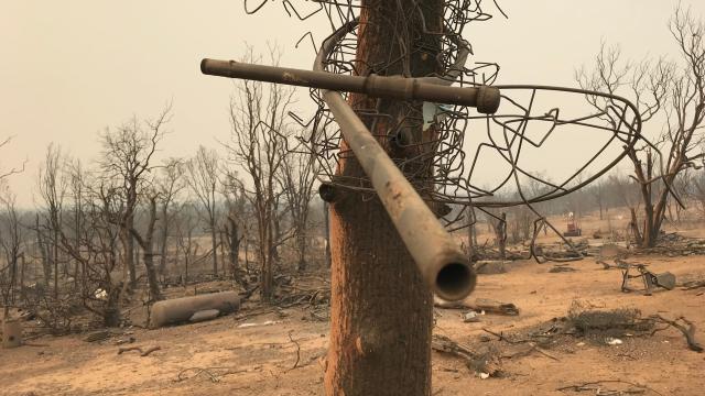
Either way, the vortex was a beast. A preliminary analysis by National Weather Service and CalFire estimated maximum wind-speeds in excess of 230km/h, making it the equivalent of an EF-3 on an intensity scale of 0-5. The twister lasted over an hour, toppling power lines and uprooting trees.
To some, the freak event felt like an harbinger of a hotter, more dangerous future. But while climate change is having a clear impact on fire season, connections to rare fire tornado events are more tenuous. As Clements put it, “if it was just climate and fuel driving tornados, every fire would have a tornado”.
He suspects that fire tornados come from some combination of loads of vegetation fuel — which generates the intense heat needed to create powerful updrafts — and the right topography. In the case of the very large, very intense Carr Fire (which is still only about 50 per cent contained), air flows racing through gaps in the mountains near Redding in the late afternoon on July 26 might have provided the necessary wind shear to set things off.
Clearly, there are a lot of unanswered questions. But future research could help fill in the gaps. Clements’ group uses a mobile weather lab — a 4×4 pickup truck outfitted with a scanning Doppler LIDAR instrument, weather balloon sounding system and a portable meteorological station — to study fire weather up close.
The system has revealed never-before-seen structures inside wildfire plumes and offered insight how pyrocumulus clouds form. And it’s getting an upgrade this fall, with the addition of a Doppler radar-equipped pickup truck that will allow them to detect plumes from farther away and at a higher resolution.
But what exactly spawned the Carr Fire’s epic display last month could be an enduring mystery. Clements lamented that by the time his team got to the scene several days later, they were only able to snap photographs.
“If we were there [during the tornado], wow”, he said. “That would be a dataset for a lifetime”.