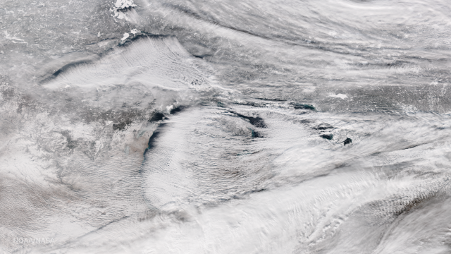
A stunning true-colour satellite image taken yesterday shows the Great Lakes in the US shrouded by lake-effect snow clouds. It’s a glorious example of this meteorological phenomenon in action.
This image of the Great Lakes was captured by the the NOAA/NASA Suomi NPP satellite’s Visible Infrared Imaging Radiometer Suite (VIIRS) instrument. (Image: NOAA/NASA)
This image was captured by the Suomi NPP satellite, and it shows bands of lake-effect snow clouds as they drift eastward from the western Great Lakes. Parts of northern Ohio and New York state got hammered last night, receiving as much as 23cm of snow accumulation. Weather forecasters expect the snow to continue into tomorrow, dumping an additional 23cm of snow.
Thousands of south towns residents are digging out after a lake effect storm hit the area. The latest ahead on @news4buffalo as you Wake Up pic.twitter.com/p7DiZzwJVz
— Ali Ingersoll (@AliIngersoll4) January 6, 2017
Lake-effect snow happens when cold air passes over the warmer waters of a lake, causing some lake water to evaporate into the air and warm it. This warm, wet air rises, and then cools as it gets further away from the lake. During this cooling process, the moisture is released and, if it’s cold enough, it turns into snow. And as residents who live east of these giant lakes can attest, it can result in tremendous amounts of snow.
[NOAA]
