Located in Utah, the Great Salt Lake is the largest saltwater lake in the Western Hemisphere, but years of drought and over-irrigation of nearby rivers have resulted in dramatic declines in water levels. New satellite photos reveal the disturbing extent to which this ecologically sensitive lake is shrinking.
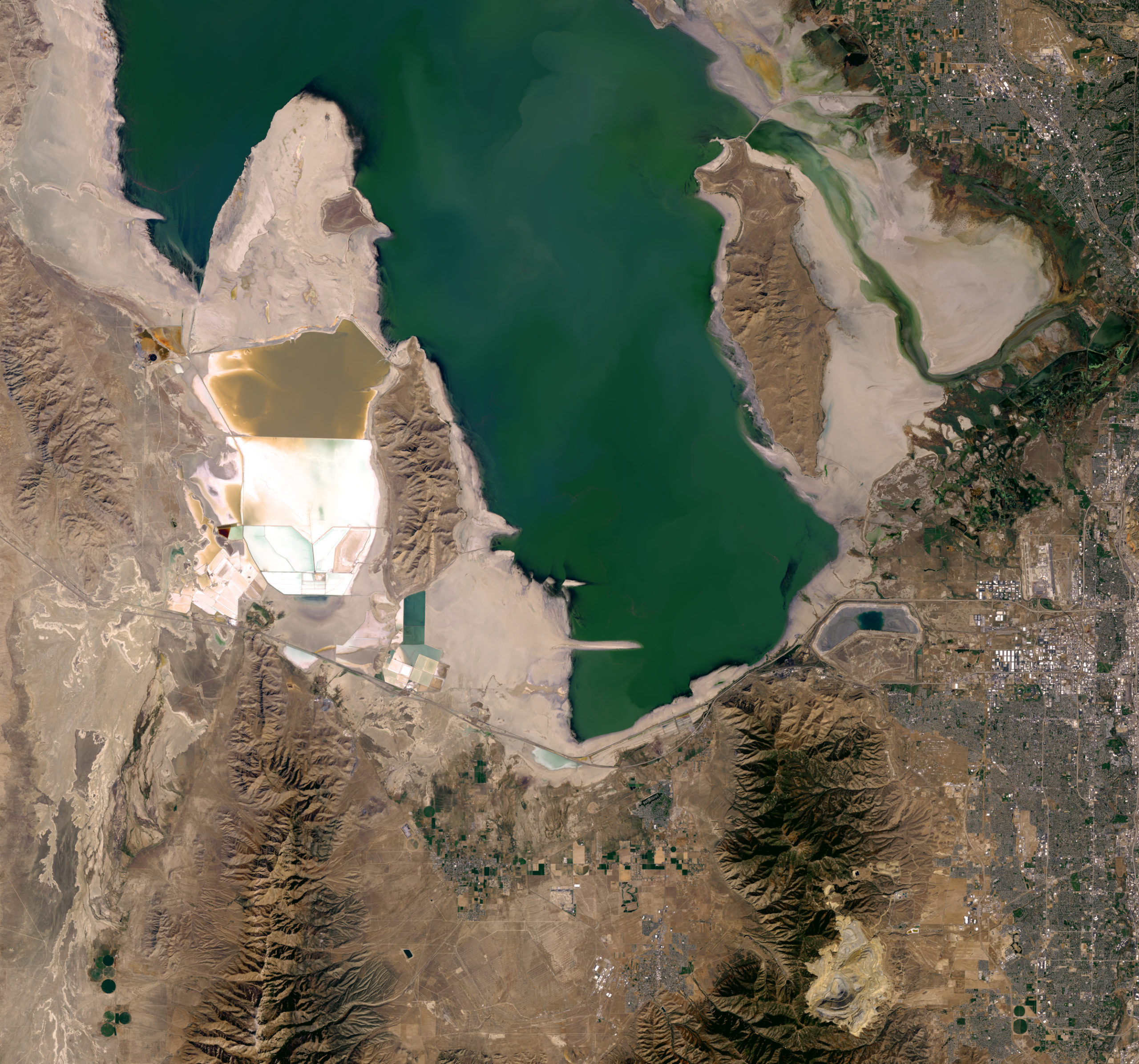
Before-and-after images taken in 2011 and 2016 show dramatic reductions in the Farmington Bay basin of Great Salt Lake. (Image: Joshua Stevens/Landsat/US Geological Survey)
Typically, this iconic lake covers an area of around 4400 square km, so it’s not going to disappear any time soon. But the lake is drying up and shrinking; in October 2016, the Great Salt Lake reached its lowest level in recorded history, covering an area of 2700 square km.
Water level height is currently averaging around 1277m, which is a reduction of 3.4m since 1847. The lake’s volume has shrunk 48 per cent over the course of this time – the result of a recent five-year drought in the region, higher than normal temperatures and farming practices that extract water from feeder river systems.
The Great Salt Lake is the world’s eighth-largest terminal lake, that is, lakes that don’t leak out any water other than through the process of evaporation. This is why the Great Salt Lake has such a famously high salt water content. But it isn’t “America’s Dead Sea” as popular culture would lead us to believe. This critical water basin provides a habitat for millions of native birds, brine shrimp, shorebirds and waterfowl.
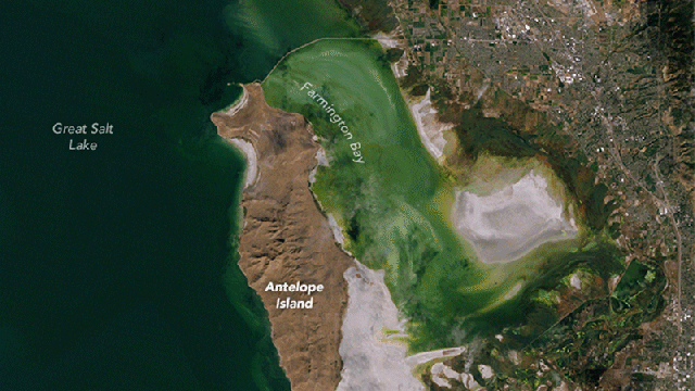
Landsat satellite image taken on 11 September 2011. Farmington Bay can be seen top right. (Image: Joshua Stevens/Landsat/US Geological Survey)
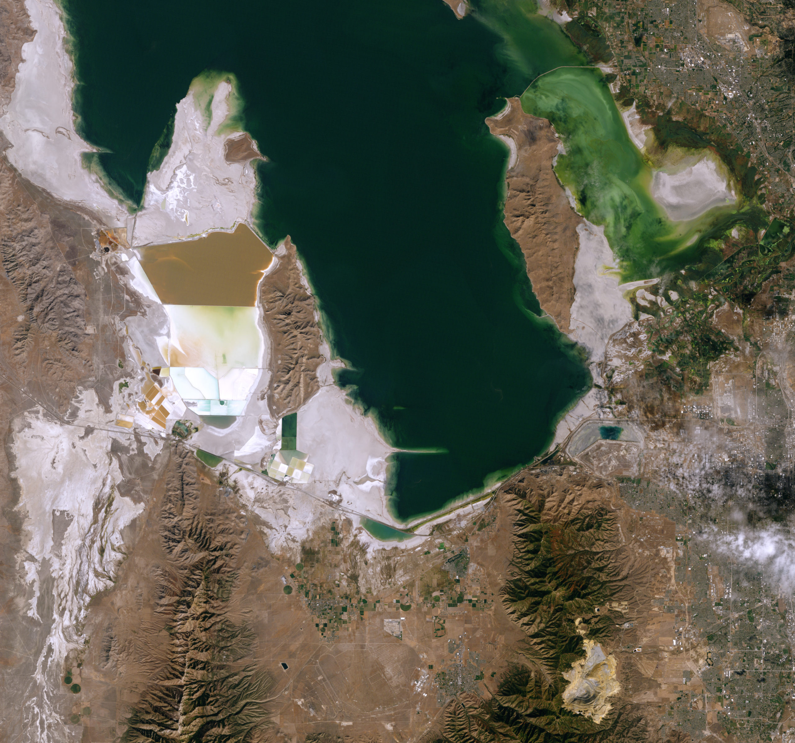
Landsat satellite image taken on 20 September 2016. (Image: Joshua Stevens/Landsat/US Geological Survey)
Satellite photos taken by Landsat 8 show recent changes in the Farmington Bay basin of the Great Salt Lake. More than three-quarters of the lake bed is now exposed in Farmington Bay. The increasingly exposed shoreline has resulted in more and larger dust storms, making it more difficult for companies to get the water required for extracting salt and other minerals.
Recent research shows that river flow into the basin has dropped nearly 40 per cent since the mid-19th century. The state of Utah has asked its citizens to cut back on water use, but that only accounts for eight per cent of total water use in the region, the vast majority (63 per cent) going to farming. The challenge moving forward will be to convince farmers to do more with less, given a growing population.