Using an unprecedented technique of matching stars to the locations of temples on Earth, a 15-year-old Canadian student says he’s discovered a forgotten Maya city in Mexico. Images from space suggest he may actually be onto something — but experts say it’s something much simpler.
William Gadoury, a teen from Saint-Jean-de-Matha in Lanaudière, developed an interest in archaeology after the publication of the Maya calendar announcing the end of the world in 2012. After spending hours poring over diagrams of constellations and maps of known Maya cities, he noticed that the two appeared to be linked; the brightest stars of the constellations overlaid perfectly with the locations of the largest Maya cities. As reported in The Telegraph, no other scientist had ever discovered such a correlation.
Here’s how he discovered the lost city: After studying 22 different constellations, Gadoury noticed that they neatly corresponded to the locations of 117 Mayan cities located in Mexico, Guatemala, Honduras and El Salvador. When looking at a 23rd constellation, he was able to match two stars to known cities — but a third star remained unmatched. Using transparent overlays, Gadoury pinpointed a location deep in the thick jungles of the Yucatan Peninsula in Mexico.
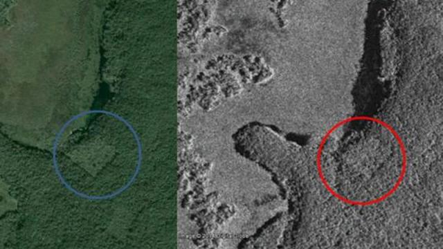
Google Earth and satellite photos show what looks to be a cluster of structures. (Image: Google Earth, CSA)
“I did not understand why the Maya built their cities away from rivers, on marginal lands, and in the mountains,” explained Gadoury in Le Journal de Montreal. “They must have had another reason, and as they worshiped the stars, the idea came to me to verify my hypothesis. I was really surprised and excited when I realised that the most brilliant stars of the constellations matched the largest Maya cities.”
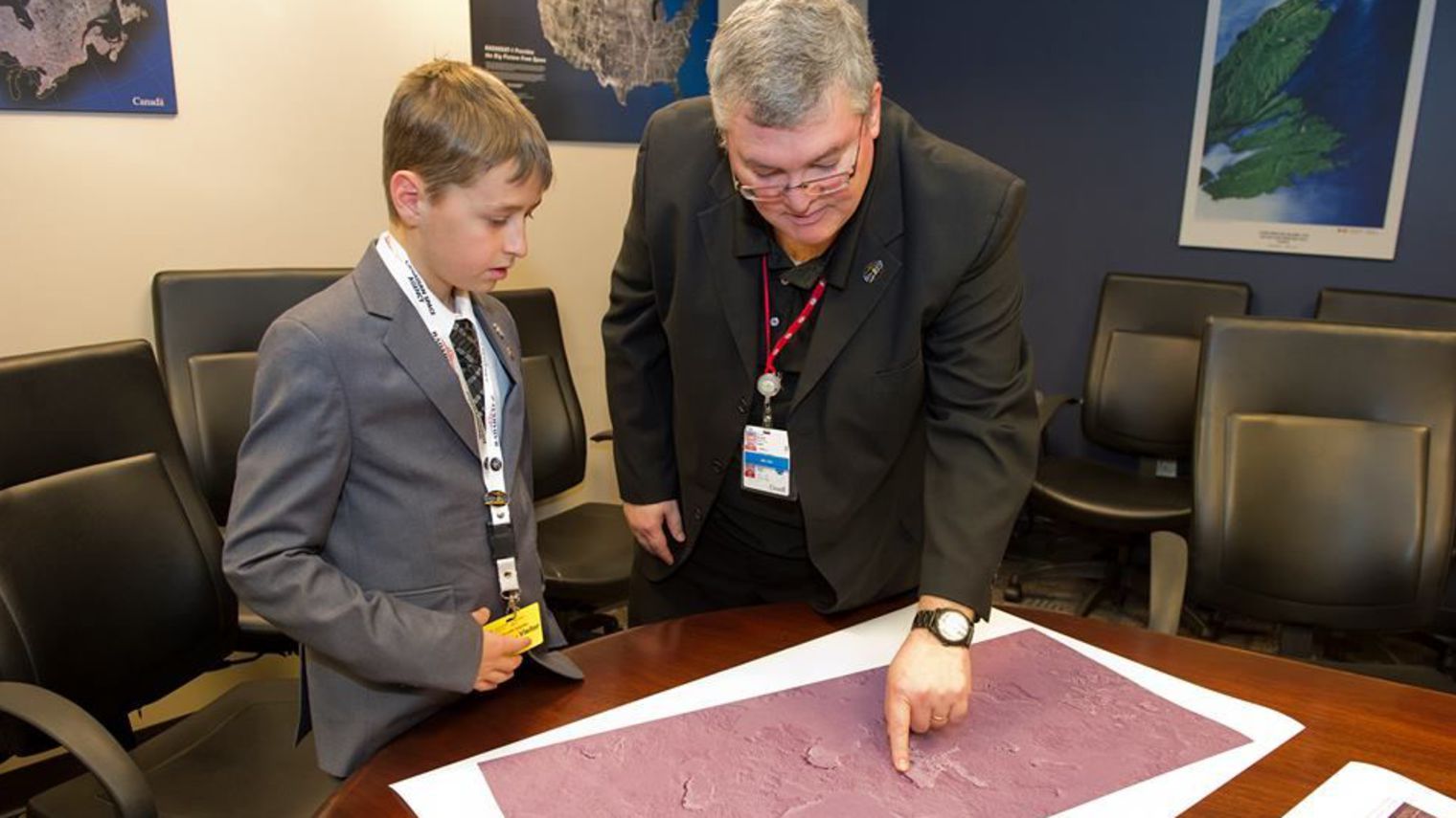
Image: Canadian Space Agency
Taking this idea further, Gadoury contacted the Canadian Space Agency, who provided him with space-based images from NASA and JAXA. These satellite images revealed a batch of undeniably geometric structures hidden under the jungle canopy. Gadoury, along with Dr Armand LaRocque, a remote sensing specialist from the University of New Brunswick in Fredericton, believe it’s an ancient Maya pyramid surrounded by 30 smaller structures. The teen has named the city — which has yet to be explored and verified — K’aak Chi, which means “Mouth of Fire”. If confirmed, it would be among the largest Maya cities ever discovered.
William Gadoury, 15, explains his theory of the existence of an unknown Maya city before scientists at the Canadian Space Agency. (Image: Canadian Space Agency)
LaRocque said the use of satellite images, as well as the contribution of digital image processing, helped to confirm the possible existence of this forgotten city. “Geometric shapes, such as squares or rectangles, appeared in these images, forms that can hardly be attributed to natural phenomenon,” LaRocque said.
Daniel de Lisle of the Canadian Space Agency said he was fascinated by the depth of Gadoury’s research, and that linking the position of stars and the location of a lost city “is quite exceptional”. He told The Independent that “There are linear features that would suggest there is something underneath that big canopy,” adding that “There are enough items to suggest it could be a man-made structure.”
Some sceptics are voicing their opinions about this story. Here’s what David Stuart, an anthropologist from The Mesoamerica Center-University of Texas at Austin, had to say via his Facebook page:
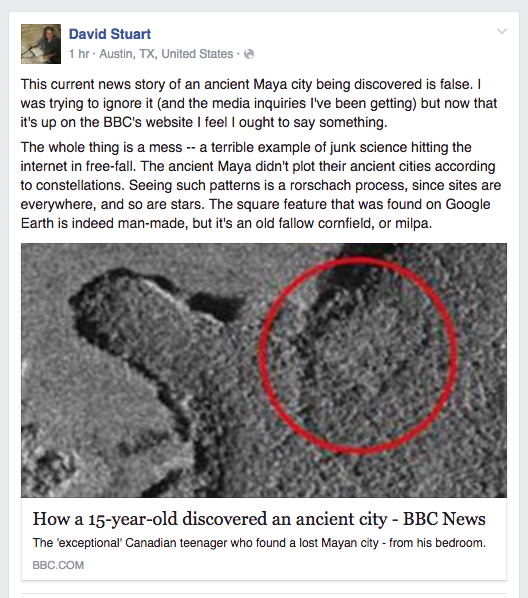
Thomas Garrison, an anthropologist at USC Dornsife and an expert in remote sensing, says these objects are relic corn fields. Here’s what he told Gizmodo:
I applaud the young kid’s effort and it’s exciting to see such interest in the ancient Maya and remote sensing technology in such a young person. However, ground-truthing is the key to remote sensing research. You have to be able to confirm what you are identifying in a satellite image or other type of scene. In this case, the rectilinear nature of the feature and the secondary vegetation growing back within it are clear signs of a relic milpa. I’d guess its been fallow for 10-15 years. This is obvious to anyone that has spent any time at all in the Maya lowlands. I hope that this young scholar will consider his pursuits at the university level so that his next discovery (and there are plenty to be made) will be a meaningful one.
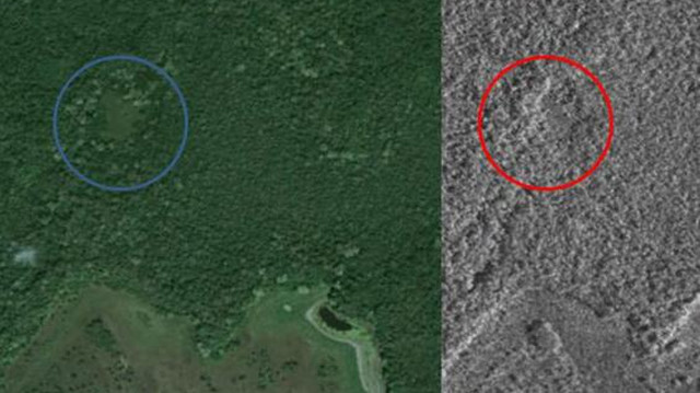
Garrison provided Gizmodo with this image of a similar feature in an area where he works in Guatemala. This field has been abandoned more recently.
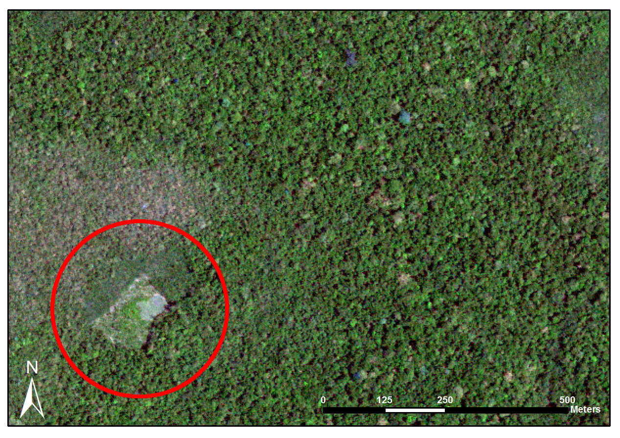
Image: Thomas Garrison.
We also reached out to Ivan Šprajc from the Institute of Anthropological and Spatial Studies in Slovenia. He says the Maya were very good astronomers, and that they were interested in certain stars and celestial objects, but he’s sceptical that these charts can be used to reveal the location of Maya sites. As he told Gizmodo:
Very few Maya constellations have been identified, and even in these cases we do not know how many and which stars exactly composed each constellation. It is thus impossible to check whether there is any correspondence between the stars and the location of Maya cities. In general, since we know of several environmental facts that influenced the location of Maya settlements, the idea correlating them with stars is utterly unlikely.
What needs to happen now is a ground expedition, but that won’t come cheap, nor will it be easy. The location of the site is in one of the most remote and inaccessible areas of Mexico. And as LaRocque put it, “Expedition costs are horribly expensive.” Gadoury has contacted a team of Mexican archaeologists, and he’s hoping to take part in any subsequent mission to the site.
“It would be the culmination of my three years of work and the dream of my life,” said the cool teen.
So, uh, can someone get a Kickstarter going for this kid immediately please?
[Telegraph, Independent, Le Journal de Montreal]
Top: Google Earth and satellite photos appear to reveal the site of a pyramid cloaked in foliage. (Image: Google Earth, CSA)