A Canadian teen says he discovered a lost Maya city using ancient star maps and satellite images provided by NASA and Google. As the remarkable story went viral yesterday, a number of experts spoke out, saying it’s highly unlikely that these features are those of a forgotten Maya settlement.
News swept the internet yesterday that William Gadoury, a 15-year-old boy from Quebec, found a lost Maya city in Mexico by correlating the locations of known settlements with the positions of the brightest stars. He received help from the Canadian Space Agency (who provided satellite images, and who described Gadoury’s work as “exceptional”) as well as Dr Armand LaRocque, a remote sensing specialist from the University of New Brunswick. The teenager won a medal of merit for his discovery and was invited to contribute an article to a scientific journal. Gadoury also received invitations to the national science fair at McGill University and an international conference in Brazil.
But other experts have expressed scepticism at Gadoury’s findings, saying the features shown in the space-based photos are merely abandoned corn fields. What’s more, they argue that the Maya people, though good astronomers, probably did not choose to settle in areas based on the positions of the stars.
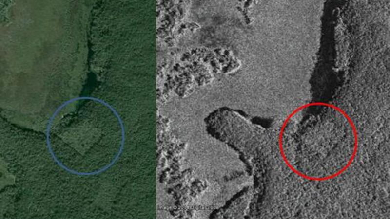
An ancient Maya structure — or an abandoned corn field. Google Earth and satellite photos appear to reveal the site of a pyramid cloaked in foliage. (Image: Google Earth, CSA)
“I applaud the young kid’s effort, and it’s exciting to see such interest in the ancient Maya and remote sensing technology in such a young person,” said Thomas Garrison, an anthropologist at the University of Southern California: Dornsife and an expert in remote sensing. “However, ground-truthing is the key to remote sensing research. You have to be able to confirm what you are identifying in a satellite image or other type of scene.”
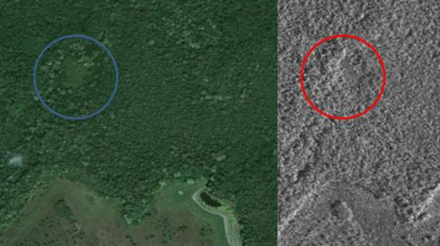
Google Earth and satellite photos show what looks to be a cluster of structures. Or, as some experts contest, a “relic milpa”. (Image: Google Earth, CSA)
In this particular instance, Garrison says the rectangular nature of the feature and the secondary vegetation growing back within it are “clear signs” of a relic milpa. A milpa is a crop-growing system used throughout Mesoamerica, primarily in the Yucatan peninsula area of Mexico (which is exactly where this supposed lost Maya city is located). The word milpa is taken from the Nahuatl term for “maize field”.
“I’d guess it’s been fallow for 10-15 years,” Garrison told Gizmodo. “This is obvious to anyone that has spent any time at all in the Maya lowlands. I hope that this young scholar will consider his pursuits at the university level so that his next discovery — and there are plenty to be made — will be a meaningful one.”
Garrison provided Gizmodo with this image of a similar feature in an area where he works in Guatemala. He says the milpa was abandoned quite recently:
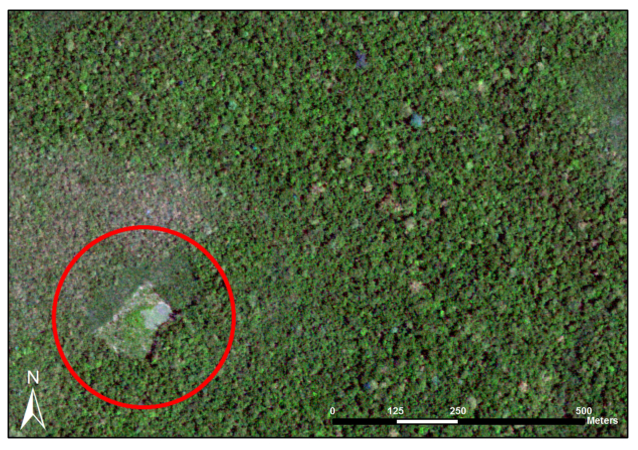
Image: Thomas Garrison.
David Stuart, an anthropologist from the Mesoamerica Center-University of Texas at Austin agrees, but his words were less kind. At his Facebook page he referred to Gadoury’s work as “junk science”.
“Seeing such patterns is a rorschach process, since sites are everywhere, and so are the stars,” he wrote. “The square feature that was found on Google Earth is indeed man-made, but it’s an old fallow cornfield, or milpa.”
Ivan Šprajc, a researcher from the Institute of Anthropological and Spatial Studies in Slovenia, also said the idea that the Maya correlated their settlements with stars is “utterly” unlikely.
“We do know that the Maya were very good astronomers and that they were interested in certain stars and asterisms,” he explained to Gizmodo. “But how could constellations reveal the location of Maya sites remains a mystery to me. Very few Maya constellations have been identified, and even in these cases we do not know how many and which stars exactly composed each constellation.”
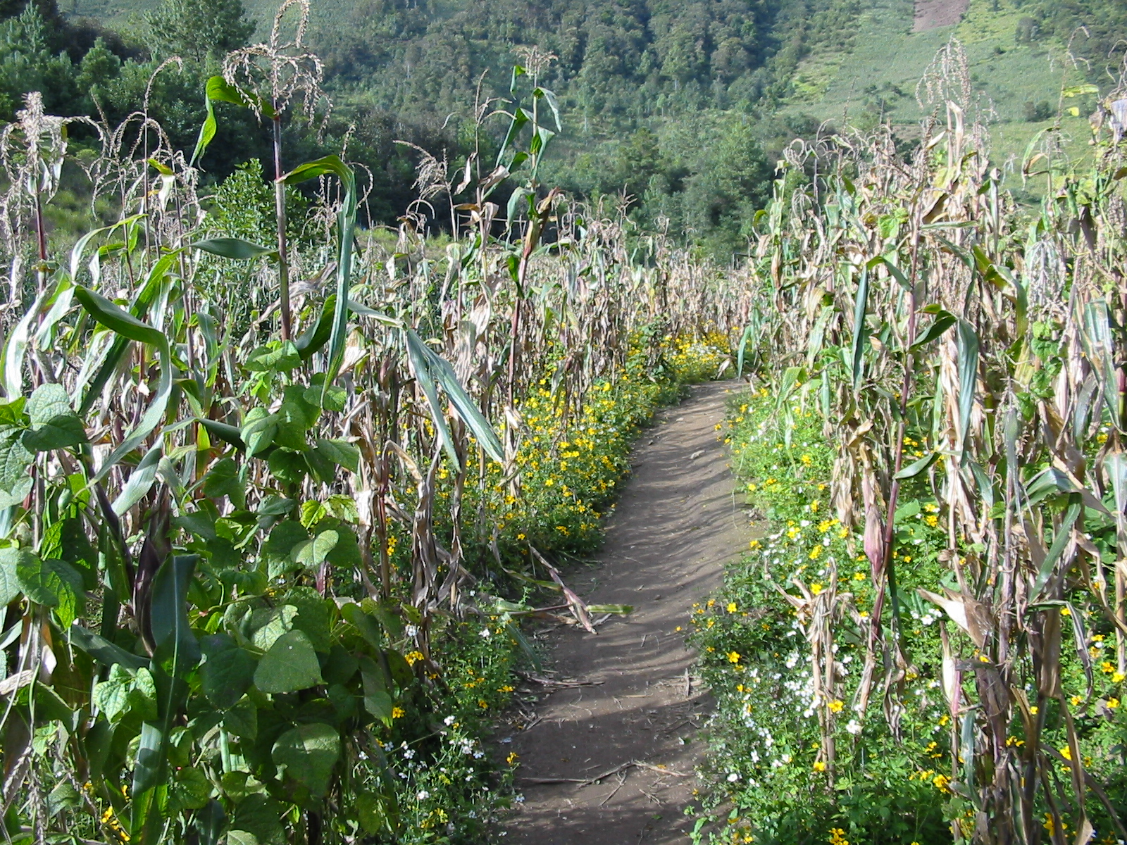
Milpa in Guatemala. (Image: Fabian Hanneforth)
As a result, Šprajc says it’s impossible to confirm whether any correlation exists between the constellations and the location of Maya cities. Moreover, anthropologists know of several environmental factors that did influence the location of Maya settlements in the central Yucatan lowlands, such as proximity to small lakes. (Also known as “aguadas”, these pools were the only fresh water sources in this karstic environment, which is landscape characterised by the dissolution of soluble rocks and underground drainage systems with sinkholes and caves.) The Maya cities were also positioned on slightly elevated grounds, and on the edges of wetlands called “bajos” which were appropriate for intensive agriculture.
“This is not to say that astronomy was not important to the Maya,” said Šprajc. “On the contrary, they were keen observers of the sky, they knew the eclipse cycles and were capable of predicting significant moments in synodic cycles of Venus and probably of other planets.”
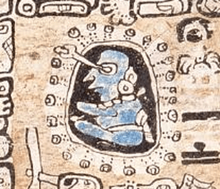
Representation of a Maya astronomer (Image: Madrid Codex)
Šprajc says that astronomy did play an important role in architecture and urban planning, but it was based on phenomena observed on the horizon, namely significant rising and setting points of some celestial objects, particularly the sun. This often dictated the orientation of important buildings, and sometimes even their placement relative to each other.
Lastly, Šprajc pointed out that the coordinates of the Maya city, which Gadoury claims is in northern Guatemala, is actually located in southern Campeche, Mexico. He also believes, like Garrison and Stuart, that the features shown in the satellite photos is an old milpa, abandoned years ago “but definitely not centuries ago”.
Based on these expert reactions, it seems unlikely that this Canadian teen’s green rectangles are lost Maya structures. But as Garrison pointed out, only a ground-based expedition to the area will confirm things one way or another. At the same time, while Gadoury’s enthusiasm and creativity should continue to warrant praise, the contributions of the Canadian Space Agency and from Armand LaRocque, the University of New Brunswick professor who corroborated the Gadoury’s research, deserve further scrutiny.
We’ve reached out to Gadoury, the Canadian Space Agency, as well as LaRocque for comment, but only received a response from Daniel De Lisle, Project Officer, RCM Data Utilization & Applications at the Canadian Space Agency, who assisted William Gadoury with his project.
We asked De Lisle to respond to the claims made by experts that this is “junk science”, and that the objects in the satellite photos are probably abandoned milpas. To which he responded: “The area of interest covers more than 78 square kilometers, and many linear features that appear manmade are visible from space.” Which is not much of an answer.
We also asked him if the CSA sought expert advice from Maya experts at any point during the project.
“CSA provides an opportunity to explore the enhanced capabilities of RADARSAT-2 and their potential contributions to various applications,” he responded. “This opportunity consists of a loan of RADARSAT-2 data to research projects. The main outcome pursued by CSA is to ensure that Canadian stakeholders benefit from the investment in this satellite, through research and development activities. Scientists are responsible of their research and must acknowledge the CSA provided the imagery in their publications.”
Again, not much of an answer.
“The only way to know is to organise an expedition on the site to validate,” he said. And on this point, he’s correct — but it’s looking damn unlikely there’s anything at the site of interest.
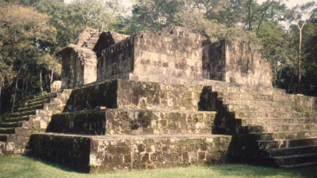
Top: Photo of an actual ancient Maya structure. (Image: Takeshi Inomata)