Researchers have developed an image enhancement technique that allows them to boost the resolution of satellite images, revealing unprecedented levels of detail on Mars.
The team from University College London call the tool Super-Resolution Restoration. It takes multiple images of the same spot, stacks them on top of each other, and matches them to enhance details. The team has now tested the technique out on images from NASA’s HiRISE device aboard the Mars Reconnaissance Orbiter.
The cameras on that satellite can usually make out object as small as 25cm on the surface of the Red Planet. The enhancement technique allows the team to ratchet up the resolution, so that it can make out objects as small as 5cm, according to the team. The results are published in Planetary and Space Science.
You can see just how impressive that looks in practice below, where original images — actually showing Mars rover tracks — are at the top and the enhanced images beneath.
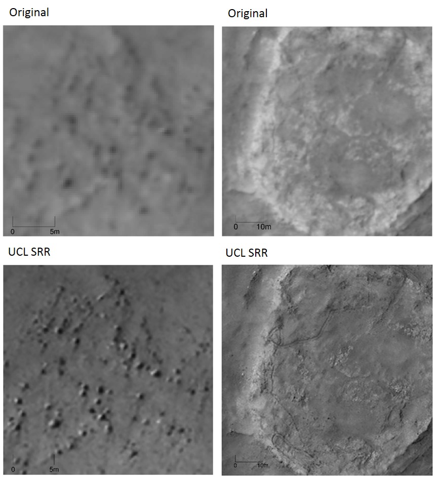
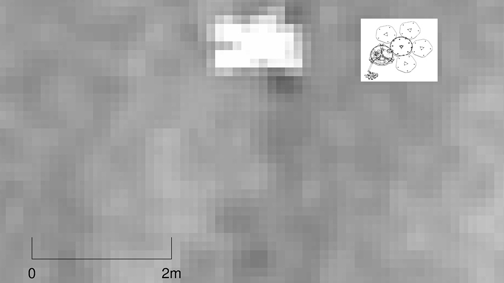
Pretty damn sweet. Meanwhile the image at the top of the page shows an enhanced image of the landing site of the ill-fated Beagle-2 mission. Zoom in, and you can see what appears to be the missing British Mars lander:
All of which is pretty neat, as Professor Jan-Peter Muller, one of the researchers, explained in a press release:
We now have the equivalent of drone-eye vision anywhere on the surface of Mars where there are enough clear repeat pictures. It allows us to see objects in much sharper focus from orbit than ever before and the picture quality is comparable to that obtained from landers. As more pictures are collected, we will see increasing evidence of the kind we have only seen from the three successful rover missions to date. This will be a game-changer and the start of a new era in planetary exploration.
We do, of course, have rovers on Mars to acquire incredibly detailed records of the surface of the planet. But they can only cover so much ground. This technique allows scientists to bump up the resolution of the images acquired by satellites, which sweep around the planet acquiring far more data than any rover ever could.
Now, the team plans to enhance stacks more images of the surface of Mars. Let’s see what they can find.
Top image: An enhanced image of the proposed Beagle-2 Landing site. (Images: NASA/University College London)