As the highest point in the contiguous United States, Mt. Whitney stands at 14,505 feet (4421m) tall. Easy accessibility makes it a prime destination for hikers and climbers from around the world. We’ve hiked it, mountaineered it and rock climbed it, and here’s how you can do any of that too.
Why Go?
As the highest point in the US of A (excluding Alaska), the draw to go is present for anyone who wants to call themselves a hiker, climber, or mountaineer. As my wife Valerie put it, “It’s just one of those things you do.” It represents a huge challenge and rewarding view even for those that attempt, but do not finish.
How To Do It
First things first, you will need a permit if you plan to go between May 1 and October 31. The National Forest Service issues a total of 100 day hiker and 60 overnight permits per day, and these are given out through a lottery that takes place at the beginning of the year, check out the National Forest Service Lottery page for more info. This may sound like a lot, but consider that 11,662 applications were submitted to the 2015 Mt. Whitney Lottery. 43% were Awarded a Date of their Choice 57% were Unsuccessful. I was among those unsuccessful. I was fortunate enough to convince all of my friends to apply for permits and was able to go with them. If you plan to hike during the “non-quota” season, you can just drop by the permit office and pick one up. It’s also worth noting that generally the weekends are the ones that everyone wants. If you have a flexible schedule, you can often times pick up a weekday permit on Recereation.gov after the lottery season is over.
The two most popular ways of reaching the top both use the same trail that is hiked either in a single day or with a night spent at elevation, Valerie and I did both of those and will break down each one.
Up And Down In A Day
From the Whitney Portal trailhead, it is 11 miles and over 6,000 feet (1828m) of elevation gain to the top. We paid $US11 for a campsite and cowboy camped (no tent) at Whitney Portal. This is the way to do it if you plan to do a day hike because you will be starting before the sun comes up.
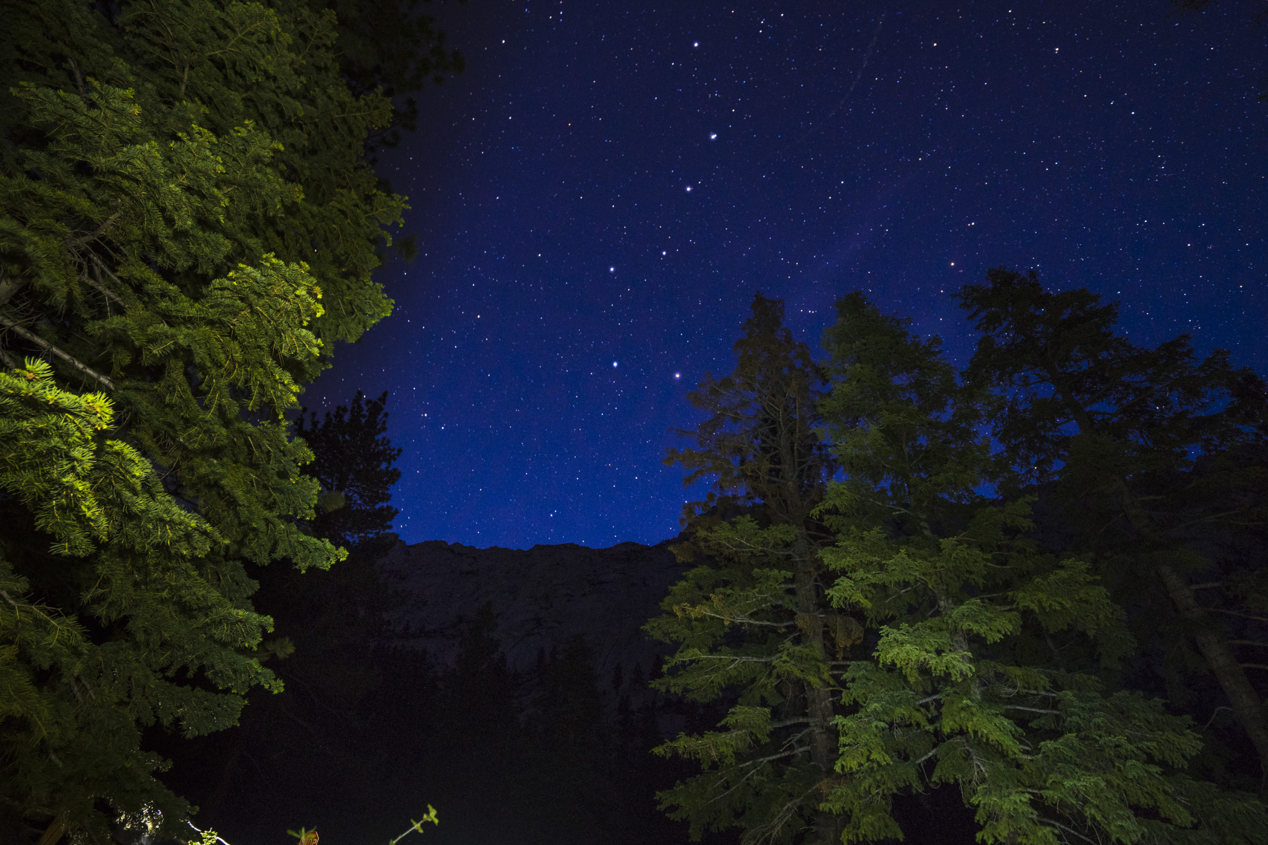
Having come from Orange County that day, I was super excited to see the stars that night and was not disappointed when the big dipper was shining bright.
We started at 3 AM and started trucking for the top. The trail is pretty gentle, rising on average about 550 feet (168m) per 1 mile travelled. To get this gentle slope, the Forest Service cut an unnecessary number of switchbacks into the trail.
My Garmin Fenix 3 did not last the whole day, which I am crediting to having the GLONASS antenna on. I have found that to cut the battery down by about 40%.
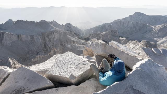
The elevation started hitting me hard once we got to about 13,000 feet (3962m) on the 99 switchbacks out of trail camp. I was basically a zombie for the remaining few miles (evident in the GPS file). After only about 5 minutes on the summit, a summit shot for the records, and a signature in the book, I made my way down and started feeling way better with each step.
Overnight
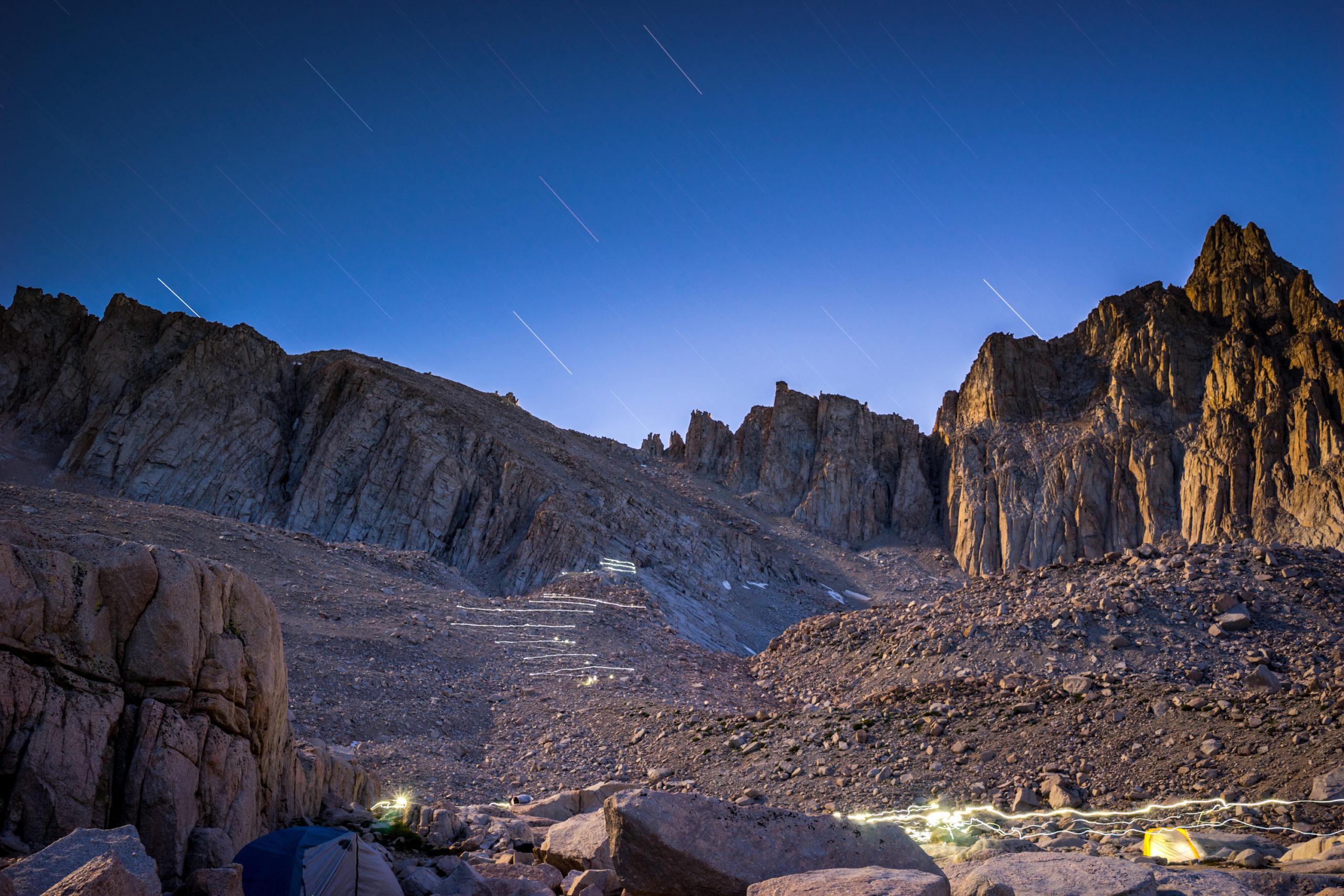
For our second attempt, we spent a night at Trail Camp. It is the last place you can legally camp on the main trail on your way up to the summit. It is about 7 miles from the trailhead and sits at 12,000 feet (3657m). There is water readily available, but you MUST filter or purify this water. With the amount of people using this trail, some a-hole (or hundreds) have probably pee-ed in the water.
We spent the night in the Alabama Hills the night before our ascent and spent the morning rock climbing while waiting for some other friends to meet us. We departed in the afternoon and made it to Trail Camp just as the sun was going down.
Even at 8 PM, people were still descending the 99 switchbacks from the summit, with another 7 miles to go.
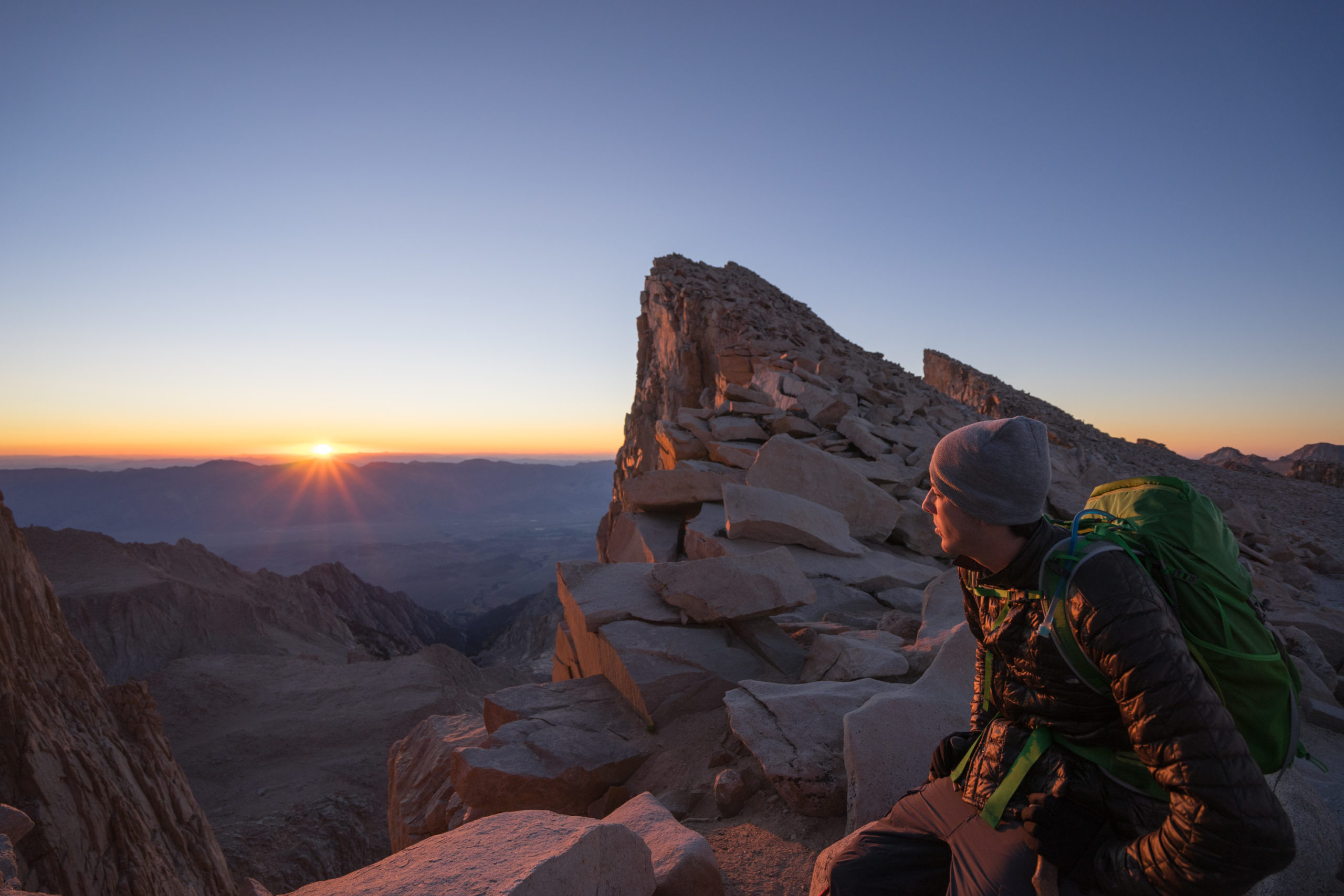
The one huge benefit to the overnight trip is that you are now only 4 miles from the summit and have a night to sleep at elevation. Altitude Sickness struck me hard on the single day trip, but with even as few as 8 hours at Trail Camp, I was able to acclimate and not feel any symptoms of AMS. My friend Sam on the other hand, was not feeling so great sleeping at altitude, which is not uncommon. He and I set out for the summit at 3 AM, hoping to catch the sunrise.
We were about a half of a mile from the summit as the sun came up, it was still beautiful.
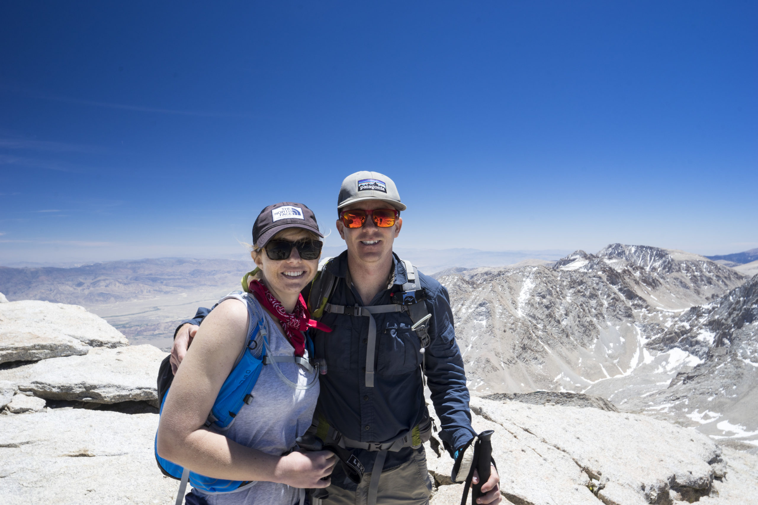
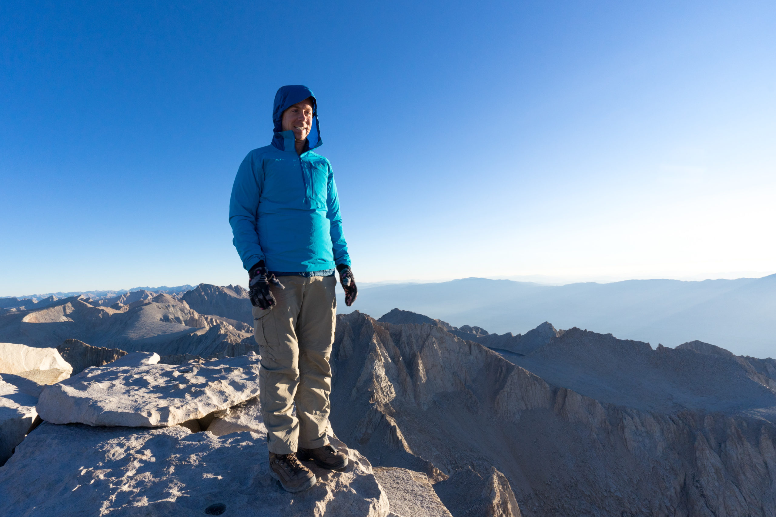
Once we made the summit, both Sam and I were feeling pretty good. We spent about an hour at the top, called our parents (because there is cell service at the top of Whitney), watched a guy film a music video, and listened to someone else play an acoustic guitar they had carried up…it was apparently a very musical time to be up there.
We spent a little bit of time in the Smithsonian Institution Shelter to get out of the wind and talked with a few other people who were up there. I find it really interesting picking the brains of other people who are going through the same thing you are at this exact moment. There was a couple up there on their honeymoon!
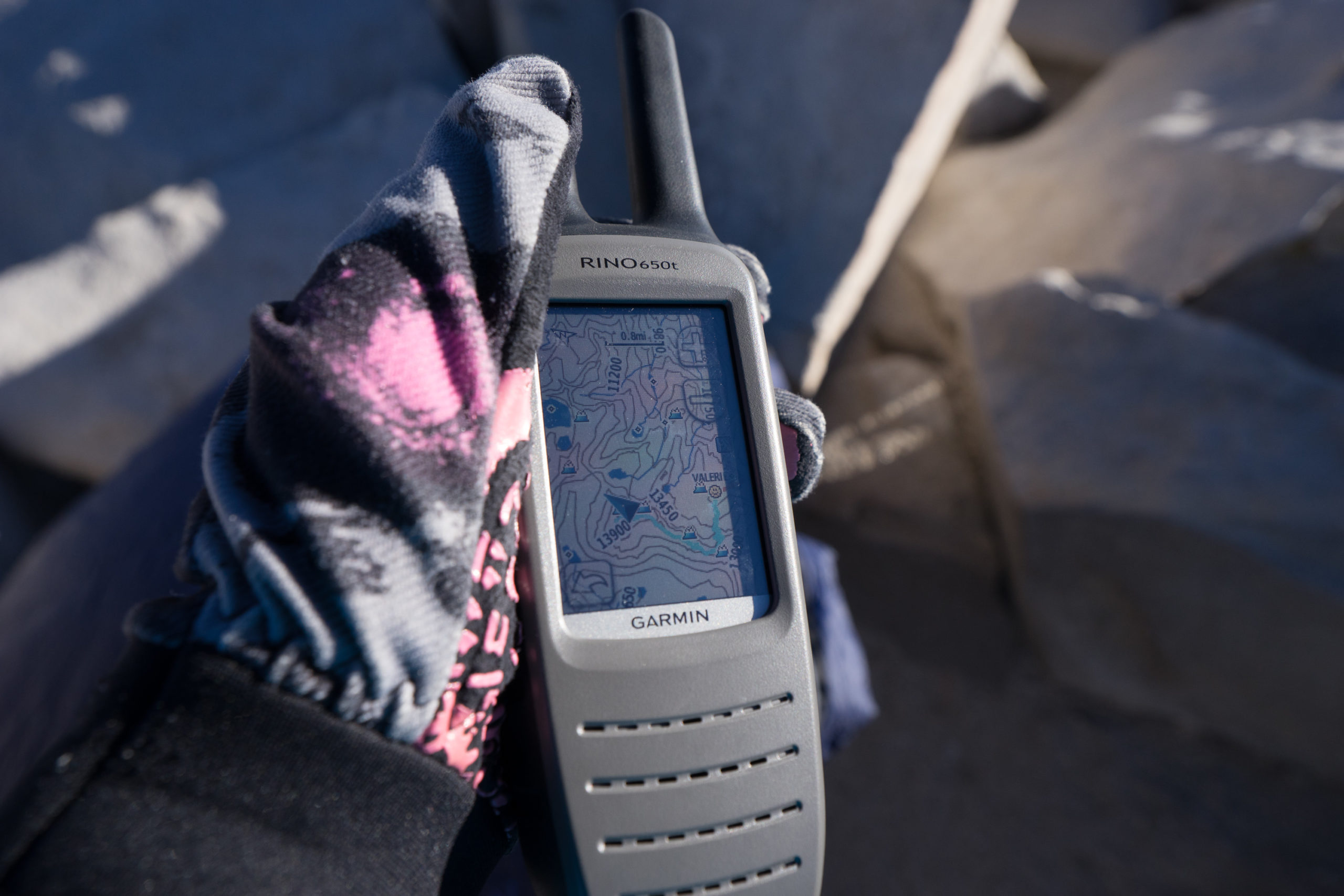
While on the summit I was able to keep tabs on Val and Courtney as they made their way up with the Garmin Rino 650t. The combo radio and GPS unit let’s you visualise the location of your partner (as long as they have a Rino as well and are within range). It was extremely nice to be able to split groups and maintain communication and coordinate the trip.
Soft yet tough, the Arc’teryx Psiphon SL kept the wind out while on the top, and at $US150 it is probably one of the cheapest jackets you can get from this top-of-the-line company.
Chris climbed the Mountaineer’s Route last winter and did a little write-up/ Q&A with a mountaineering guide, here are some more of his thoughts:
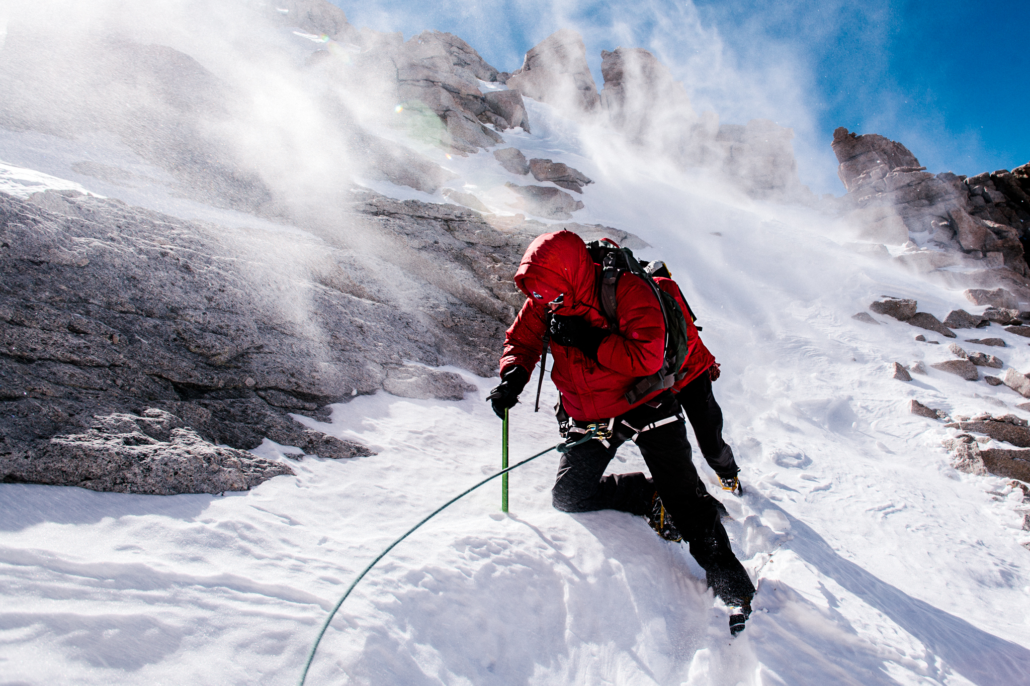
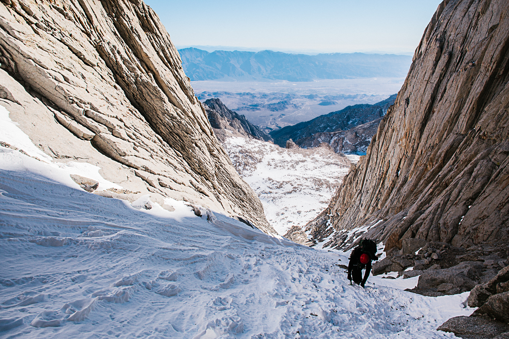
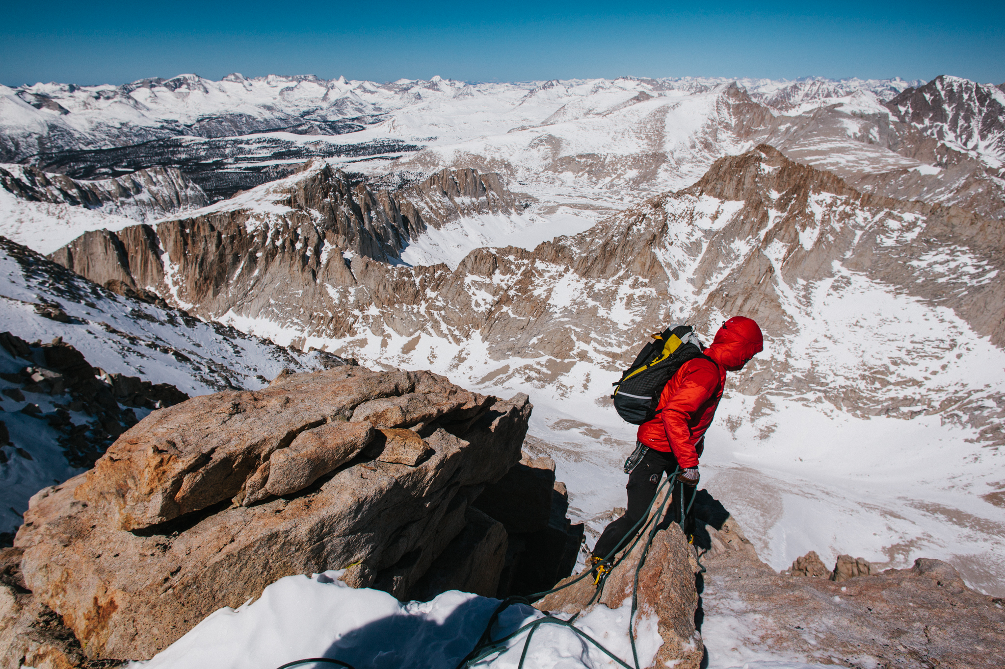
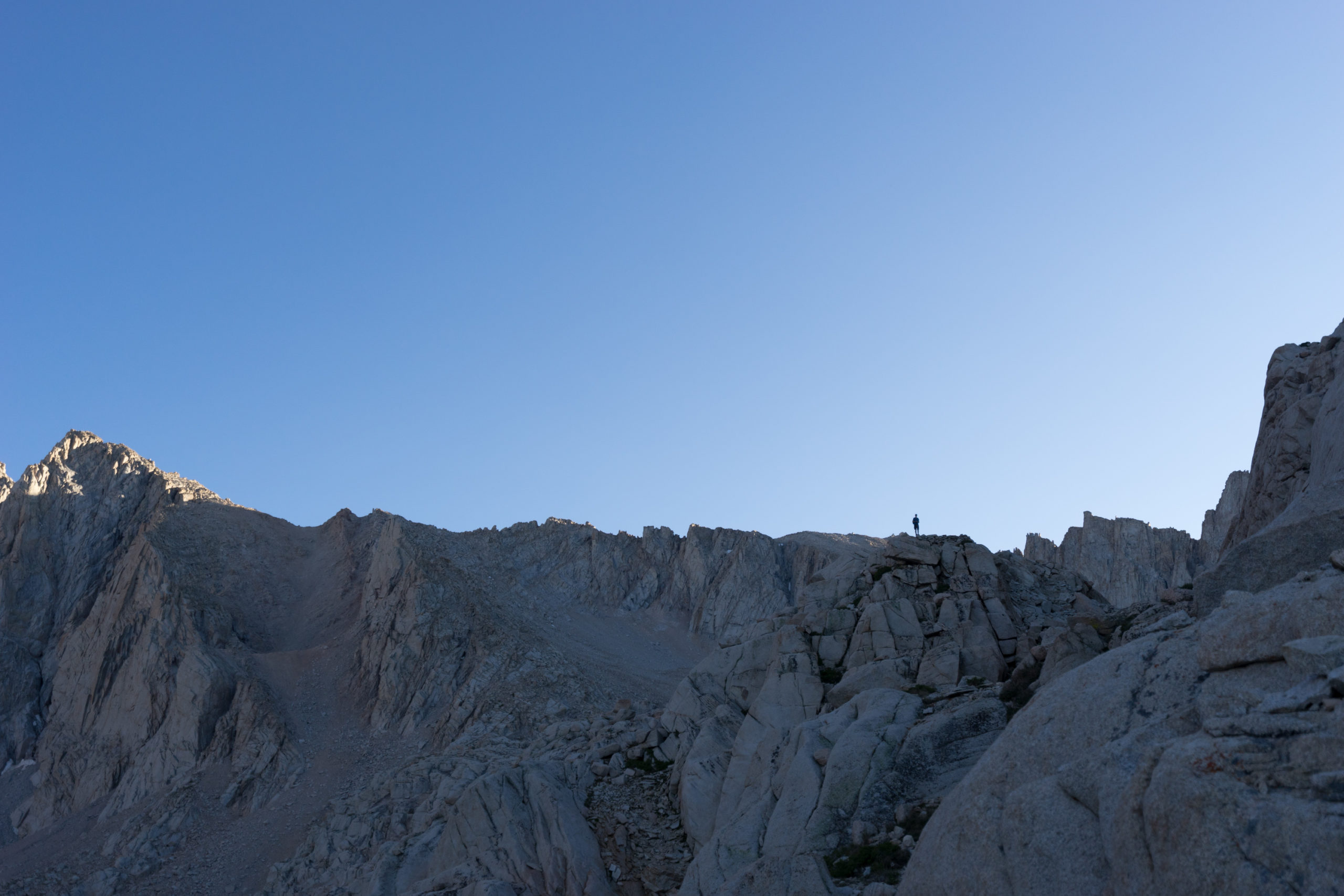
My first experience on Mt. Whitney was via the mountaineers’ route, which is much more direct — and much less crowded — than the main hiking trail. I climbed it as part of American Alpine Institute’s Winter Mountaineering in the Sierra course, where we used its unforgiving alpine environment to develop a specialised set of skills for devoted to winter climbing.
If climbing any of the routes during winter, chances are that the gate on Whitney Portal Road will be locked — adding up to four miles of asphalt-pounding approach, before even reaching Whitney Portal. That was the case for our party; we lost a couple of hours to the pavement. Shortly after departing Whitney Portal to officially begin our adventure, we cut off-trail, following a cross country route. Within an hour of hiking our team reached snow and donned snowshoes for the remaining approach. We stopped for the first night near Lone Pine Creek.
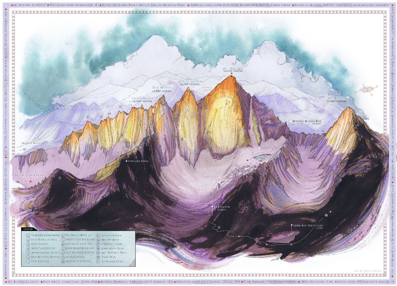
From there, we followed the valley upwards, past Lower Boy Scout Lake, and on to Upper Boy Scout Lake, which would be our camp for the remainder of the course and the climb. Oftentimes parties will continue to Iceberg Lake, which is the last campsite on the mountaineers’ route before the summit, but windy conditions forced our team to stay at Upper Boy Scout, where there was ample snow to dig pits and escape from the extreme conditions we encountered.
From Iceberg Lake, one has a direct line of sight up the route’s couloir. In the summertime, the slope is covered with scree; it only requires Class 2 scrambling. During the winter, however, it can be very icy, depending on conditions. Our team swapped out snowshoes for crampons at the base before continuing up the slope to a notch in Whitney’s ridge, about 500′ below the summit.
From the notch, there are a couple of different options: traverse up steep, exposed third class terrain, or head up the steep gully immediately west of the notch. Both are about equal in terms of technical difficulty; both will land you on the summit plateau.
The mountaineers’ route has a great potential for rockfall, so it’s important to wear a helmet once you begin climbing the couloir. If attempting the mountaineers’ route during winter, the entire approach is avalanche-prone, so be sure to check conditions from the Eastern Sierra Avalanche Center before you head out. If avalanches are likely, don’t go up!
-Chris Brinlee Jr.
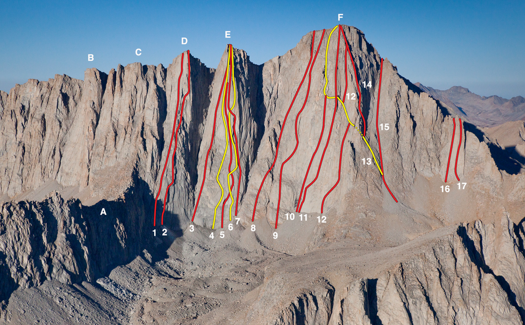
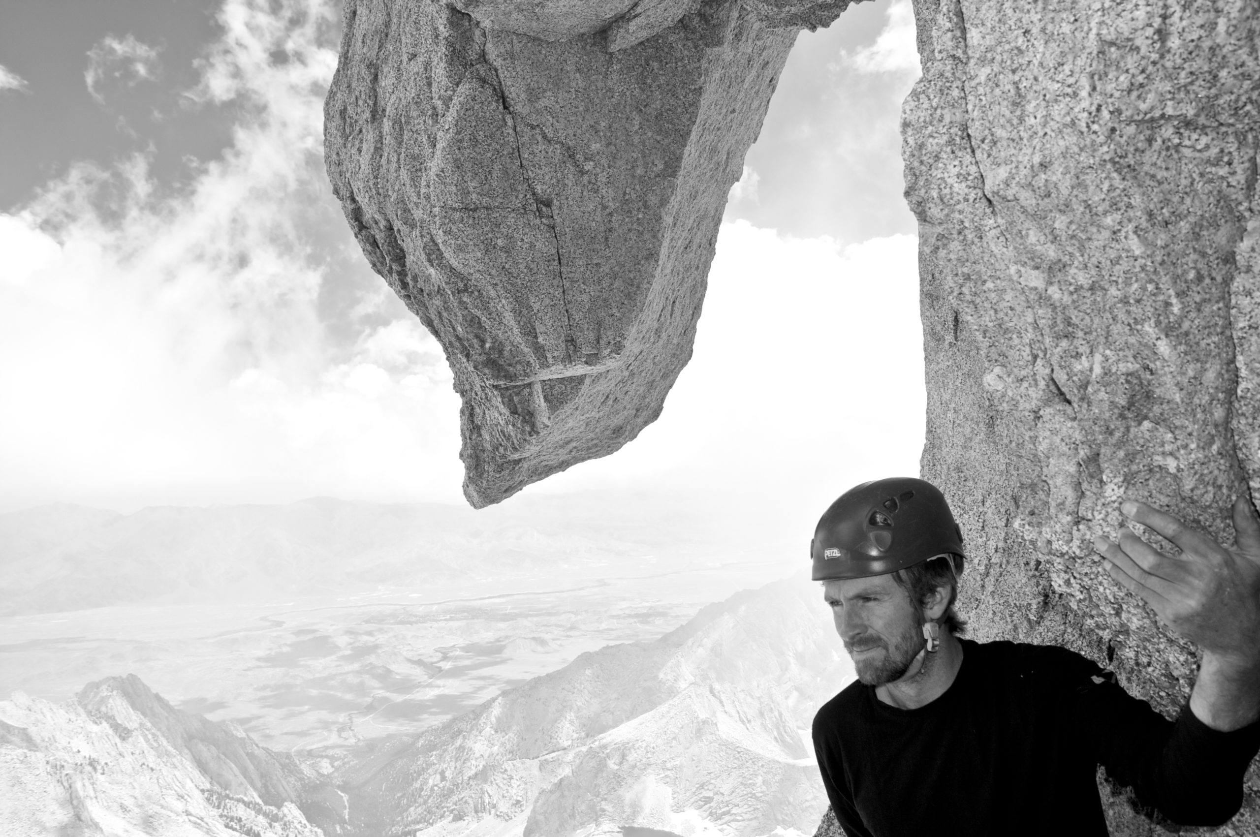
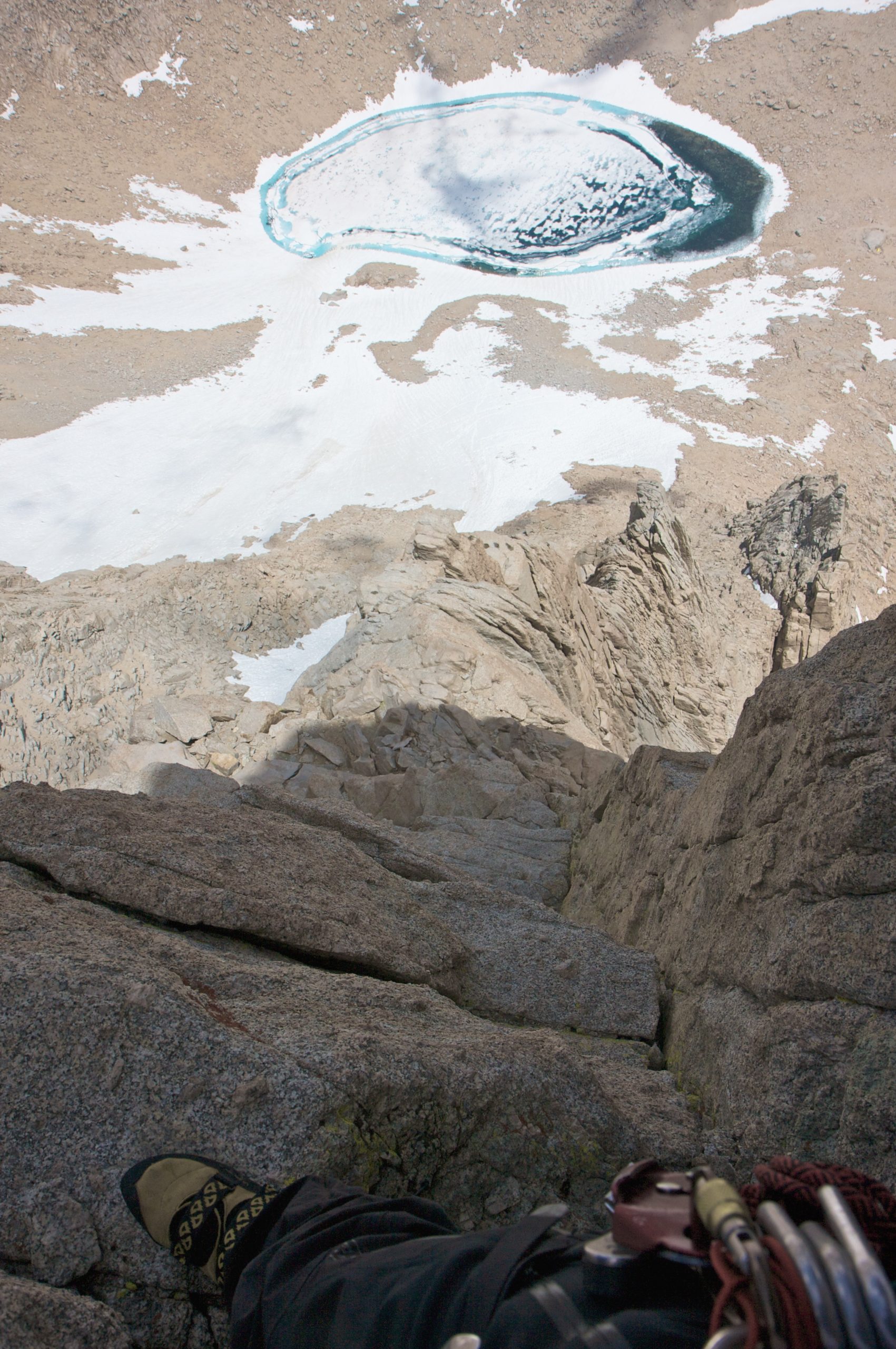
Real Climbing — Sunshine-Peewee Route (East Buttress)
Photo by Stephen Miller
Stephen, a good friend who has accompanied me on many trips that have been featured here has also climbed Mt. Whitney via the East Buttress, this requires multi-pitch trad climbing skills, here are his thoughts:
Photo by Stephen Miller
Climbs like the East Buttress are what rock climbing is all about. Quality rock, consistent exposure, enjoyable climbing and a great summit all come together to make this an inarguably classic route of the High Sierra. At 5.7 it is a very approachable entry into the world of technical alpine rock climbing. Climbers comfortable leading 5.9 multi-pitch trad routes at lower elevations should have no trouble with the climb if they acclimatize appropriately and plan ahead. Making it a multi-day trip allows time to get used to the thin air and to make an alpine start the morning of the climb. There is almost no fixed protection on the route save for a few old pitons harkening back to the early years of technical climbing in the Sierra when the route was first climbed.
-Stephen Miller
Thoughts On The Trail
The trail itself is not that difficult. What is difficult is dealing with the altitude and amount of time you’ll be hiking. The day trip, with stops and all, took us over 15 hours (including an hour-long nap at trail camp). After both trips, no part of my body was physically sore because the trial is so gradual. After trying to Climb the Grand Teton last month and going a total of 14 miles (7 miles up and down), I couldn’t walk the next day because of how steep and physically demanding the trail was.
If you are hoping to find peace and tranquility on the trail, you will be left wanting more. While it is beautiful, there are more than 150 other people doing the exact same thing you are. We were often leap frogging with groups back and forth.
What You’ll Need To Bring
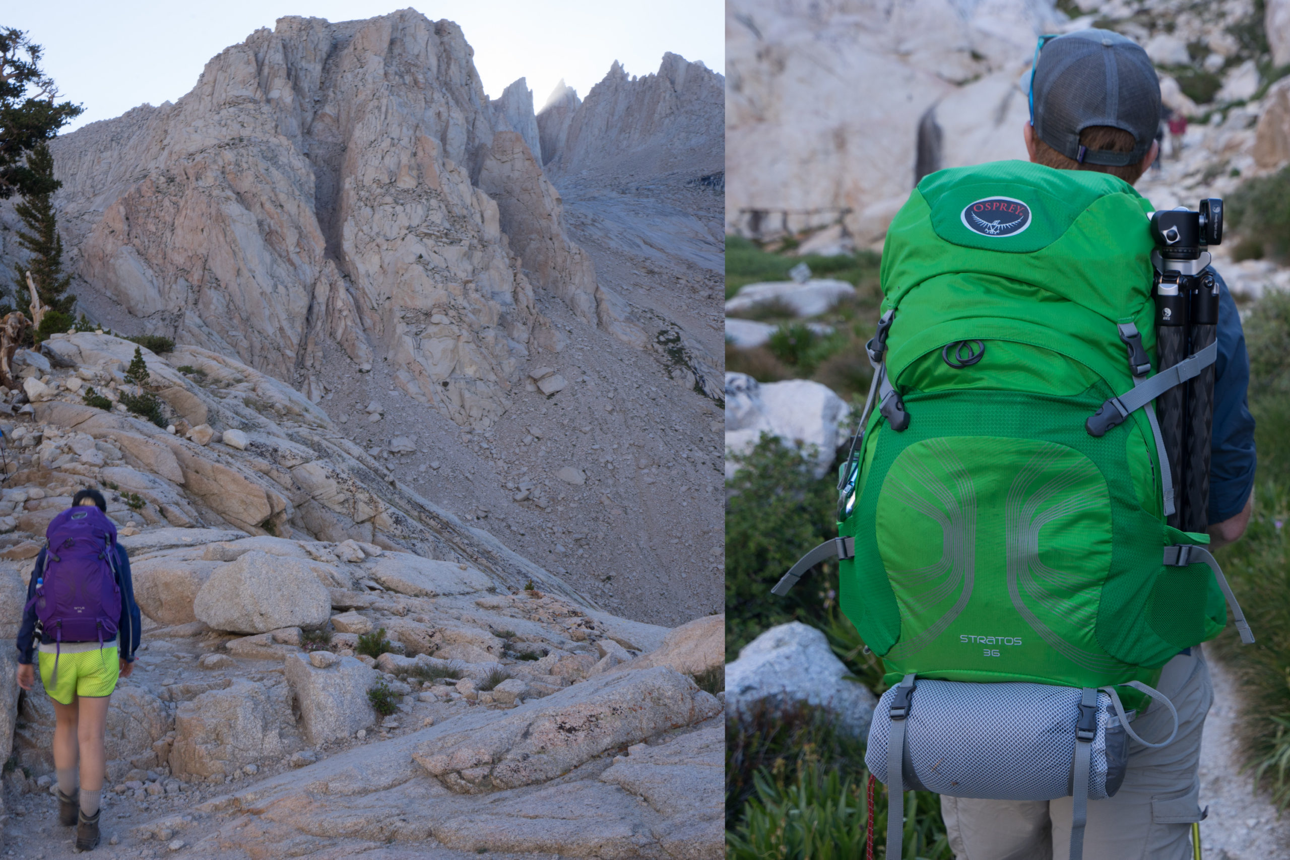
Depending on if you are doing a day hike or an overnight, your gear list will change. For the day hike, we each had a small pack, Valerie was wearing the 12 litre Osprey Rev 12, and I had the Osprey Stratos 24.
On the overnight, we had a “his and hers” set of Osprey Stratos 36 and Sirrus 36 packs which had just enough room for all our overnight gear. They are a little heavy compared to other similarly sized packs at just under 3 pounds but super comfortable to wear all day long.
I completely love the support and feel of the Osprey Airspeed frame, so much so that we own 5 Osprey packs.
Because we were trying to keep our packs around 20 pounds each, we limited our food to dry goods/ quick eats only. This meant no coffee or scrambled eggs for breakfast, but it also meant we did need to carry a stove or any dishes. We did have cheese/ crackers/ sausage for dinner and plenty of trail mix, energy bars and gels, and other quickly easy to eat items.
Check out more on IndefinitelyWild for how to get into Backpacking:
Don’t forget to read up on How to Poop in the Woods! Each hiker is issued a poop sack for carrying your business back down with you. On our day hike, I was fortunate enough to not have to use it, but on the overnight, I had to use the same bag multiple times after my stomach did not sit right with something I ate. It was unfortunate to have to carry that down, but when you see the “human waste” bin at the base, you get an idea for how much crap would otherwise be all over the trail. With nothing but rocks above 10,000 feet (3048m), there isn’t really much of a place to dig a hole anyways. The pack that the forest service gives you includes a larger trash bag for all your business that is full of smell absorbing kitty litter like stuff. You also get some toilet paper, a little hand wipe cloth, and another tougher bag for putting everything back inside. Be a respectful hiker and carry your poop back down with you.
How Do You Get There?
Less than 4 hours from LAX, it could not get much easier to get to Mt. Whitney. You’ll need to make a quick stop by the Eastern Sierra Interagency Center to pick up your permit. They are open from 8 AM – 5 PM. If you plan on driving up the night before your hike, don’t worry about rushing to get there, you can call them a day in advance and have them put your permit in the night drop box, see the above link for all that info.
What Else Should You Do While You’re There?
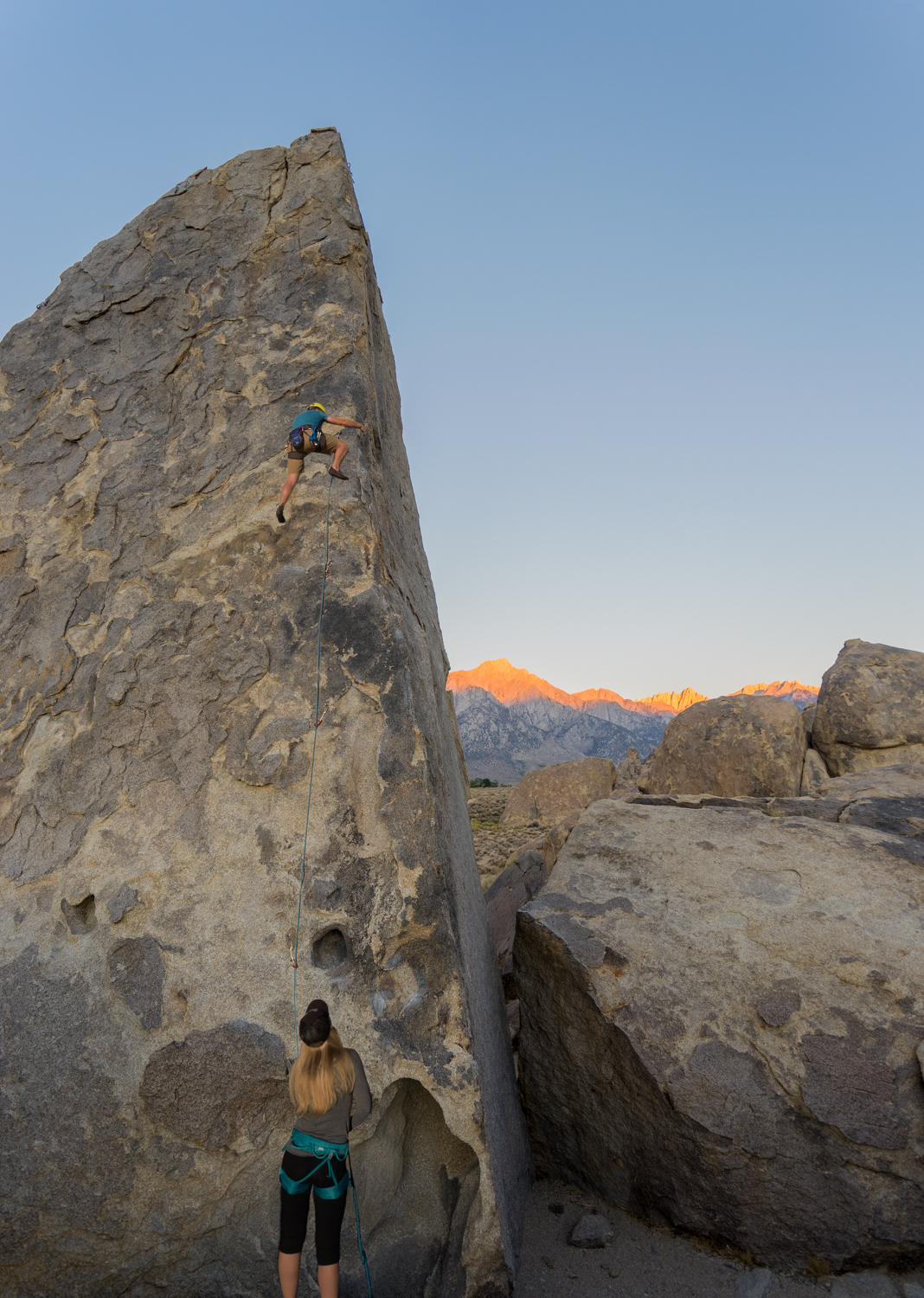
Mt. Whitney looming tall in the background during our sunrise climb up the Shark Fin aêrte in the Alabama Hills.
The Eastern Sierra is my second home, and the first place I look for adventure. You will drive through the Alabama Hills to get to Mt. Whitney and the piles of rocks are just begging to be climbed. We camped under this rock and started climbing it as the sun came up. It was only my third time sport climbing (leading) outside of a gym, and Val’s third-time lead-belaying outside as well…we stuck to the easier 5.8 routes. Once I topped out, I built a top rope anchor so that she and my friend Sam who had never climbed outside before could go up without worrying about clipping quickdraws.
Bishop is an hour north of Lone Pine, and just 20 minutes beyond that is the Owen’s River Gorge, a world-class climbing destination for dirtbags and climbers alike. Head to the Looney Bean in Bishop for some coffee, then walk across the street to the Mammoth Mountaineering Gear Exchange and Consignment shop and rifle through the largest collection of quality used adventure gear. Val picked up a pair of $US130 climbing shoes, gently used for $US10! Pick up a guide book to the area, like the one I had by Tom Slater: California Road Trip: A Climber’s Guide Northern California. Another 45 minutes north of Bishop and you are at Mammoth Lakes, a primo spot for backcountry adventuring and resort town living.
What We Would Have Done Differently
Since we climbed the mountain twice, we have a pretty good feel for how we would do it again if we came back. I had planned to climb the mountaineer’s route with Wes, but then he went off to Romania, so that is still on my to-do list, for another year.
The day trip had the advantage of a super light pack, but it was an extremely long day. Both Valerie and I felt physically better on the overnight trip. Breaking the trek up helped immensely with the elevation and the acclimation. Valerie noted that the 7 miles to Trail Camp were the worst of the bunch. We’ve both had enough Mt. Whitney for a few years. If I were to do it again, I would definitely forgoe the main trail and shoot for the mountaineers route, you start and finish at the same spot, but walk half as many miles. That should give you an idea for how many unnecessary switchbacks the main trail has.
It’s the most popular NBN speed in Australia for a reason. Here are the cheapest plans available.
At Gizmodo, we independently select and write about stuff we love and think you'll like too. We have affiliate and advertising partnerships, which means we may collect a share of sales or other compensation from the links on this page. BTW – prices are accurate and items in stock at the time of posting.