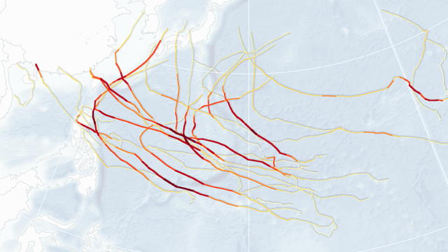
It was an uncharacteristically quiet hurricane season in the Atlantic, but the same cannot be said for the eastern Pacific and central Pacific basins, which got absolutely hammered this year. New maps by NASA and Unisys Weather show the extent of this year’s storm season.
The hurricane season in the Atlantic and the eastern and central Pacific basins is now officially over. In all we saw some, 30 major hurricanes, typhoons, and cyclones, most of them fuelled by El Niño, which appears to be the worst ever recorded. Prior to 2015, the greatest number of storms in a single season was 23, set in 2004. Incredibly, of the 30 storms recorded this year, 25 of them, or 83 per cent, attained category 4 or 5 status — again, another record (the previous record was 18).
Meanwhile, the Atlantic was comparatively quiet; the total from the past three years is the lowest since 1992-94.
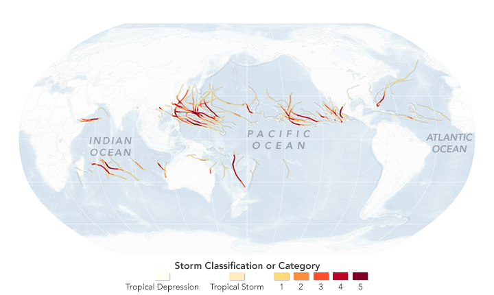
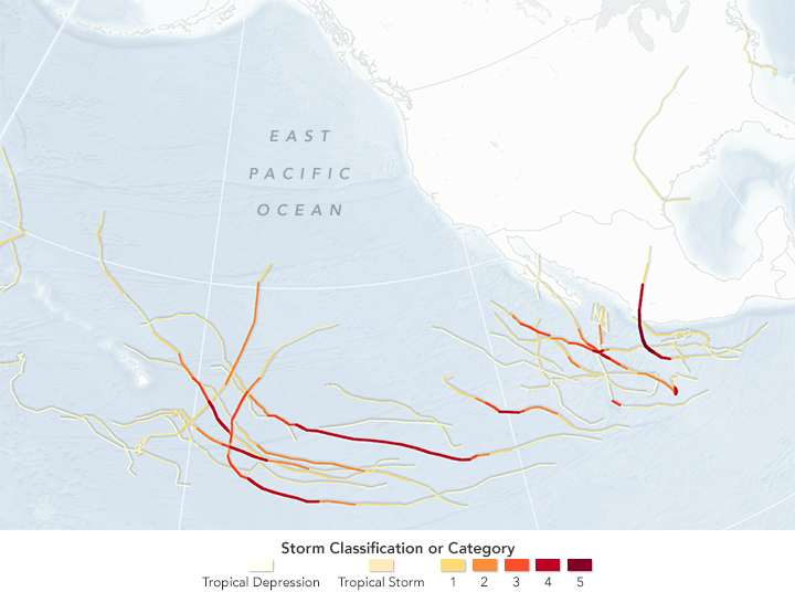
These new maps, which were produced by NASA using data collected by Unisys Weather, show the tracks and intensity of all tropical storms from the past season.
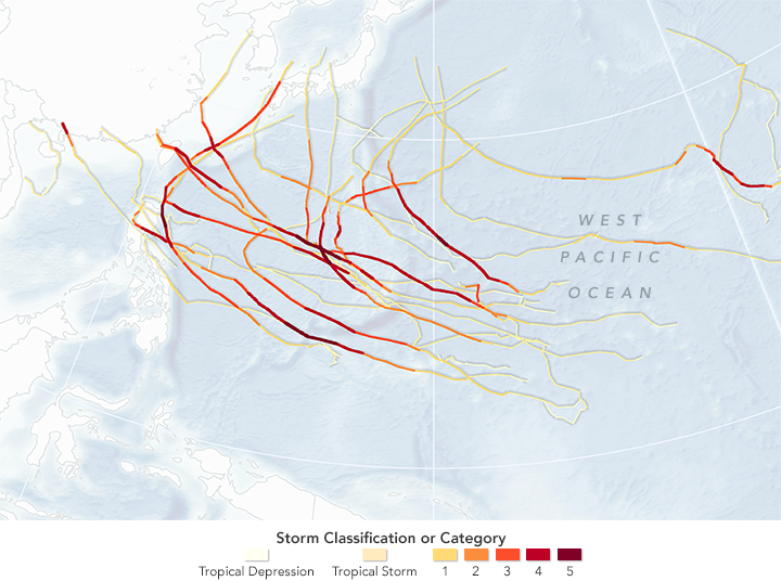
According to meteorologist Phil Klotzbach of Colorado State University, the biggest story was the amount of activity in the middle of the Pacific Ocean. NASA’s Earth Observatory explains:
In the region above the equator from 140 to 180 degrees western latitude — the North Central Pacific — 14 named storms and eight hurricanes formed or moved into the region. (The previous record for the region was four hurricanes in 1982.) Five of this year’s storms reached category 3 or above (major), eclipsing the previous record of three. At one point in August, three major hurricanes spun through the region east of the International Date Line at the same time, the first time any meteorologist has seen such activity.
“The 2015 season broke pretty much every prior record for that portion of the Northeast Pacific basin,” Klotzbach said. “That portion of the basin had record-warm sea surface temperatures and record-low vertical wind shear, a prime combination for hurricane intensification and maintenance.”
One of the more surprising developments of the 2015 season occurred when two cyclones emerged in the Arabian sea. The storms inflicted heavy damage, mostly through flooding, on dry and arid areas not used to dealing with such storms.
And then there was Cyclone Patricia, which produced 322km/h winds, making it the strongest tropical cyclone ever recorded.