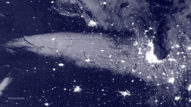
Image Cache: Sure, satellites can track storms and precipitation — but they can also measure snowfall on the ground.
This amazing satellite image shows snow on the ground after the record-breaking blizzard in the US that hit quite a few Midwestern states this weekend. The blueprint-style image above was taken yesterday by a weather satellite, the Suomi NPP, using the satellite’s VIIRS (Visible Infrared Imaging Radiometer Suite) instrument.
How does VIIRS actually see snow cover once it’s on the ground? It uses a snow cover algorithm that makes a good guess at snow based on specific spectral bands, as the scientists who developed it explain in a paper in the Journal of Geophysical Research. It doesn’t do as well when there are clouds, but when it’s clear? You get beautiful images like this one.
