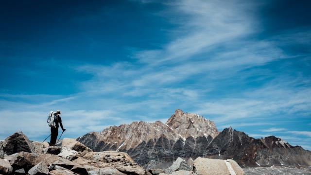
Stretching 320km through the Sierra Nevada, most of the High Route is off-trail, posing challenges both physical and mental as you attempt to navigate dangerous, unmarked terrain. It took us two solid weeks. Worth it? Well, at least the photos came out good.
Brutal. That’s how I’d describe my experience on the Sierra High Route. Each day was a constant physical and mental barrage. We’d fight as hard as we could to stay on track — but often lagged one pass behind schedule each night; only to make up the time, distance, and elevation early the next morning.
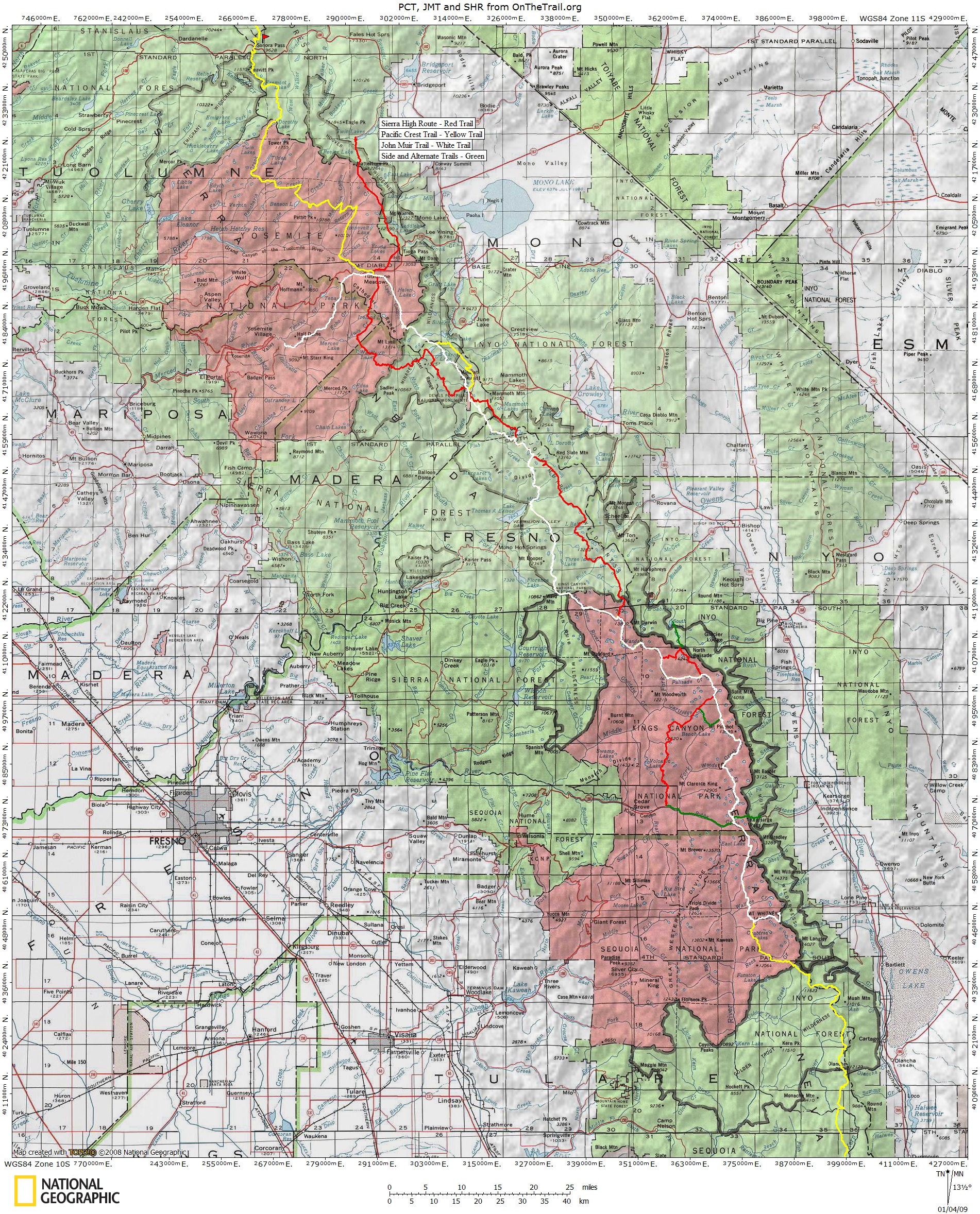
Sierra High Route (in red), courtesy OnTheTrail.org.
I had learned about the High Route last March while shopping for supplies in Bishop at the start of my winter mountaineering course with The American Alpine Institute. It was the book’s title that caught my eye: Traversing Timberline Country. In it, the author — also the route’s creator, Steve Roper — details the adventure.
Only about 60km of the 320km route are on-trail. When High Route hikers do make their way along the beaten path, oftentimes they will be on the JMT. (Photo by Gilberto Gil.)
So, what exactly is the Sierra High Route? Any who have tackled the John Muir Trail weren’t too far off. Both run South-North through the Sierra Nevada. Both clock in at about 320km. Both share the same resupply points. And, for about 50km, they even share the same path. But, the similarities stop there.
Sierra High Route hikers spend more time on rock than they do on dirt. (Photo by Gilberto Gil.)
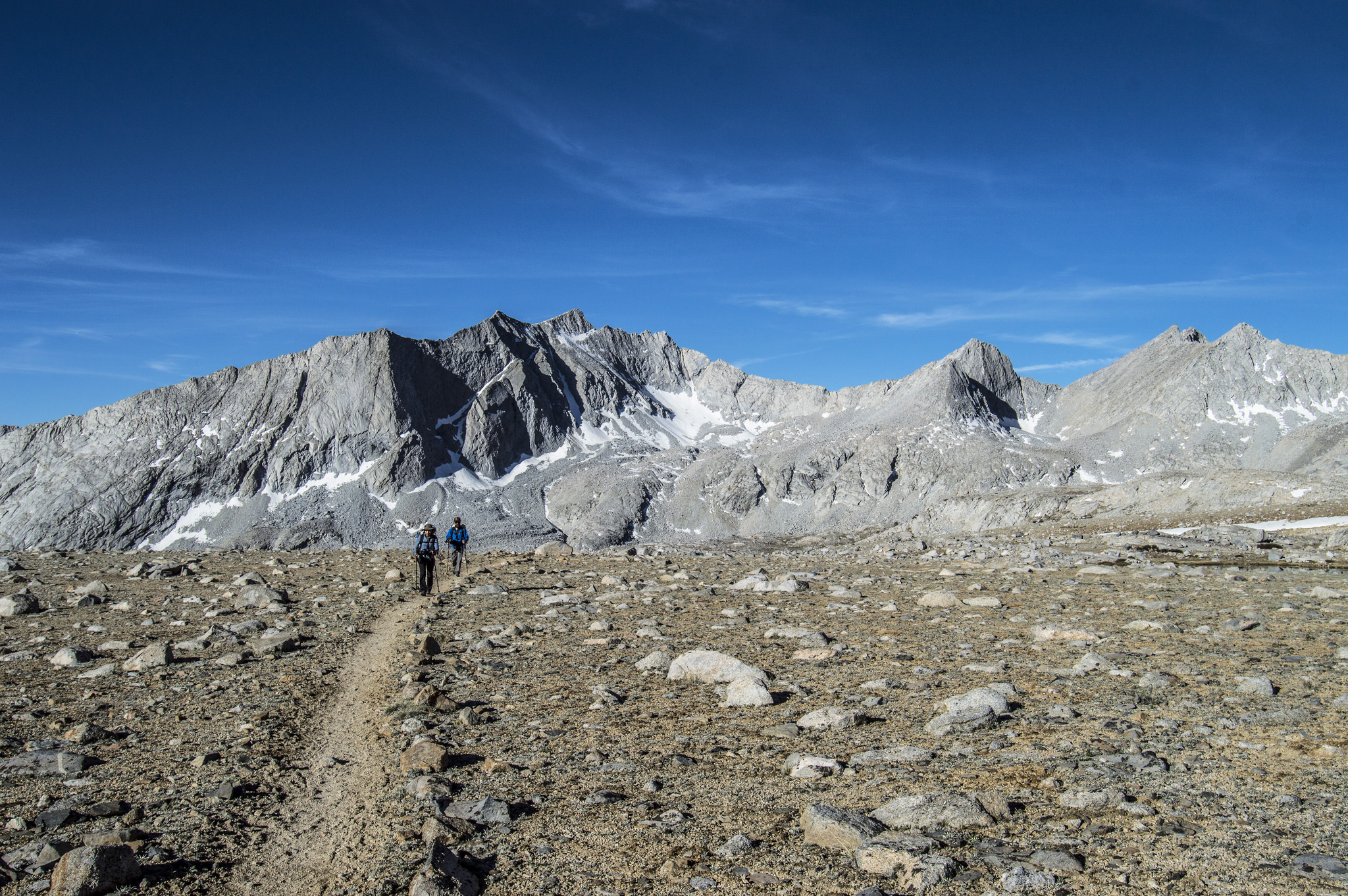
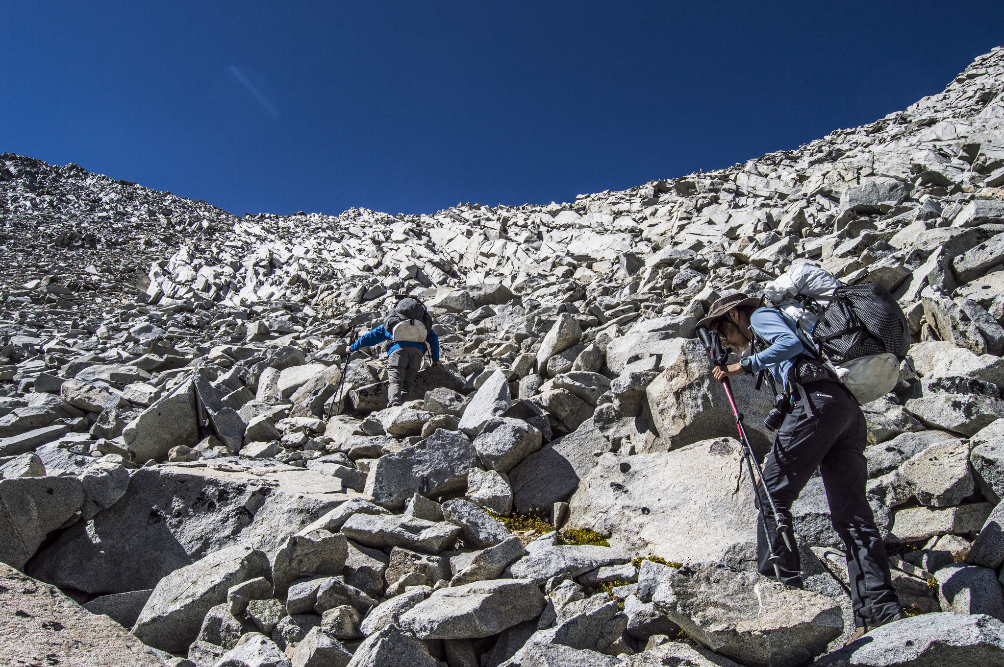
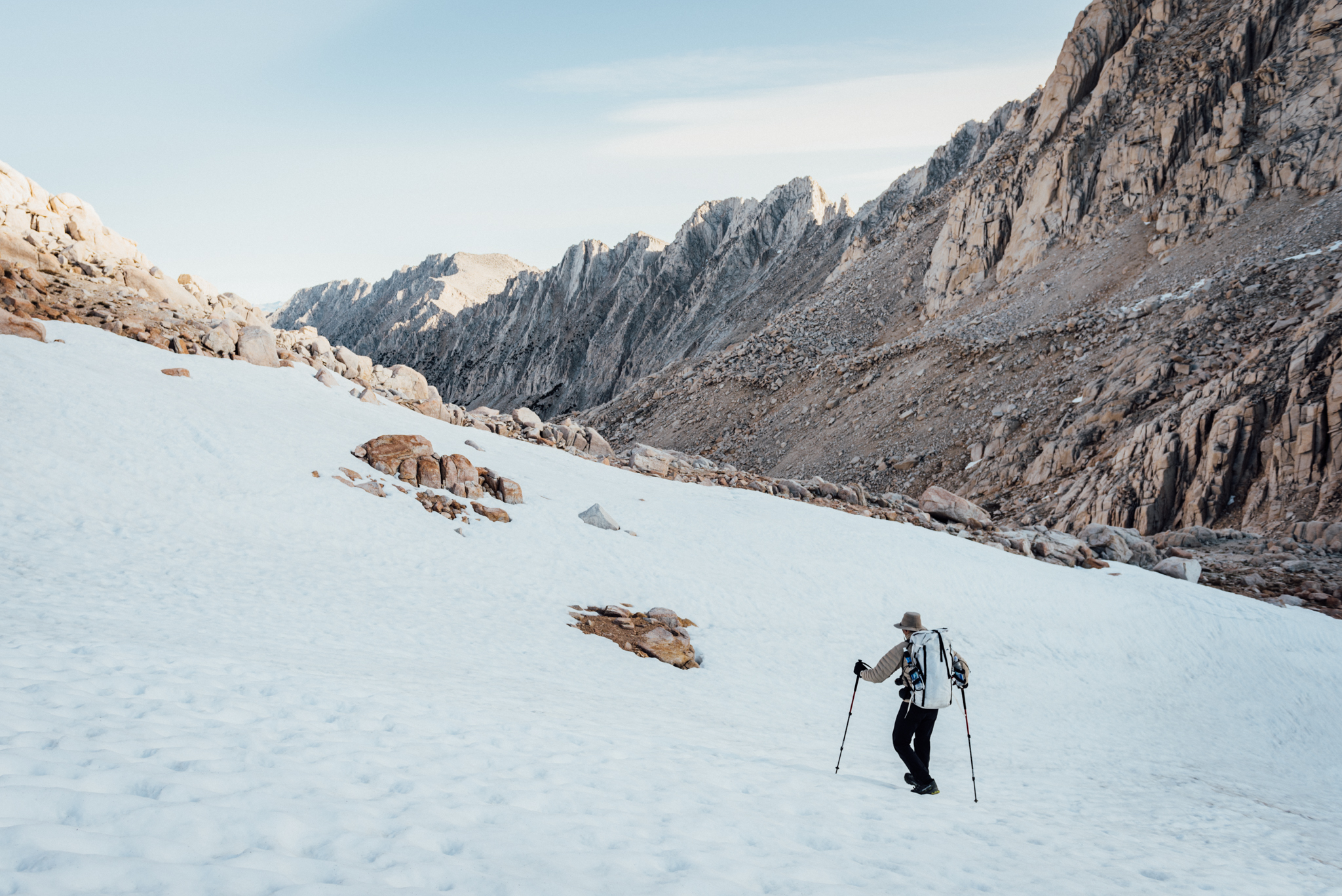
Where the JMT dips low, the SHR stays high, rarely dropping below the treeline; with the exception of just a couple of nights, we slept above 3000m. The SHR rarely touches trail; instead of relying on a well-worn path, trekkers must travel cross country, navigating rugged terrain that requires as much climbing as it does hiking. With more than 30 mountain passes on the route, most ranging from Class 2-3 (non-technical climbing that often requires the use of hands to overcome obstacles) we spent more time on granite than on dirt.
Roper recommends taking a month to complete the SHR; and most tackle it in sections. We’d be doing it all at once; only taking two weeks. Now, it’s easy to see where brutal fits into the picture.
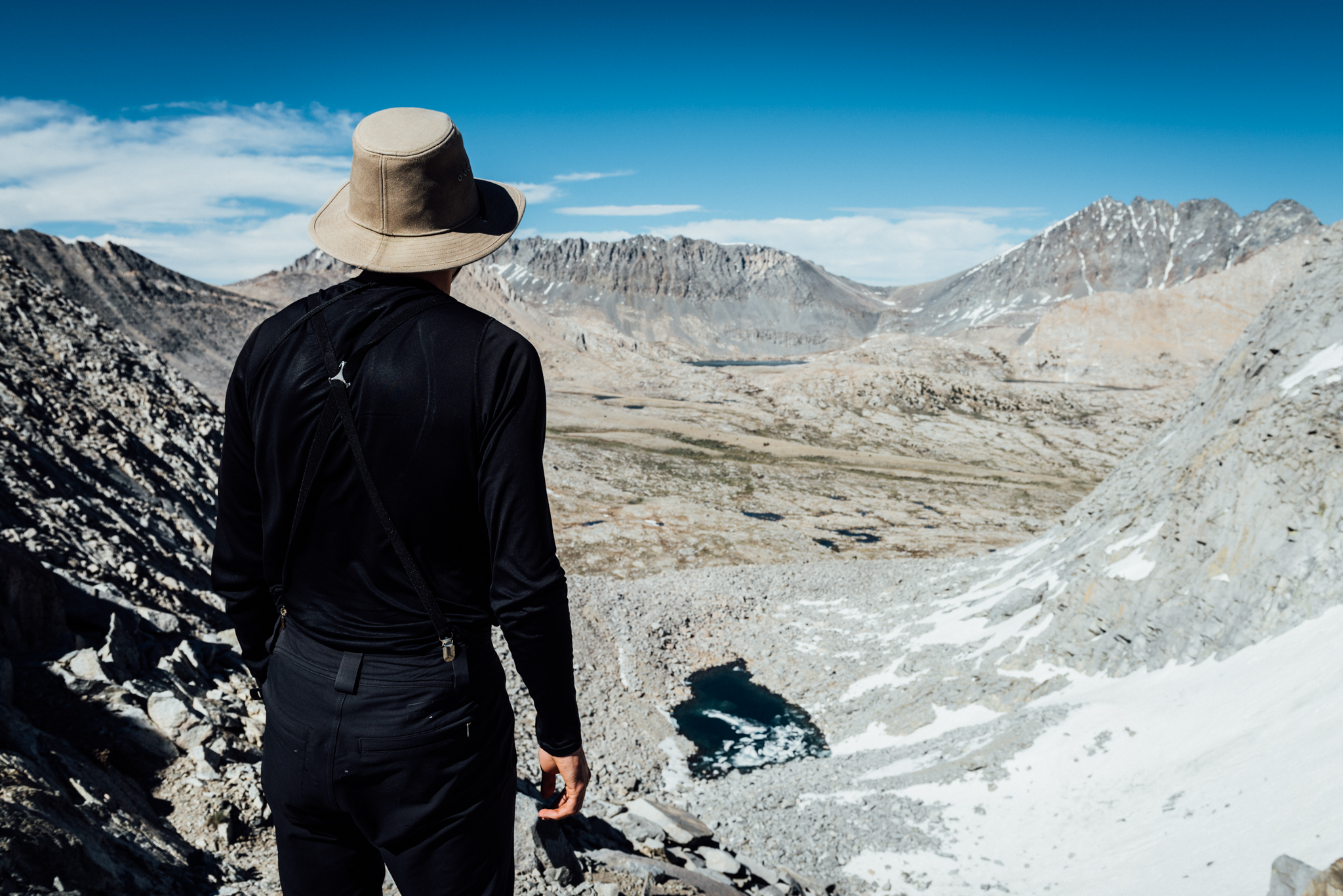
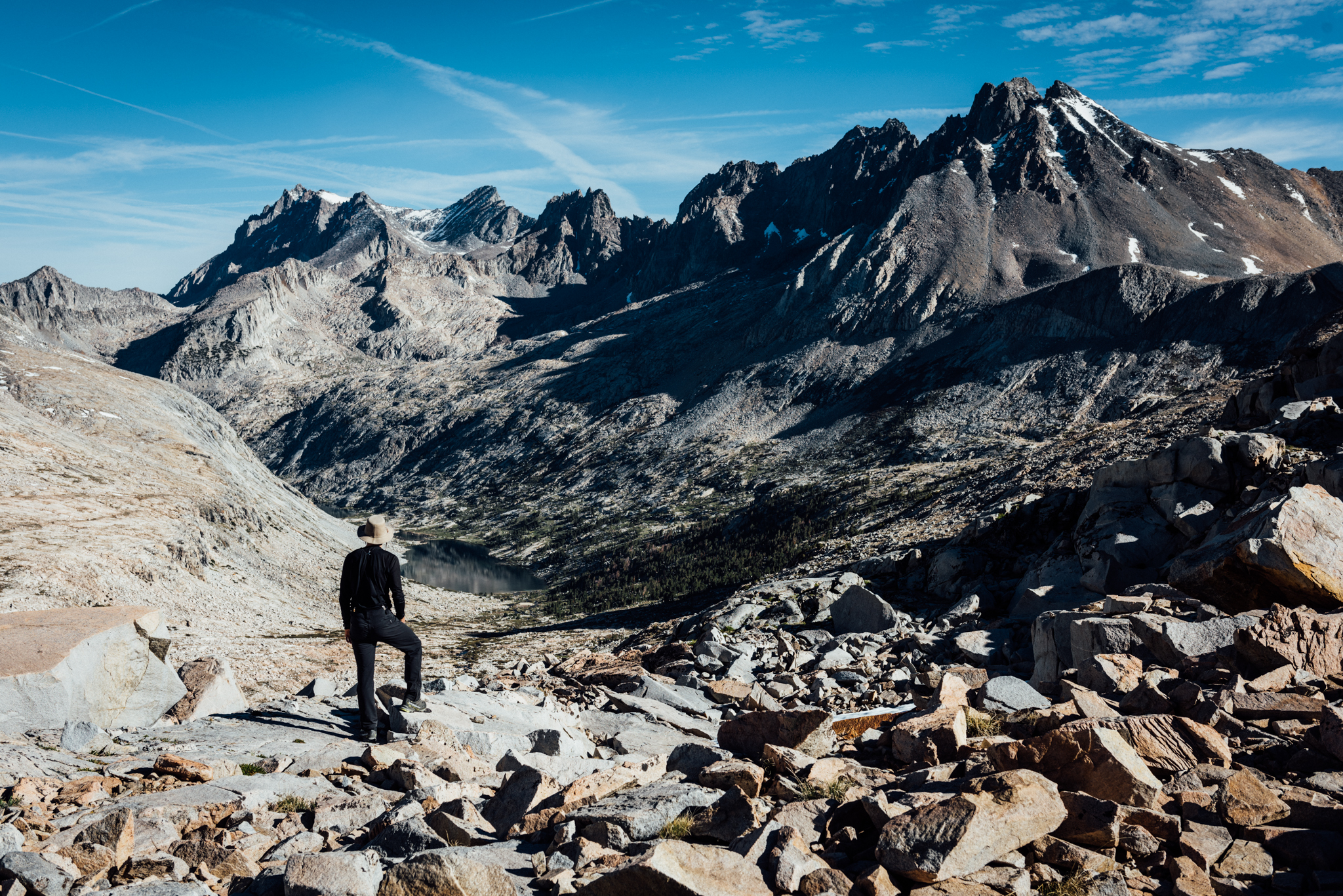
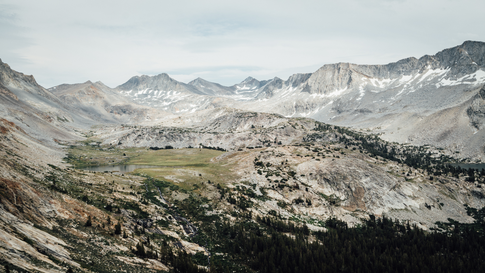
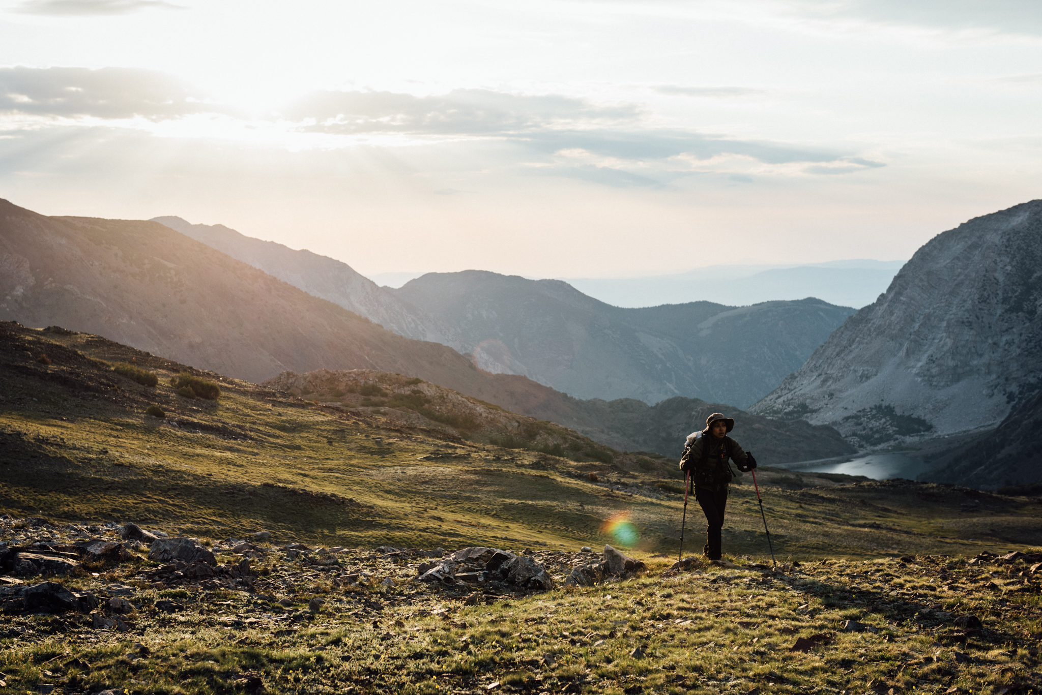
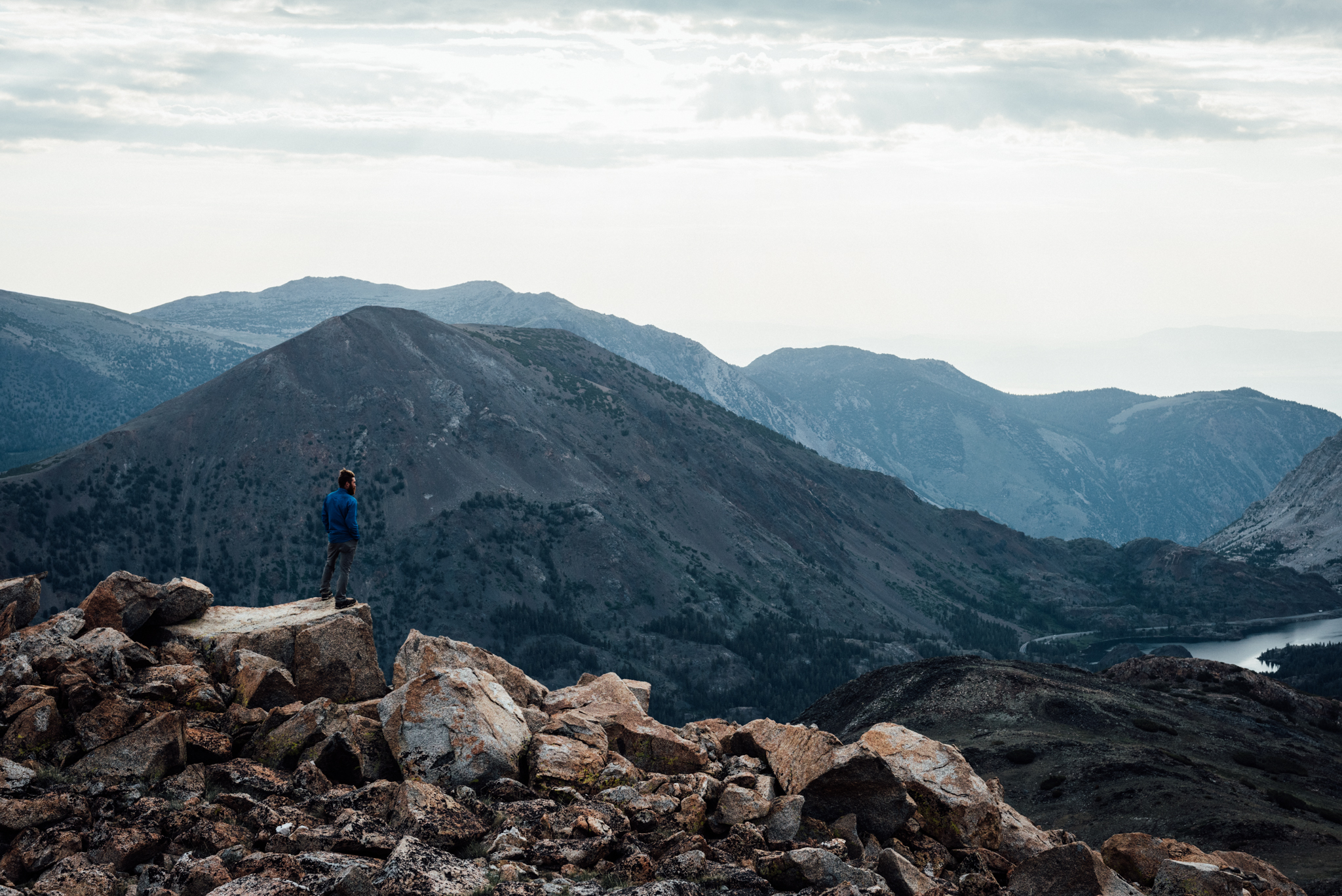
Gil takes a look out over Upper Basin from the top of Frozen Lakes Pass.
Why Go?
You think that trails are too restricting and don’t provide enough challenge. You want to do a long trek through the Sierra Nevada, but you don’t want to deal with crowds on the JMT. You want to experience places that are off the beaten path — actually, you want to go to places that aren’t on the path at all. You prefer alpine landscapes to swaths of trees. If any of those reasons sound appealing, then the SHR would be worth checking out.
Week One
After a five hour long drive from LA, we arrived at Road’s End in King’s Canyon National Park at 9am. Olivia’s gracious mother had not only gotten up at 3.30am to drive us, but she’d be taking the trip back home alone.
Our permit had us entering the wilderness the following day, but since we were there early we decided to get a jump on the route. The station ranger would allow us to change our permit after 1 pm, so we got a ride a few kilometres back to Cedar Grove to eat breakfast before hitchhiking back to the station. By 1:30 pm, we set foot on the route — 13km of trail with nearly 1524m of gain; topping out for the night at 3048m. The next morning we got up at 5am; went cross country for the first time. We wouldn’t see trail again — or people — for days.
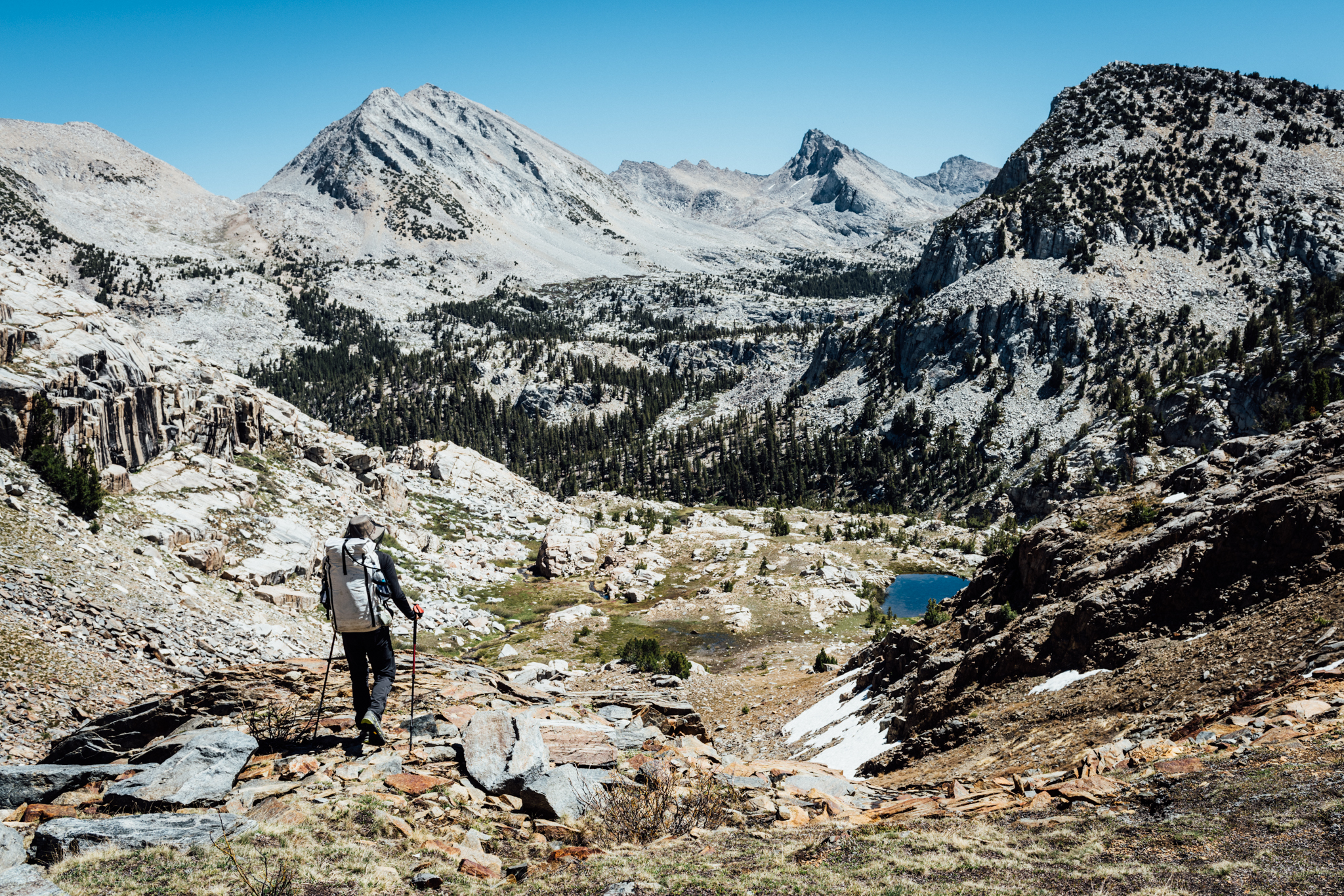
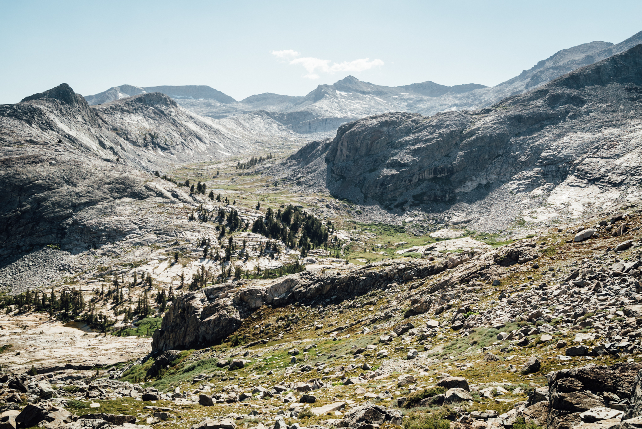
From the top of Windy Ridge, we caught a great view of what the next few days had in store.
The first day was rough. I hadn’t been backpacking in a while and wasn’t in the best shape starting out. Regardless of physical condition, 1524m of gain in 13km with full packs during the heat of the day isn’t easy. The worst part about the day, however, was that it only represented half of Gil’s “day one” itinerary for the trip. That is, our “day two” — 20km and 1067m of gain; 914m of descent, all cross country — was still supposed to be part of day one. The fact that it took us so much longer than anticipated to travel 29km was a crushing blow that would haunt us throughout the entire trip.
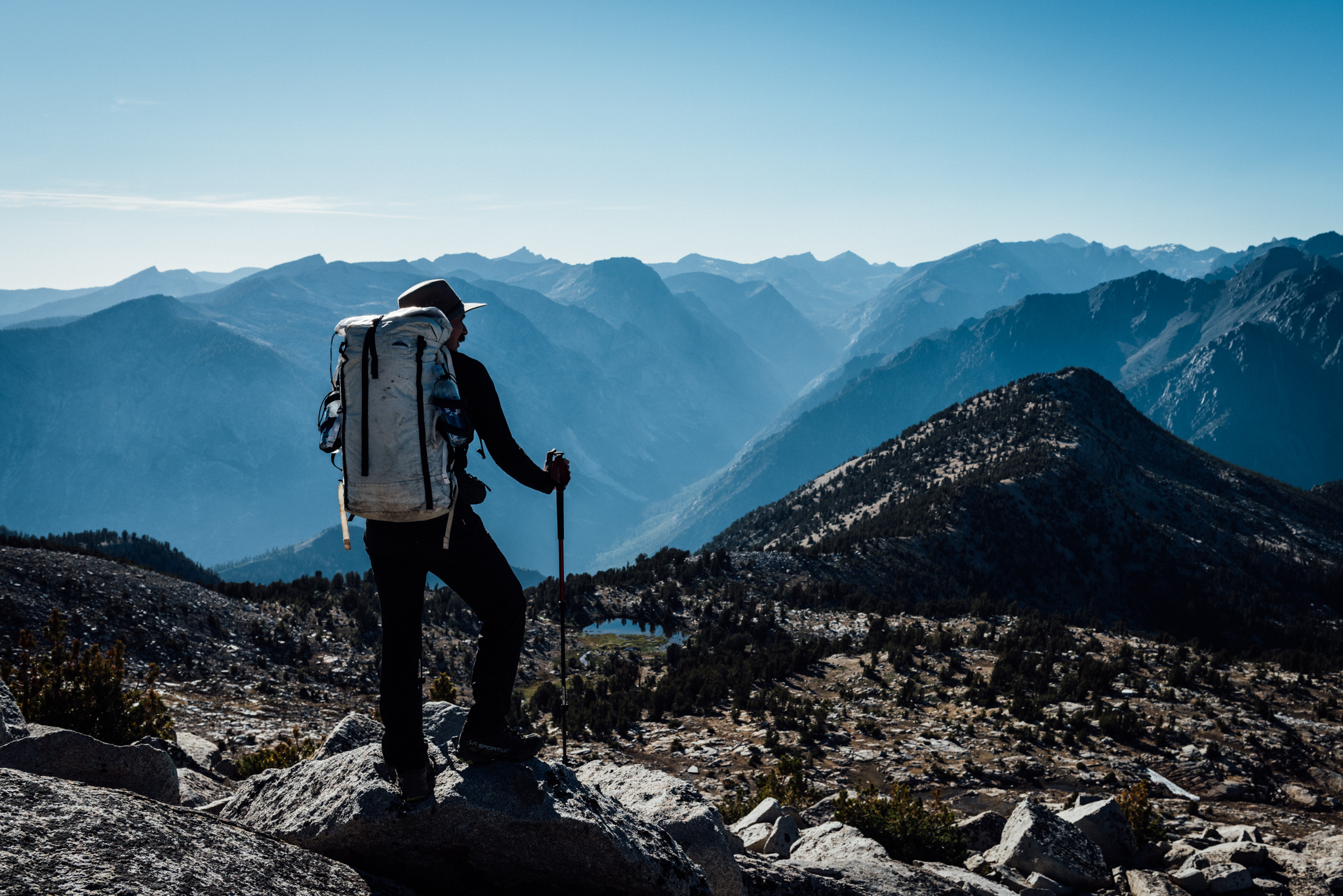
Gil points out The Palisades to our east.
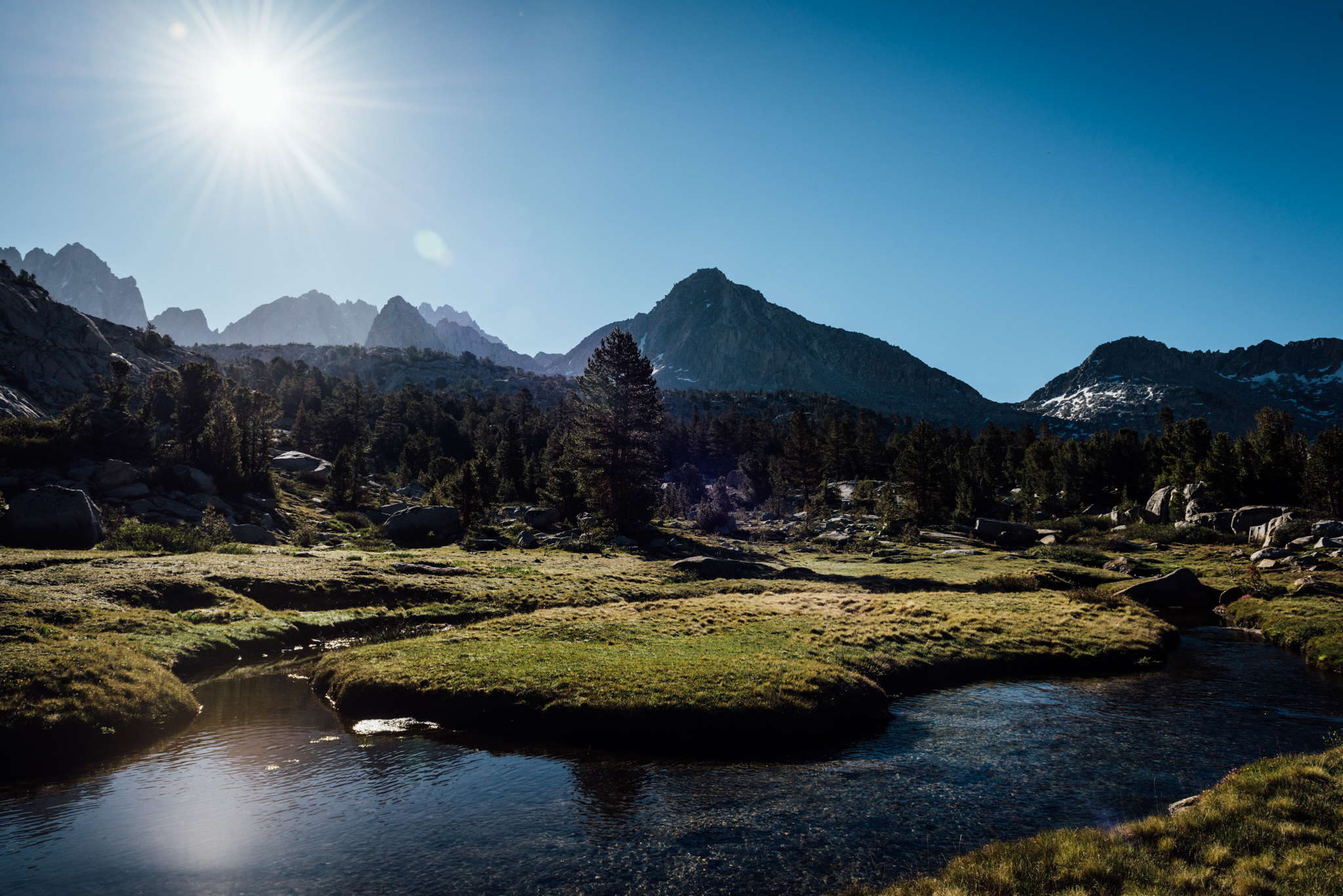
The sub-alpine landscapes we encountered once going off-trail were stunning though; with a solid night’s rest we continued trudging along, fuelled by beef jerky, Cheetos, and Gu. Eventually we reached the Windy Ridge, a vista which provided stunning 180-degree panorama views of the High Sierra we’d traverse over the next few days. The Palisades — some of California’s most rugged and beautiful fourteeners — were visible to the northeast; we’d be passing through that region in a couple of days.
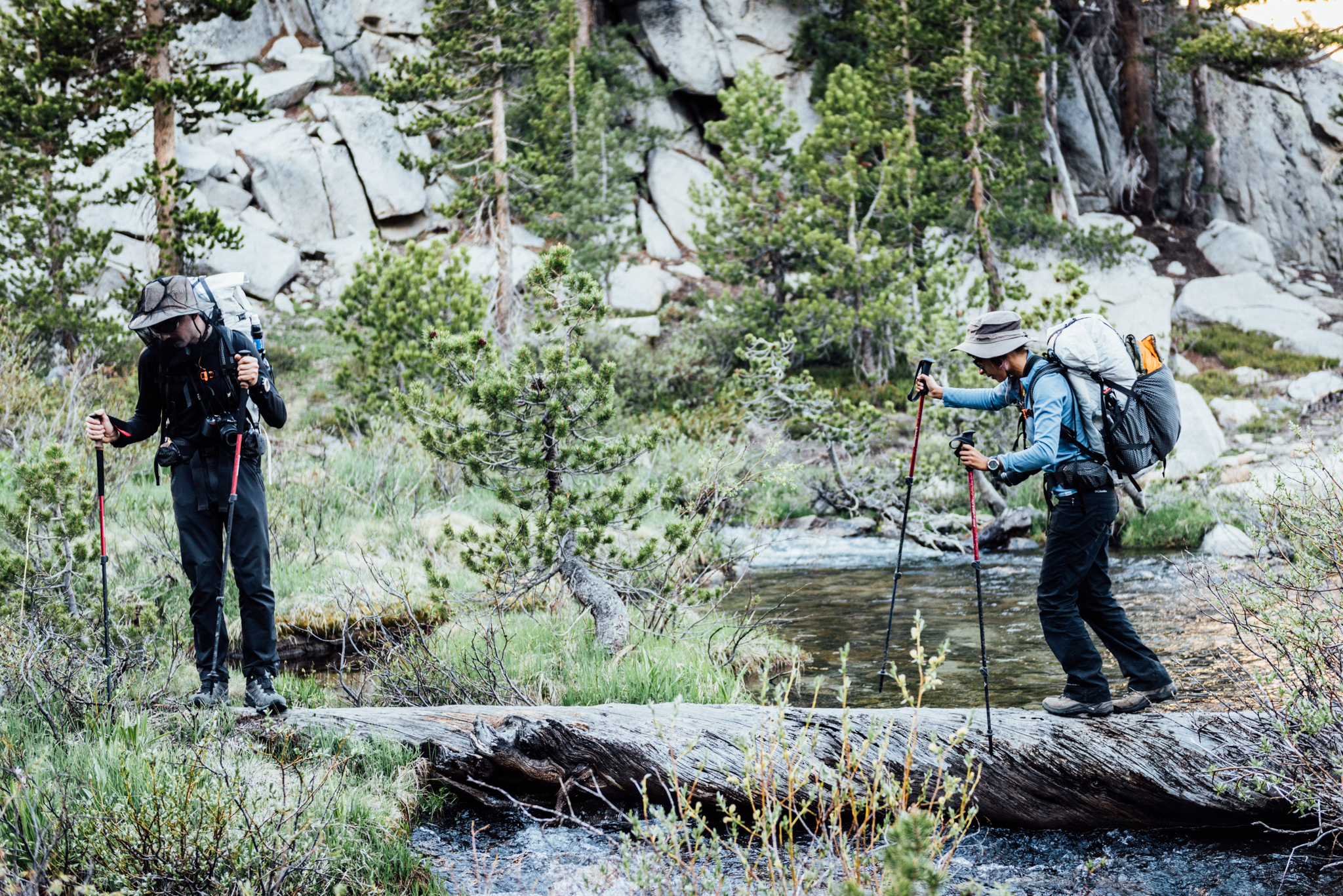
Since most of our hiking was off-trail, we had to find natural bridges whenever water crossings were necessary.
The next morning we dropped down from our campsite at 3350m to Grey Pass at 3261m. We continued dropping, passed through some forest, crossed a stream, and started heading back up toward our next objective — White Pass, at 3566m. From White Pass we could see Red Pass, where we’d head next. Instead of dropping into the valley below, just to immediately gain the elevation back, we continued heading up and traversed along the scree slopes and snow fields, another pass down.
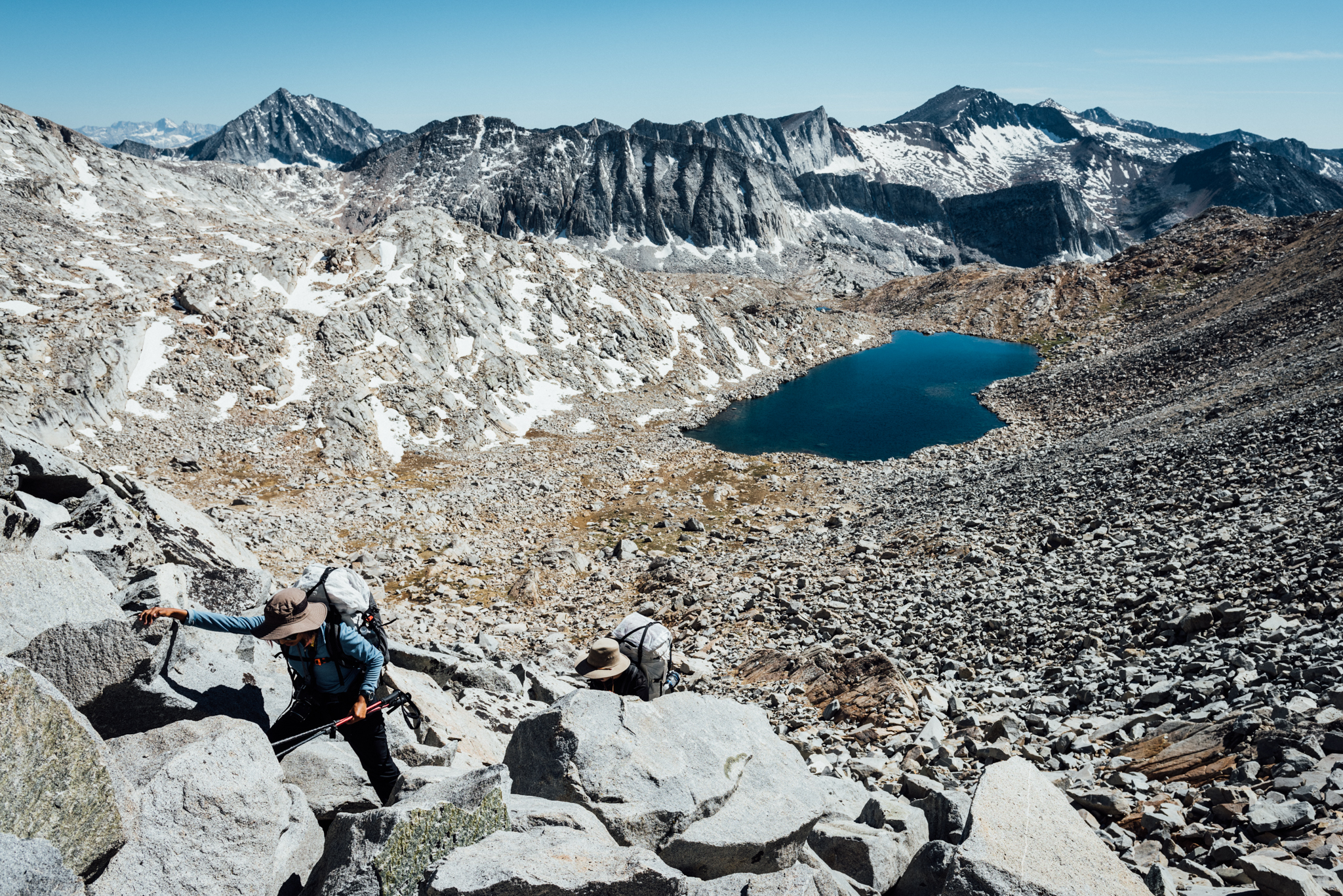
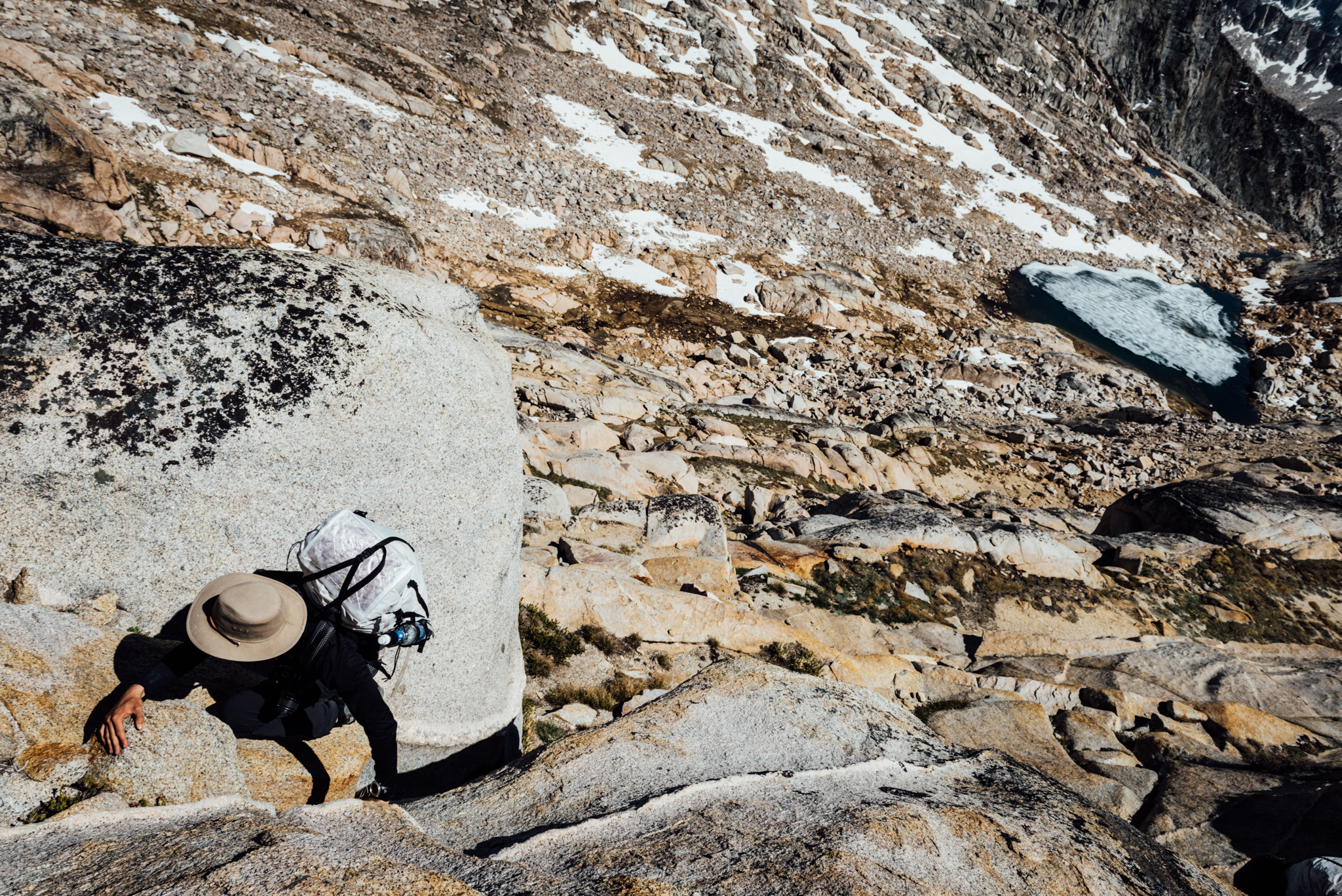
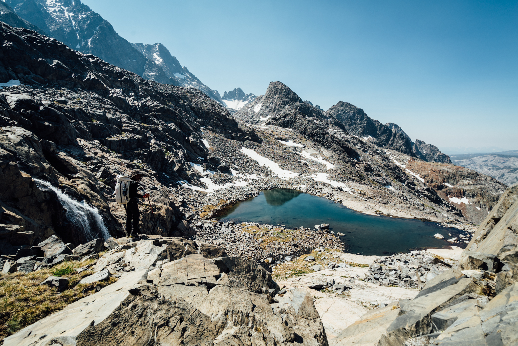
Frozen Lakes Pass was the furthest visible point as we descended to Marion Lake.
From Red Pass we dropped down to Marion Lake which was beautiful, but infested with mosquitoes. We breaked only long enough to jump in before the pests overwhelmed us and we continued on our way. With three passes down, there was only one more to tackle that day.
Most passes on the High Route required the use of hands for climbing.
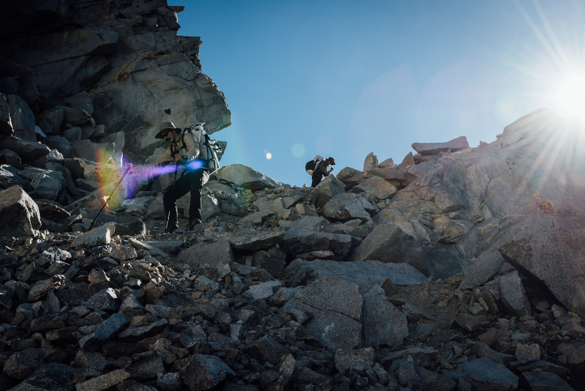
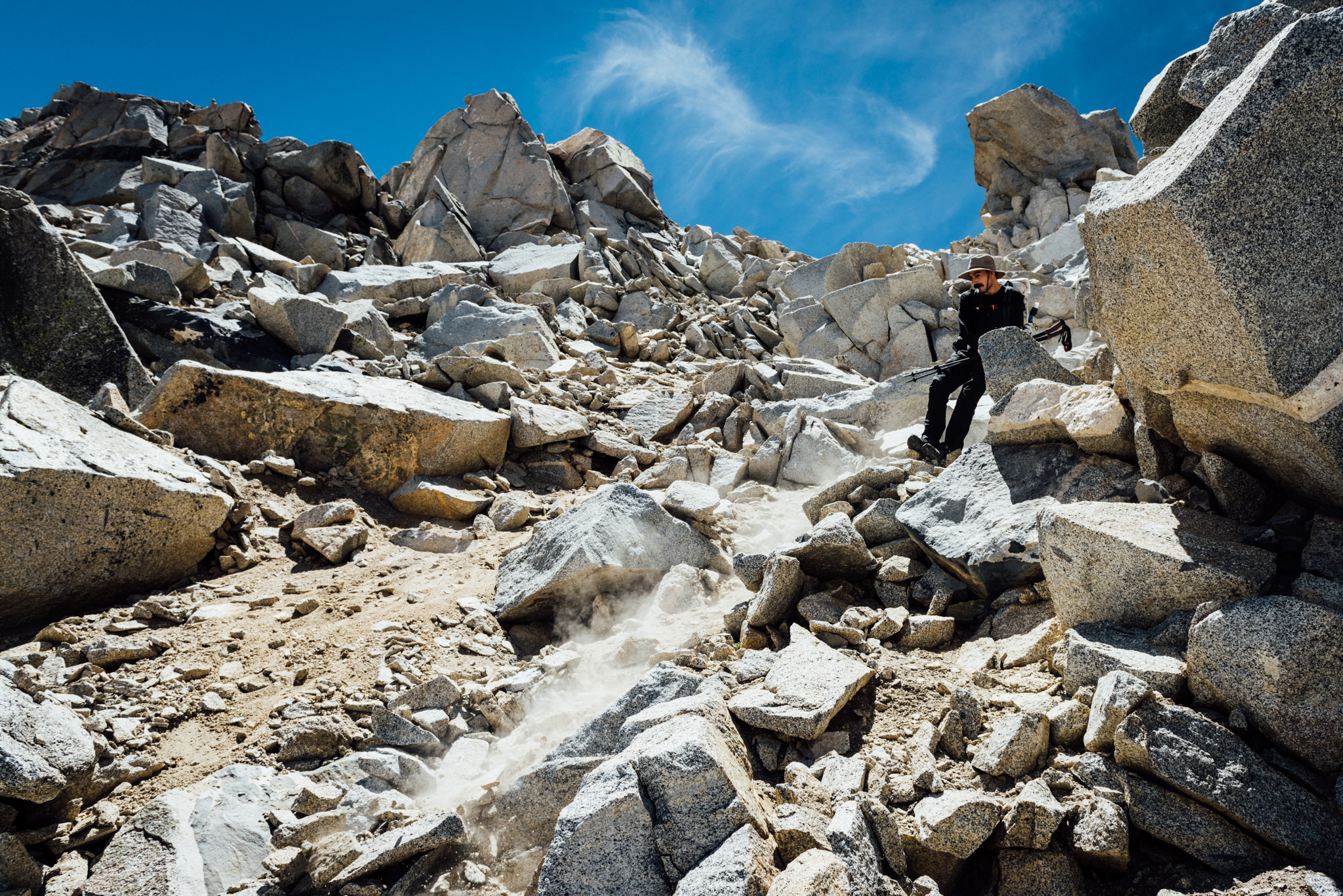
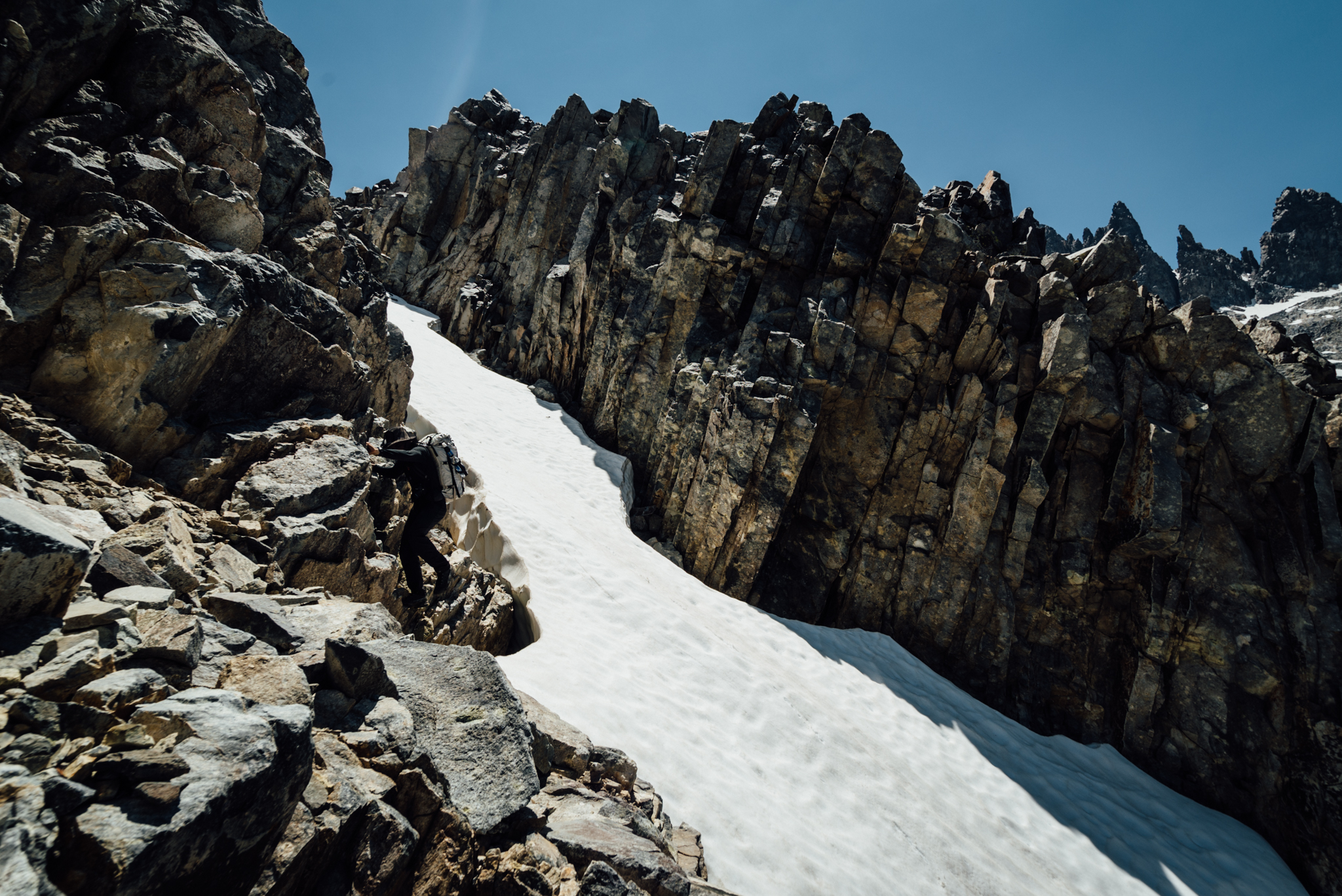
In his book, Roper describes Frozen Lake Pass as one of the two most difficult passes on the route. He wasn’t joking. The ascent was defined by steep, loose talus; the boulders were small enough to easily be dislodged — but large enough to break a leg. All of the expansive Upper Basin could be seen from the top of the pass; we’d be hiking through there the next morning. But first, we had to get down.
Sketchy.
The descent was steep Class 2-3 rock; as Roper promised, it was extremely unstable. We set off a couple of small rock slides coming down the initial slope. Below that was a boulder field. Then there was another 90m talus slope that was equally treacherous. Finally we arrived at camp with barely enough time and energy to set up our shelters and eat before nightfall came.
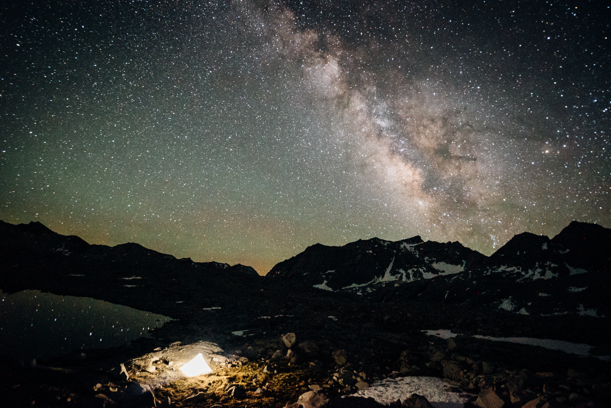
I woke up at midnight to grab a shot of the Milky Way spiralling overhead. The Sony A7S‘s specialised sensor was designed to provide maximum sensitivity for capturing the stars at night. (30 seconds, f/5.6, ISO 16,000)
A full night’s rest wasn’t nearly enough time to recover from the previous day’s physical barrage, so we got a late start at 7am. Fortunately, the first 13km of our fourth day would be on trail.
The top of Mather Pass provided an excellent view of the Palisades.
With our cross country conditioning, we blazed up the JMT at a solid 5.5km/h; the top of Mather Pass was reached in no time at all. We stopped at the top long enough to eat some snacks and answer questions from JMT’ers about the High Route before taking the well-groomed switchbacks down to Palisade Lakes.
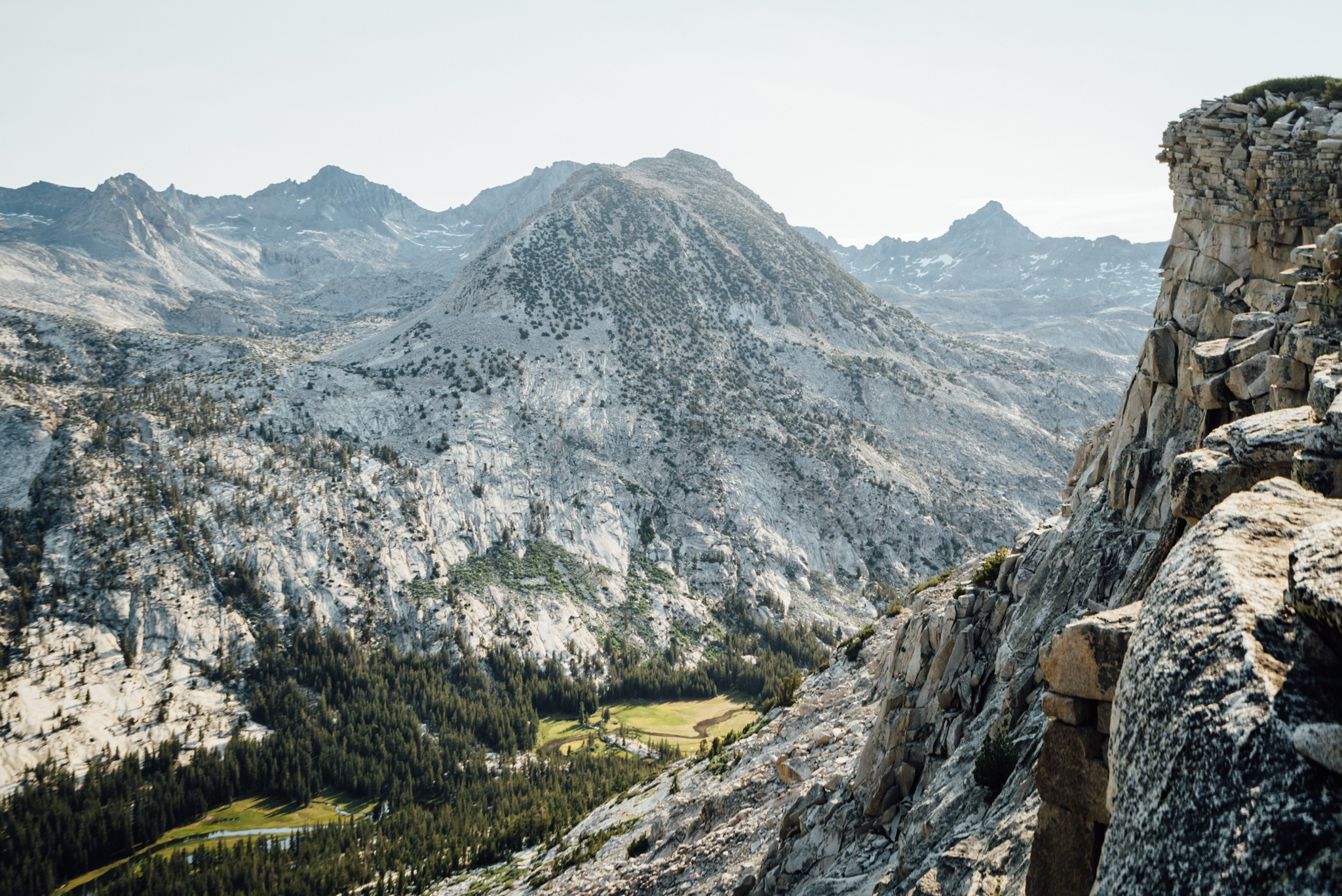
Granite ramps provided a straightforward path to the top of Cirque Pass.
At the north side of Palisade Lakes we headed back off trail; immediately climbing up toward our next destination, Cirque Pass. Three hundred vertical foot sections of scrambling were separated by small meadows and tarns (small, snow melt fed alpine ponds,) all the way to the top of the 3688m pass.
The Palisades towered above Glacier Lake.
From the top we had a stunning view of Mather Pass behind us, and the Palisades in front — but up close and personal this time. The massive Glacier Lake was situated directly below Cirque Pass, so we climbed down the slabby Class 2-3 section before making our way around the still-frozen body of water.
Gil scrambles up Potluck Pass with Glacier Lake in the background.
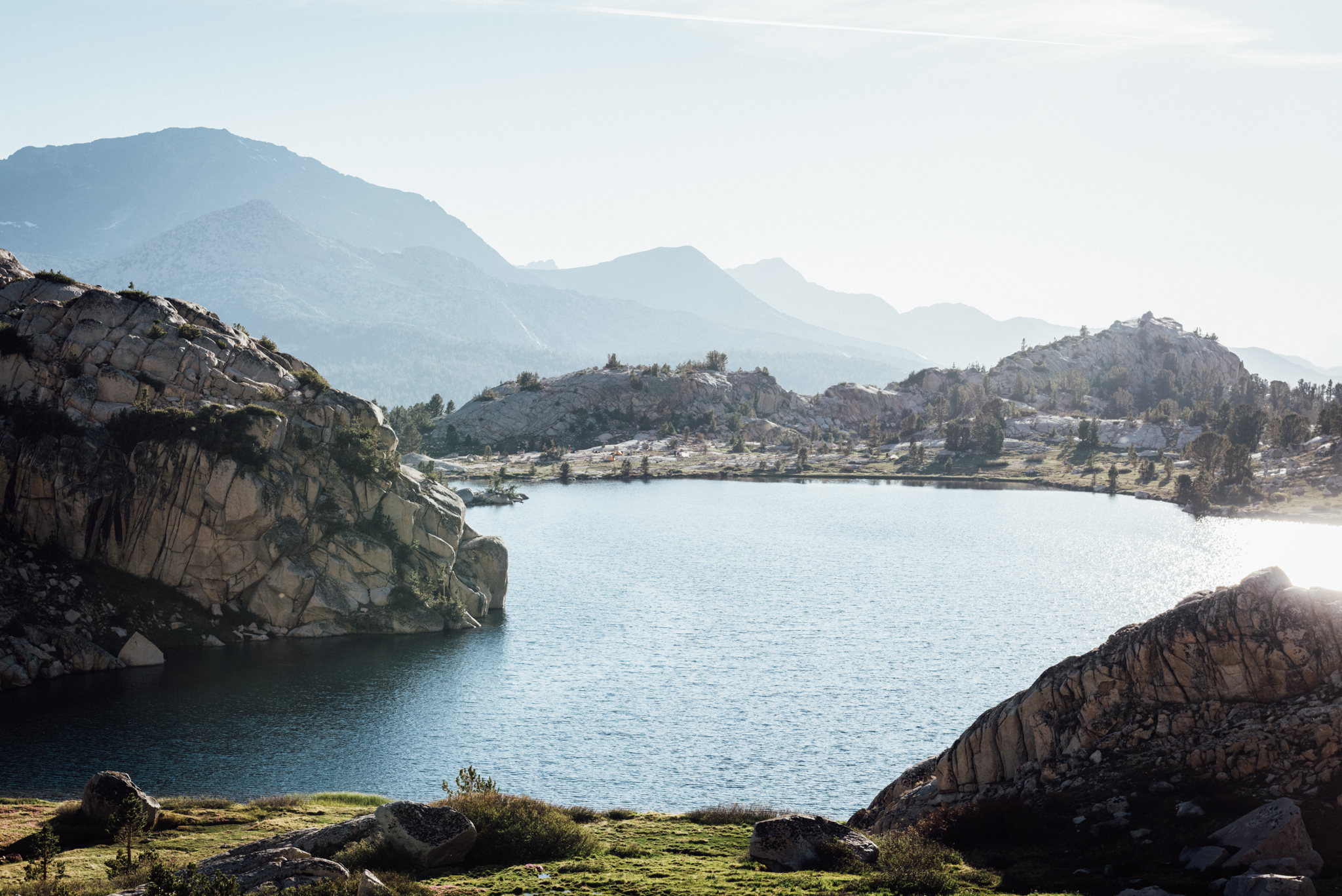
Potluck Pass was next. Route finding proved a little more difficult here, but before long we were scrambling up to the top, leaving the Palisades behind. Knapsack Pass, our final objective for the day, was in sight on the horizon. We spent the next couple of hours hiking across the gently sloping glacial basin in order to reach it. The landscapes we encountered along the way looked incredibly similar to those that I experienced while cross country hiking in Norway: streams and lakes littered mossy meadows; rounded granite boulders were strewn throughout. The only difference was that this basin was surrounded by jagged giants.
Running low on sunlight and energy, we opted to stop for the night just below Knapsack Pass. We’d tackle it first thing in the morning. Mosquitoes were terrible and we were exhausted, so we ate a quick meal and wasted no time crawling into bed.
Have you ever seen a more pristine sub-alpine landscape?
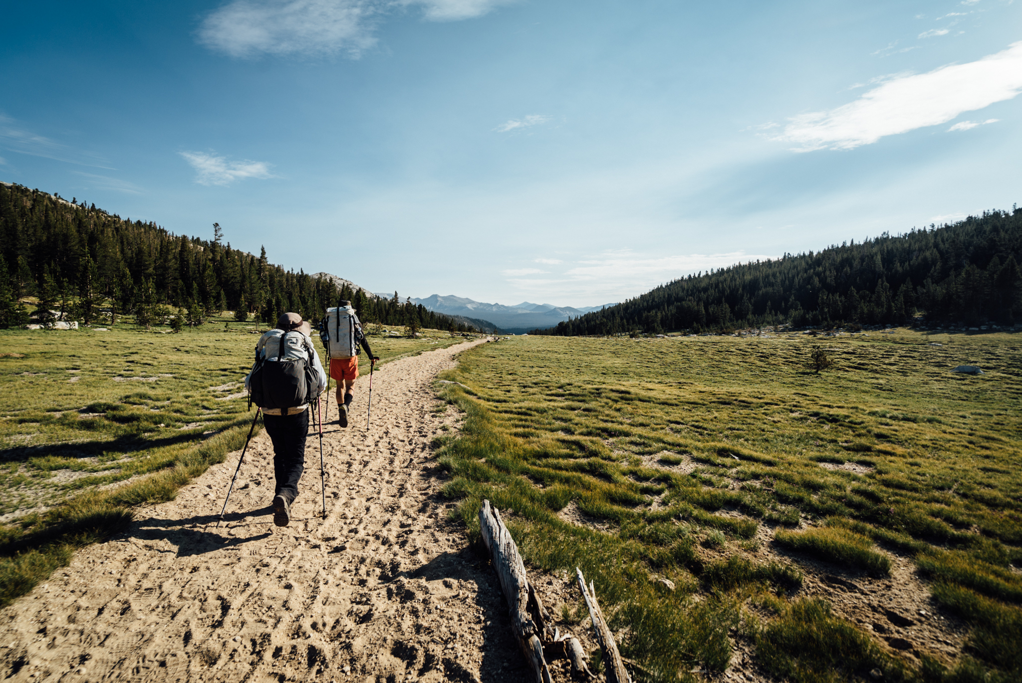
Another pre-dawn start. Knapsack pass was a pretty straightforward Class 2 climb; the descent into Dusy Basin wasn’t too bad either. Once we reached the lakes below we jumped on trail and started knocking down about 30km in total.
The trail was full of dirty and entitled northbound Pacific Crest Trail hikers who took every opportunity to inform others along the way that they themselves were the only true thru-hikers — JMT’ers need-not apply. Their perplexed looks upon receiving information that “No, we’re not doing the JMT, we’re doing the High Route” offered plenty of opportunities for enlightenment: “Your PCT hike might be good practice for the SHR, but don’t get used to seeing cairns.”
Eventually we reached Muir Pass, which afforded completely treeless panorama views of the alpine valley below. From there, we descended into Evolution Basin, which rivalled western Norway in its beauty.
Evolution Basin rivalled the fjords of Norway with its beauty.
Alpine lakes surrounded by lush green meadows reflected jagged monoliths from every direction. Layers upon layers of mountains faded into the atmosphere while polished granite boulders glistened in the evening sun. After hiking about 30km, Evolution Basin would be our paradise for the night.
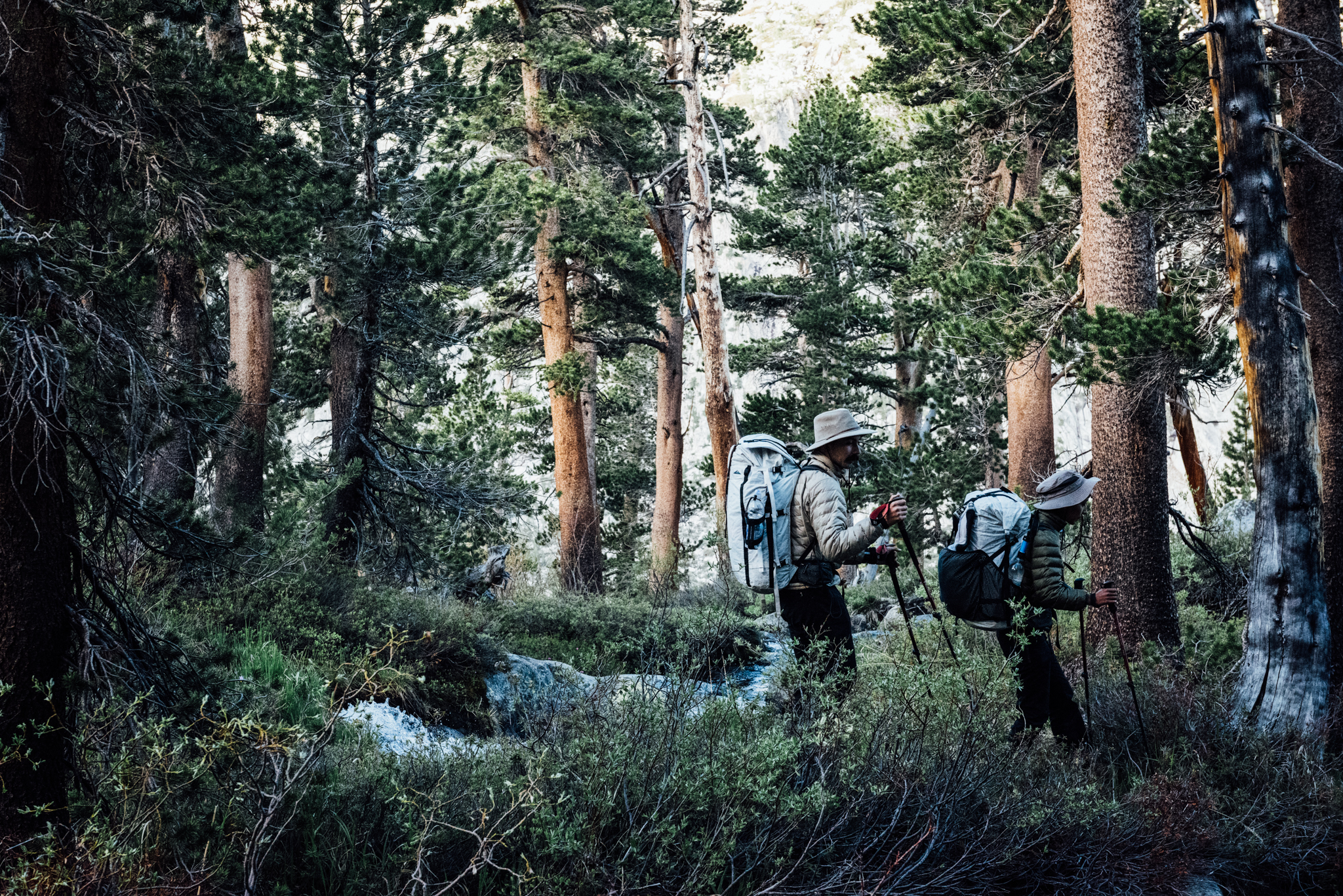
We wandered through the forest shortly after leaving Evolution Basin, one of the few times we were ever fully in the trees.
The next morning we hit the trail by 6am sharp; started going cross country by seven. Snow Tongue Pass — the other one of the two most difficult passes on the SHR — was our next objective.
Snow Tongue Pass would better be described as “Sketchy Arse Pass.” Rock falls were waiting with every step.
As was the case with Frozen Lakes Pass, Snow Tongue wasn’t so bad going up, but the north side was comprised of extremely steep, loose talus, with just enough sand to make things slippery. Rock falls were inevitably set off as we climbed down, but we had the foresight to space out enough that they were not problematic. After getting off the main slope we traversed another boulder field comprised of car-sized stones and continued dropping down into Humphrey’s Basin; our first steps into the Sierra National Forest.
Mt Humphreys, as viewed from Desolation Lake.
The first section of Humphrey’s Basin was incredibly stunning; almost fairytale-like in feeling. Jack rabbits bounced along the meadows, which were speckled with purple and yellow flowers. Waterfalls broke up a large stream, while a couple and their dog fished below. Mount Humphreys, one of the Sierra Nevada’s most imposing peaks, towered overhead.
As we hiked, the landscape quickly transformed into a barren tundra that more closely resembled Mars than the earth we had just been passing through mere hours before. Soon we reached Desolation Lake — who’s expansive shores would be our home for the night. Though we remained one pass behind, each kilometre ticked off more easily than the one before.
The next morning we chased a coyote up Puppet Pass, but our two fewer legs were clearly no match for the animal’s agility. Still, the three of us reached the top within 30 minutes. The north side of the pass was steep, but more stable rocks allowed for a swift descent.
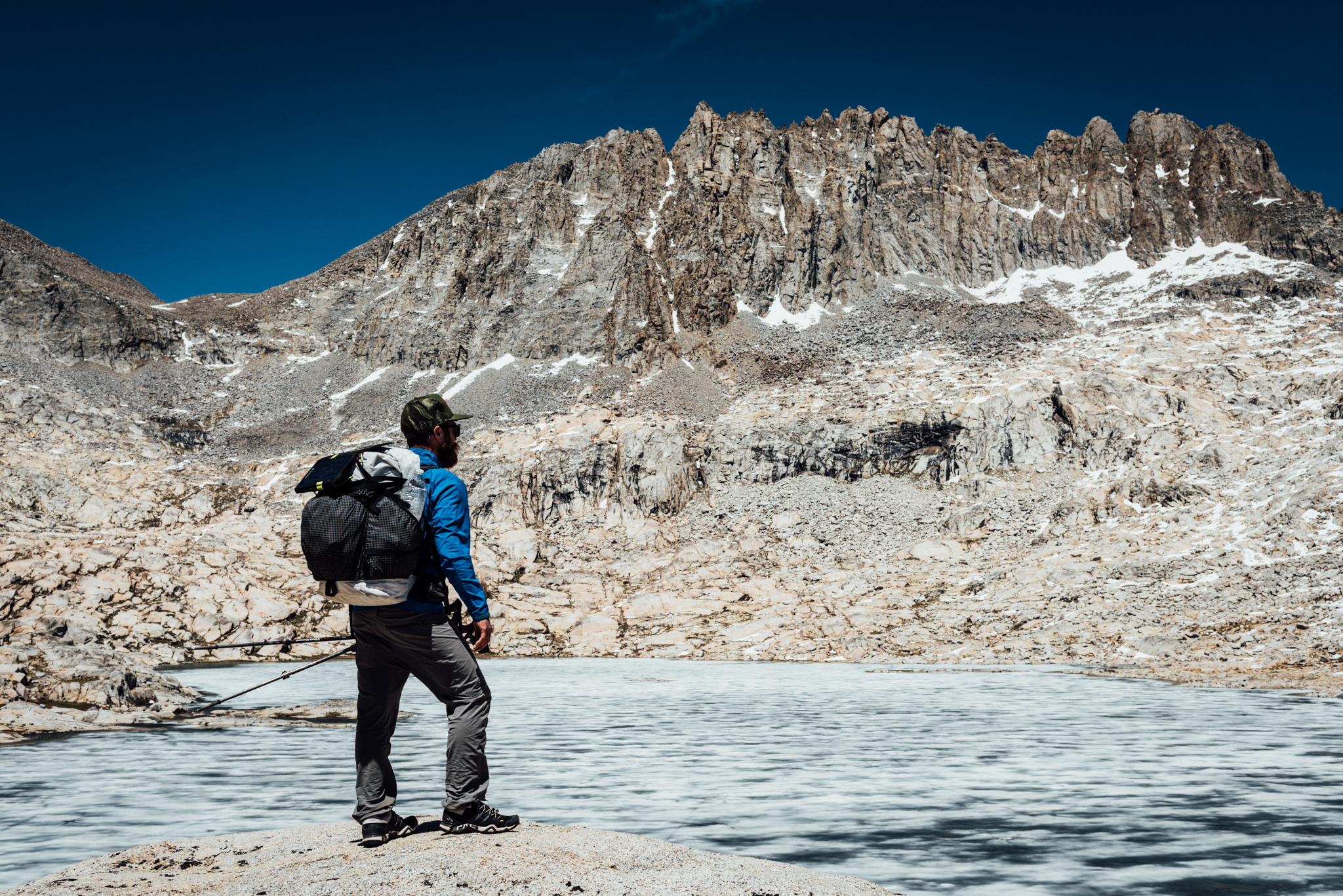
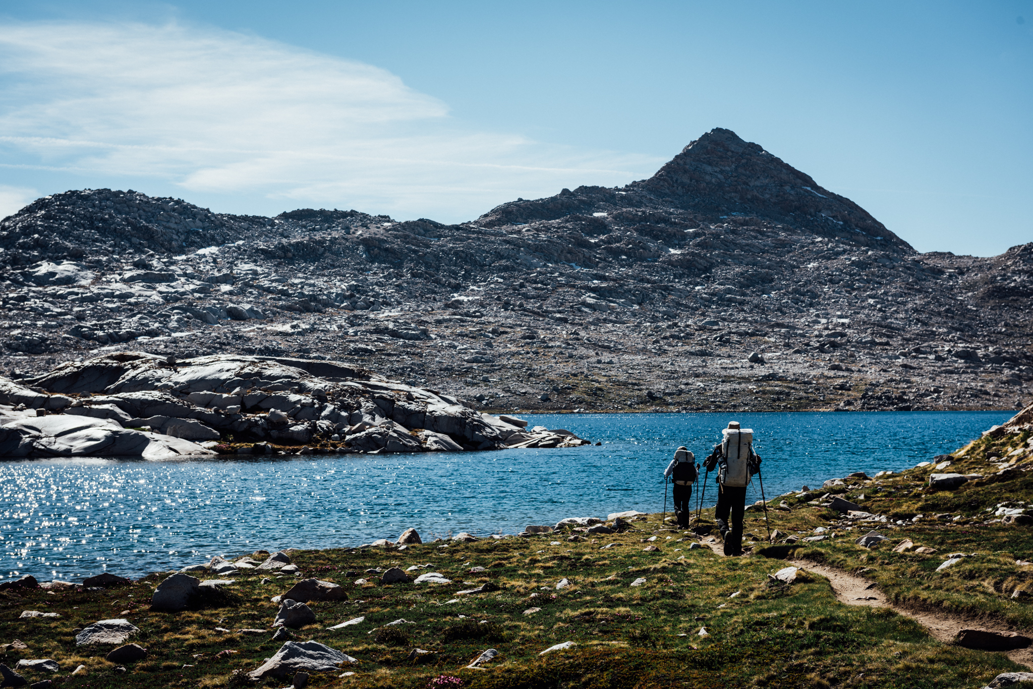
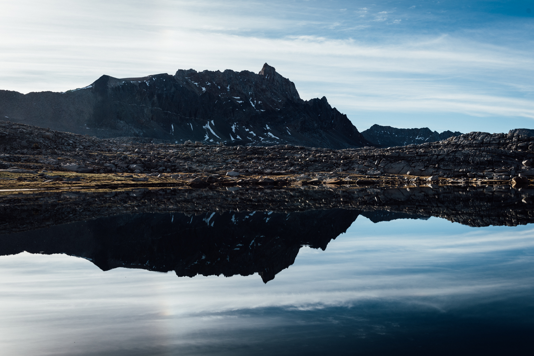
Roper described Lake Italy as uninspiring, but I rather enjoyed the views as we hiked around its banks.
The next several kilometres of travel were relatively uneventful, that is until we missed a small section of trail that led to Bear Lakes Basin, supposedly one of the High Route’s more scenic sections. Instead, we had continued east, circled around a couple of lakes and peaks, hit a different pass, and finally dropped down to Lake Italy — back on track. Missing Bear Lakes Basin was a disappointment for Gil, as it’s a relatively difficult section of the Sierra to reach; we should have passed right through. Taking one’s own path is part of the High Route allure, however.
At less than a kilo, the Cuben Fibre Hyperlite Mountain Gear Echo 2 ($US675) provided incredibly waterproof, durable shelter for two.
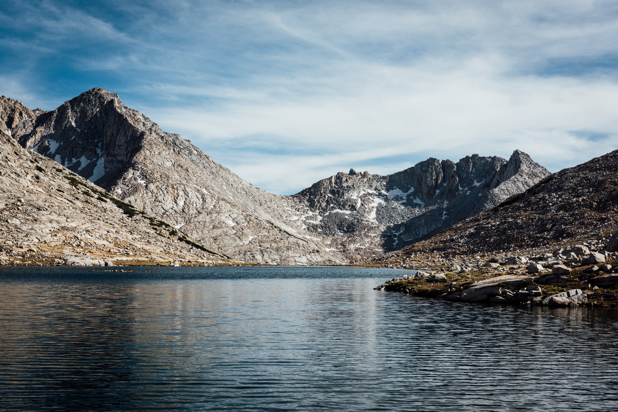
At 3km long, Lake Italy was utterly massive; the only safe way around it was to go left, and circle around to the back side. The route to the right was much shorter, but according to Roper, laden with massive, loose boulders that were far too treacherous to cross. We set up camp once we reached the opposite side of the lake, still one pass behind.
Resupply day. Our destination, Vermilion Valley Resort, which rested on the shores of Lake Edison, was 30km away. The first 16km would all be cross country; the remaining kilometres would all be on trail. With our packs lighter-than-ever and our conditioning stronger than before, we made quick work of the day.
Stubborn snow fields remained on the north side of Gabbot Pass.
First we tackled Gabbot Pass. The climb was relatively easy; snow fields on the other side provided a taste of winter’s cool relief. From there we started dropping down. Down, down, down. I picked up the remains of an ancient trail; we followed it through the gnarled timberline country, skirting granite slabs alongside a raging waterfall. Finally we levelled out and picked up a proper trail at about 2682m, the lowest we’d been since the beginning of our trip. Back on the beaten path, we kept a cool 5km/h pace for the next couple of hours.
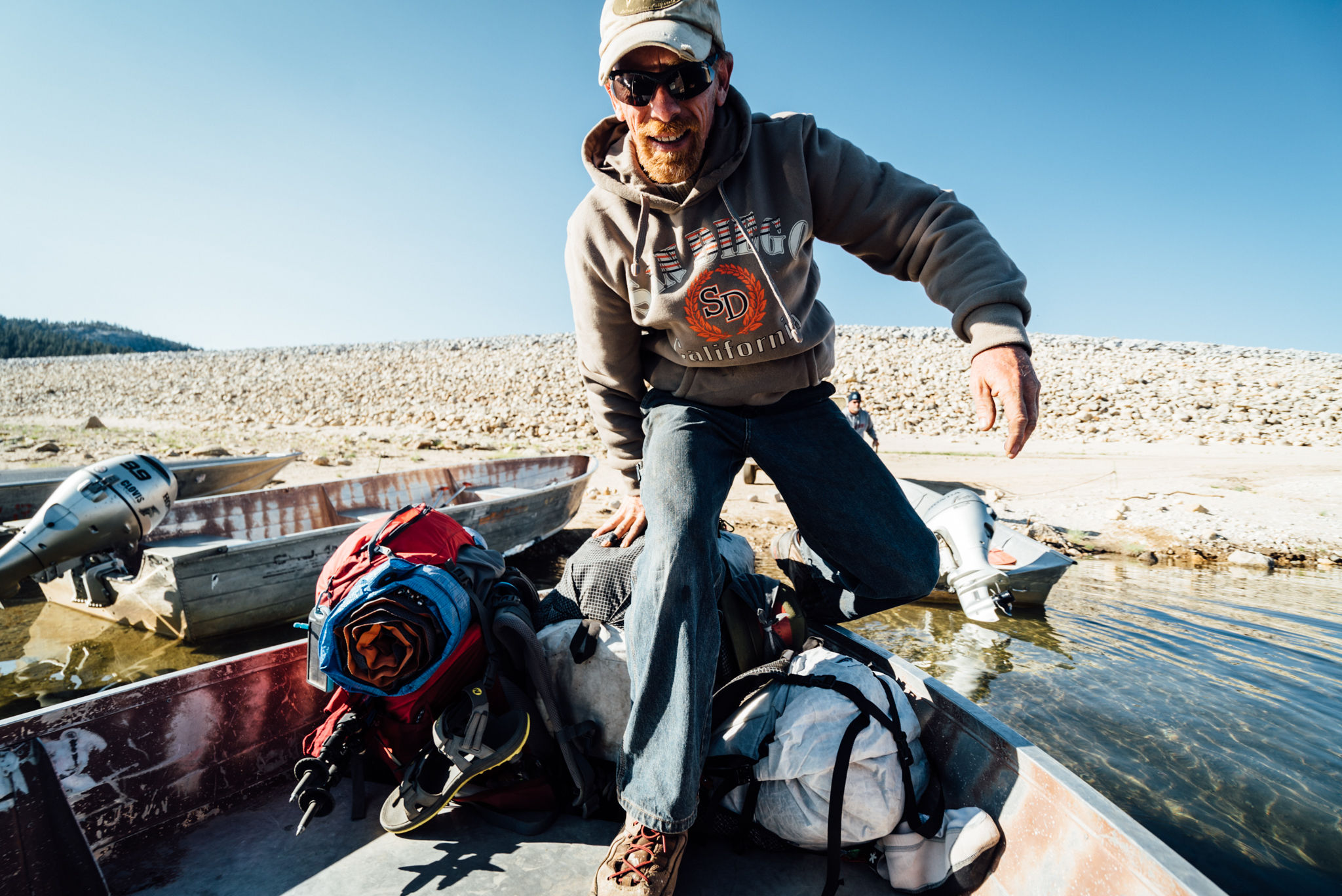
VVR’s ferry had been reduced to small flat-bottom boats due to the drought. They still got us across, however.
We reached the outer banks of Edison Lake at 2pm. A posted sign described the ferry schedule — we were two hours late to catch a ride. A phone number on the flyer provided a glimmer of hope, but alas, it was too windy for them to send a boat out to pick us up. Fuelled by a hunger that only a fresh, hot meal could satisfy, we begrudgingly humped the last 7km around the lake to VVR on foot.
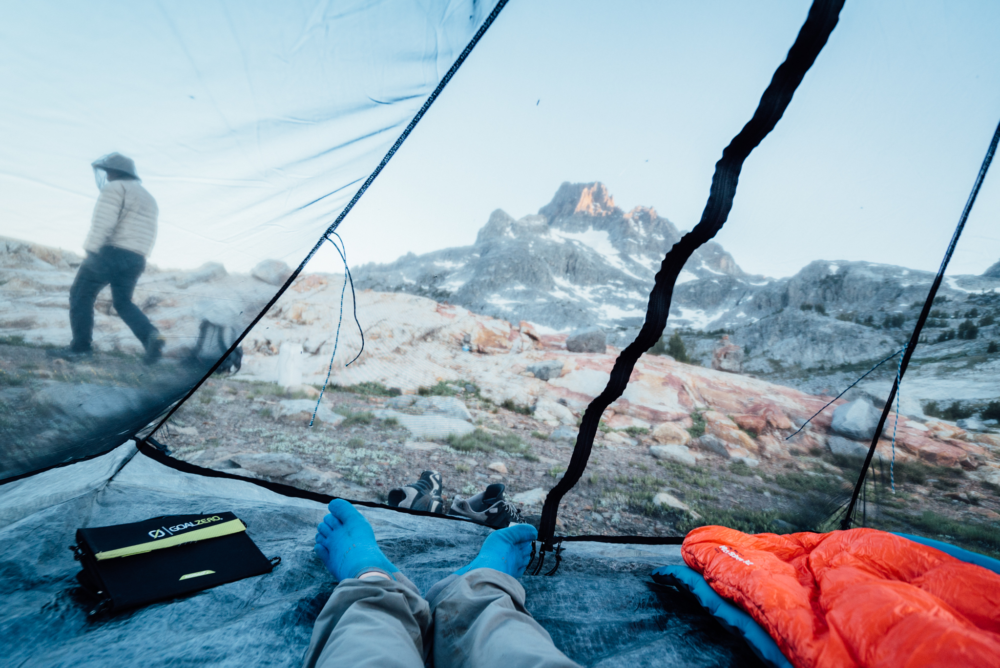
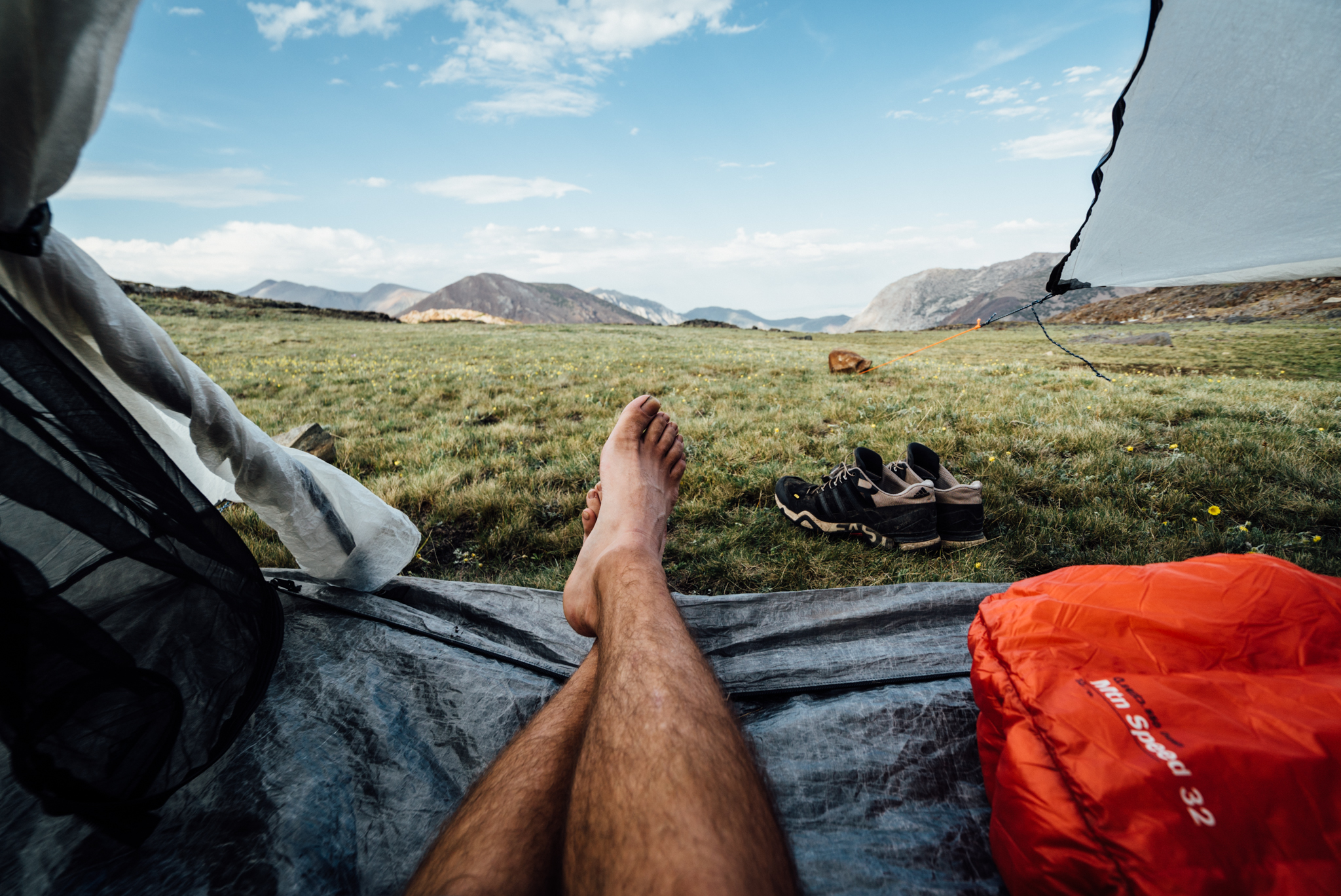
The remote, rustic Vermillion Valley Resort was a haven for dirtbag hikers and general outdoor lovers alike. Their store was stocked with reasonably-priced snacks, supplies, and cold drinks. Their kitchen served hearty, albeit expensive, hot meals from morning till night. Hot showers provided a refreshing sense of hygiene that wet wipes could never achieve. With bellies full of fish tacos and pork roast with veggies, we collected our resupply buckets, set up my Hyperlite Mountain Gear UltaMid Insert (to keep the bugs at bay,) and all piled in for the night.
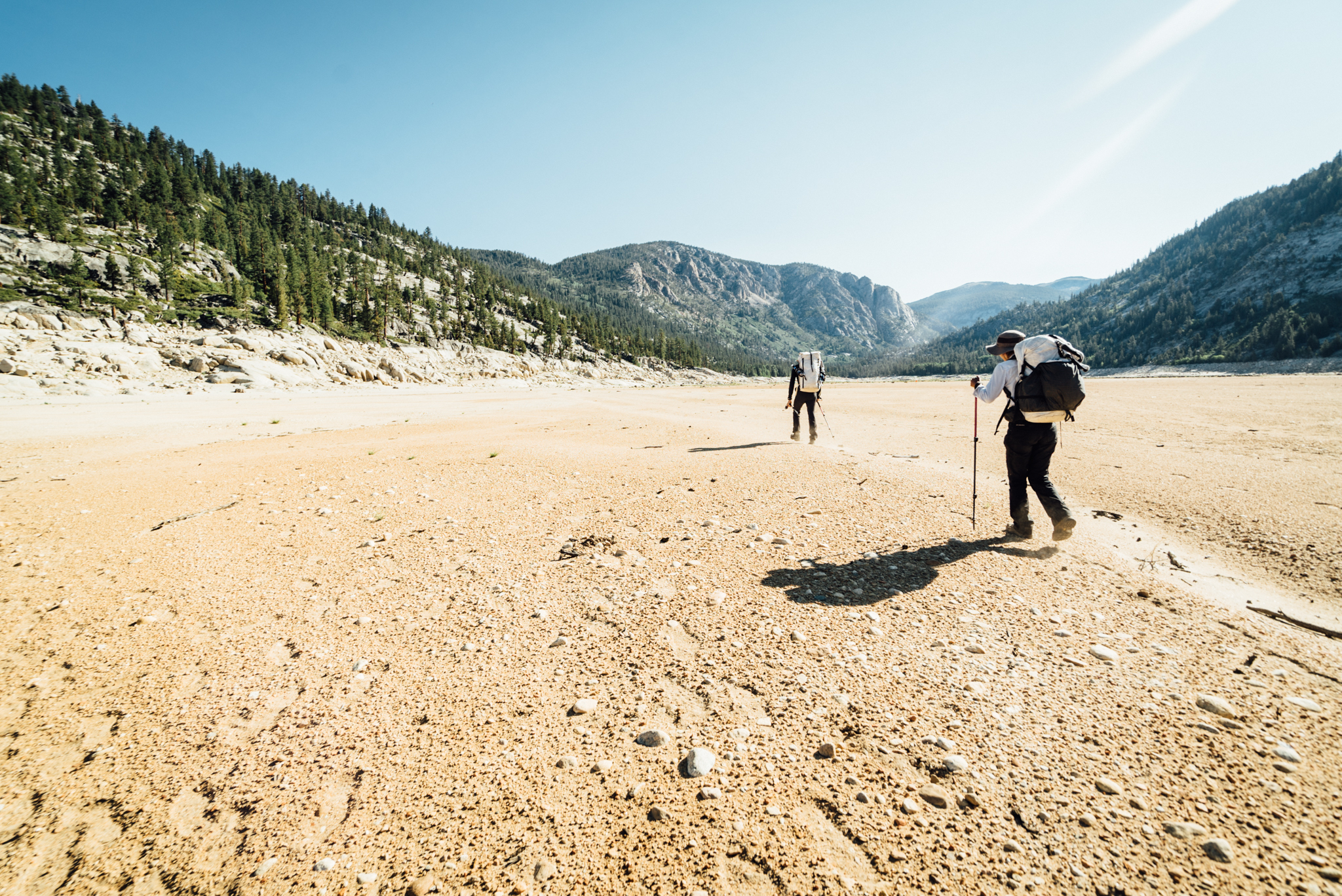
We experienced the sobering reality of California’s drought while hiking on the bed of what used to be a massive lake.
Week Two
We caught the first ferry across the lake the next morning at eight. The initial part of the ferry ride was actually in the back of a cargo van. The second half was in a tiny flat-bottom boat. VVR’s large pontoon boat had been beached, because the lake was so low. Finally, the remaining 800m hike back to the trail across Lake Edison’s dry bed provided a stark reminder of California’s devastating drought.
The rest of the day was all on-trail and relatively unmemorable. We hiked for 29km before settling in for the night.
The next morning we woke early and got a decent start to the day. It would be a hybrid cross/trail day with big mileage broken up by a stop at Red’s Meadow — a popular store/restaurant/lodge, similar to VVR — near Devil’s Postpile National Monument.
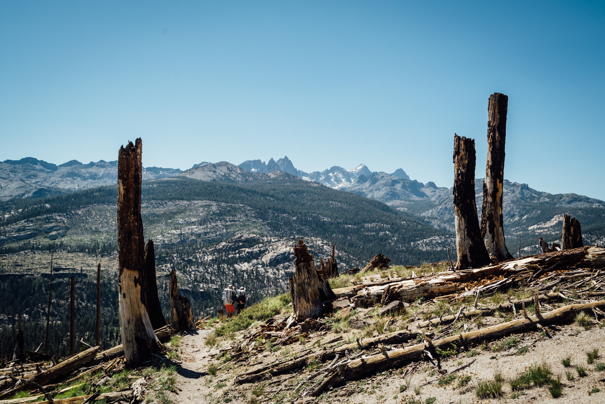
Remnants of the Rainbow Fire while hiking down to Red’s Meadow.
The morning was mostly uneventful, but by afternoon we reached an area that resembled the high desert more than the High Sierra. For the first time on our trip, water sources were sparse; we went for a couple of hours without much to drink. Mammoth Mountain was in sight though; we followed signs of civilisation down to McCloud Lake where we filled up on water before jumping in. We passed a handful of families swimming at the other end, the town of Mammoth wasn’t far.
At only 2850m, Mammoth Pass hardly felt like a pass at all; before long we were dropping through the remnants of 1992’s Rainbow Fire on our way to Red’s Meadow.
The pack station provided a nice break with hot meals and cool snacks. We got our fill and jumped on the Eastern Sierra Transit shuttle to Devil’s Postpile, got back on the trail, and banged out another 10km, stopping for the night just before dark. The day’s damage: nearly 35km, with 2317m of gain and 2530m of descent. For perspective, that’s 457m more gain and 610m more loss — with a similar distance — to hiking Mt Whitney’s summit from the Portal, in a day.
We kicked off the next day with a climb of Nancy Pass, which was named for its first climber, an eight year old girl who died two years later (a plaque at the top commemorated the moment). From the top we had an excellent view of the Minarets — a series of jagged spires that represent some of North America’s best rock climbing routes. The north side of Nancy Pass was comprised of slabby Class 2 rock; we descended into a small valley before heading back up through a series of lakes on our way to our next objective, Whitebark Pass.
Gil descends the side of a snow-covered saddle on the way to Whitebark Pass.
To get to Whitebark, we had to cross a series of saddles which seemed prominent enough to be passes on their own. One in particular was defined by a steep snow field; with no other routes down in sight, that’s the one we took. The incline was much too steep to glissade; the snow was too firm to plunge step, so instead we opted to climb down via the rocky wall that defined the chute on each side. The downclimb was a little sketchy, so I scouted ahead, routing a path for our descent.
Only my HMG UltaMid 2 Insert ($US375) could provide refuge from the mosquitoes at Thousand Islands Lake.
The rest of the day was a constant series of ups and downs — the skyline dominated by Banner Peak and Mt. Ritter to the west. Finally we tackled Whitebark Pass before settling in for the night at the incredibly scenic Thousand Island Lakes.
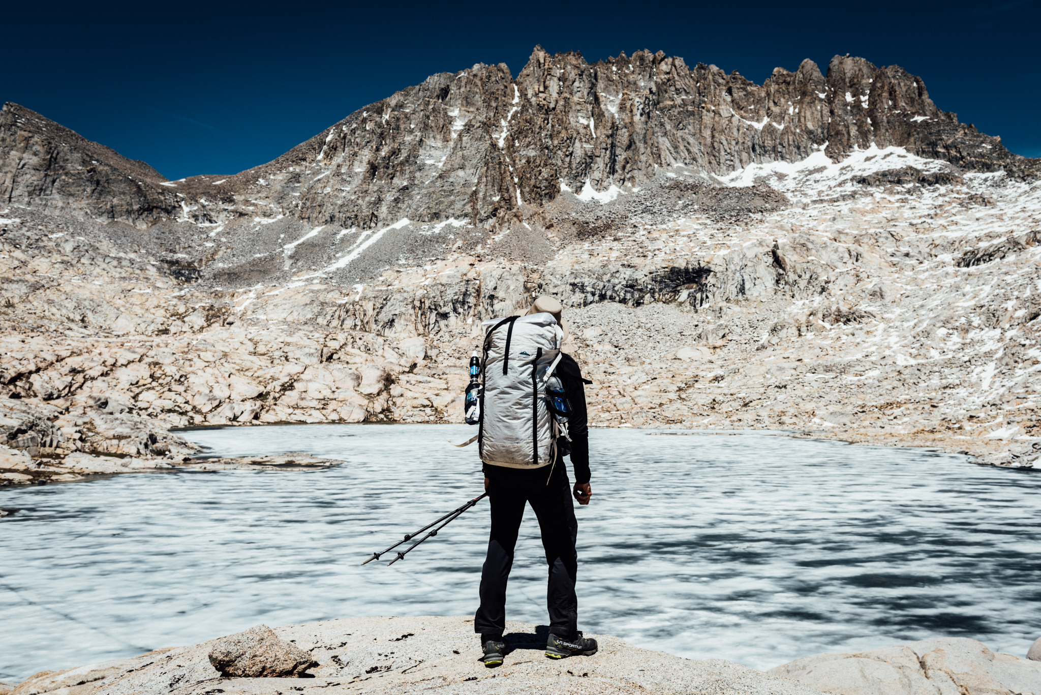
The next morning, we trailed several hundred yards behind a lone backpacker up Glacier Pass; caught up with him by the time we dropped down to Lake Catherine, parts of which were still frozen over. From a short conversation we learned that he was tackling “Stevie’s route” in sections, based off his original, first-edition (©1982) copy of the book. The guy had clearly spent a lot of time in the Sierra; we leapfrogged each other throughout most of the day.
Gil stops to survey the next section of our route below.
From Lake Catherine we descended down a steep slabby slope that was riddled with waterfalls and Class 3 polished granite. Our vantage point on the slope provided unparalleled views of the gorge below. Little did we know that the day’s scenery would only continue to get better as we progressed.
Though water flowed calmly from Twin Island Lakes, the sound of a powerful waterfall just out of view served as a reminder to cautiously wade across.
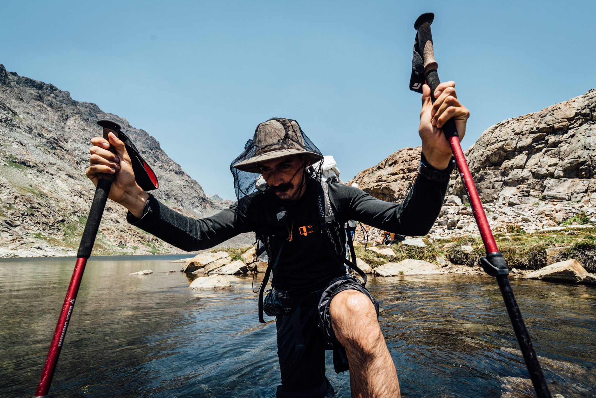
We navigated a tricky section to Twin Island Lakes, stopped for lunch, and then proceeded to our first true river crossing. The lake’s outlet was only about 6m wide, but the water was up to my hips. Fortunately it was not flowing swiftly; though our sight was limited, we could hear it plummeting into the gorge below.
Due to our intense itinerary, this was really the only opportunity I had to swim in a lake. (Photo by Gilberto Gil)
From there we continued up and around several slopes, making slight elevation changes as we went, in an effort to create the most direct path to a non-visible pass. By mid-afternoon we stopped for another swim (though I was the only one who got in.) The bugs weren’t bad in the area, we were back on track, and the scene begged to be taken in.
Bench Canyon wasn’t tainted by a single person, fire pit, or cairn — it was truly a pristine wilderness.
After our break we continued heading up, circumnavigating another slope until finally we could see Bench Canyon. Roper described the canyon as “one of the most sublime valleys in the [Sierra Nevada] range.” He wasn’t joking. One could not help but notice how the perfectly polished walls of the S-shaped glacial valley reflected sunlight onto the conifers below. Dozens of brooks babbled throughout the grassy meadow, which was littered with tiny wildflowers in an assortment of colourful hues. The place was paradise; there was not a single person, fire pit, or cairn tainting the view.
We hustled up the valley, only daring to enjoy its tranquility as we advanced, for Blue Lake Pass (3734m) was still lingering ahead. By now we were in excellent shape; our bodies propelled us 213m up the boulder-strewn pass in less than 20 minutes.
Gil enjoys his first sunset and meal in Yosemite.
From the top we could see the entire Ritter range, Mount Abbott, and even the Kaweah Peak Ridge 145km behind us. In front was the Clark Range, only 11km ahead. As we dropped down to the other side of the pass, we left the Sierra National Forest behind in search of our first Yosemite campsite. For the very first time on our trip, we watched that big glowing ball of orange drop below the horizon. It felt good to be nearing the end.
This isn’t the Yosemite Valley you’re looking for.
With morning came a new-found vigour that is achieved only when nearing the end; we continued cross country in search of a trail that would lead us to the backside of Vogelsang Pass. We cliffed out on what could be another Yosemite Valley, if a road led tourists in. Instead we marvelled at the view all on our own while tracing the ridgeline down to the trail.
Our elevation dropped quickly as we followed the desolate switchbacks down. Eventually the earth planed out; we crossed one more river to commemorate the valley we were passing through. A lone backpacker was perched up against a tree, reading a book. He looked even more surprised to see me.
We spotted this bench across the valley while ascending Vogelsang Pass. I don’t know what it is, but I know I want to go there.
As was the norm on the High Route, as soon as we lost elevation, we started to gain it right back; before long we were making our way up Vogelsang Pass. The switchbacks on trail made it relatively mild compared to most of the passes we had encountered earlier on the route. The High Sierra Camp was visible on the other side; the closer we got, the less wild we felt until at once there was a dude wearing basketball shorts and blaring music from a miniature boom box while bounding up the trail. With only 10km left until Tuolumne Meadows, we found a lake and set up camp for the night.
With breakfast waiting at Tuolumne Meadows, we moved swiftly along the trail.
We could smell breakfast cooking the next morning, all the way from Tuolumne, so we packed up quick and headed out on our way. Yosemite’s trails were easy compared to the terrain we were used to; our 3.7 mph average to the restaurant revealed them as such.
We spent the afternoon hanging out around the restaurant, indulging in breakfast and lunch, all the hot food that our hearts desired. Then at 3pm we caught the free Yosemite shuttle to Tioga Pass, 13km away (Skurka recommends walking along the highway for this section).
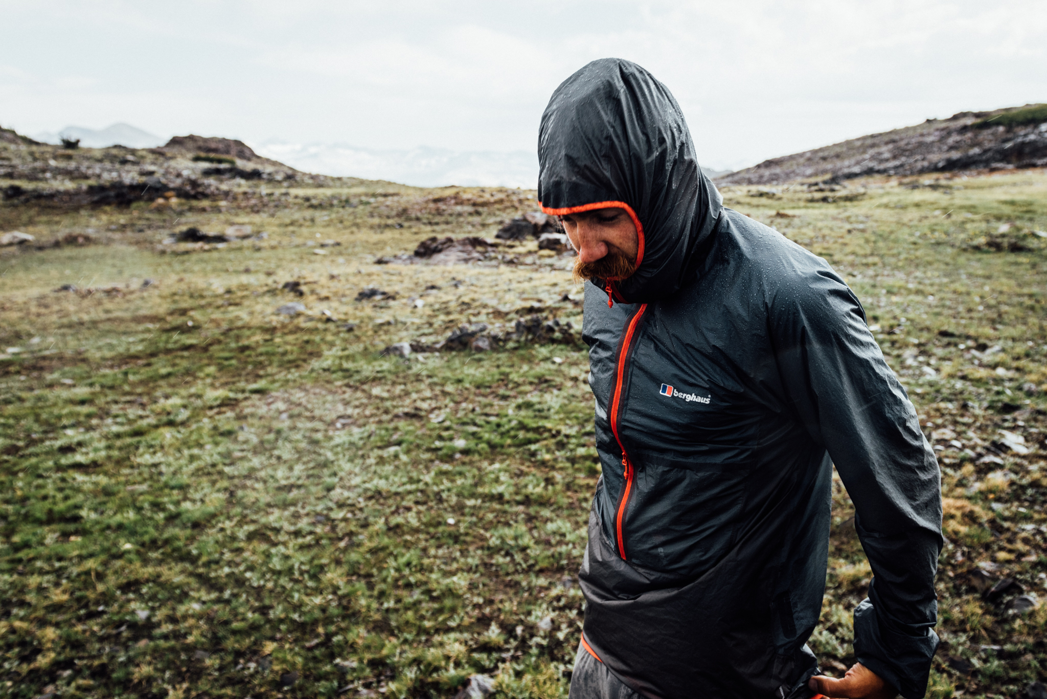
At only 2.6oz, the waterproof/breathable Berghaus VapourLight Hyper Smock 2.0 ($US150) is the exact type of weather protection you want to be carrying if it doesn’t rain — and if it does. (Photo by Gilberto Gil).
This was the perfect view for our last evening on the journey. The Adidas Outdoor Terrex Fast R ($US135) — and my feet — held up to all of the abuse that the High Route dished out.
From the bus stop we crossed the road and headed a few kilometres up the trail before splitting off toward Granite Lakes. We found a high plateau on which we could set up camp, just before the sky fell out. Our first rain of the trip didn’t last long; within 30 minutes the grey clouds gave way to the setting sun, and the start of our last night on the High Route.
We got a sunrise start up an unnamed 3505m peak on our last day of the High Route.
An alarm woke us well before the rising sun on the final day of our journey. We had connected with Olivia’s sister, who was visiting the Valley and would be our ride home, the day before. Instead of having her meet us at Mono Village, the route’s official terminus, we’d meet her back at Tuolumne Meadows, effectively saving three hours from a drive that was already five long ones back to LA.
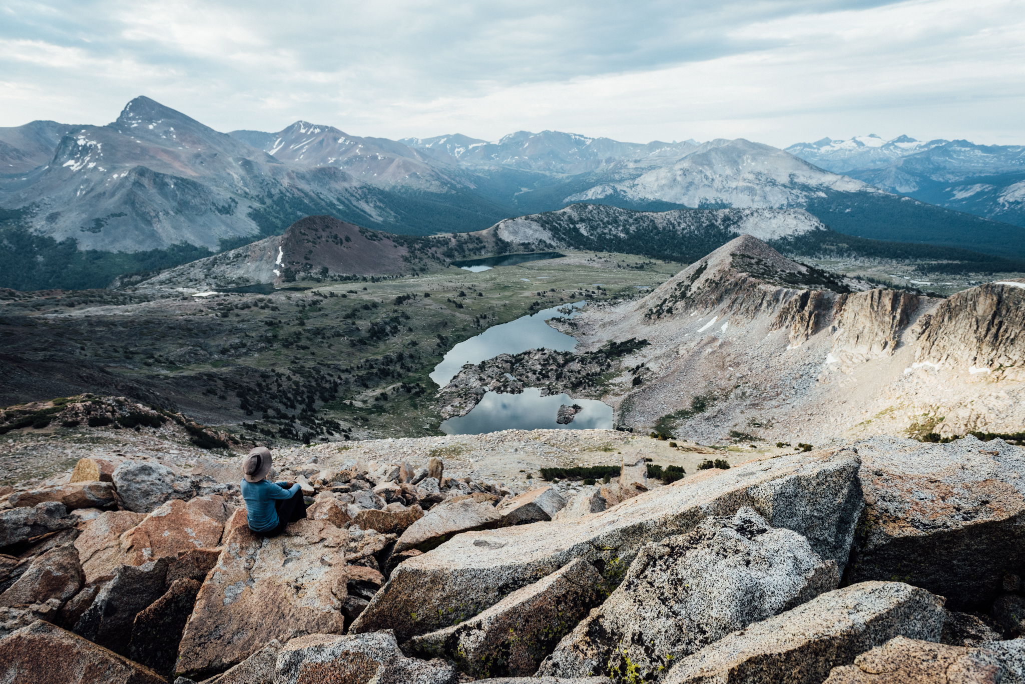
Olivia takes in a stunning view from 3505m. Granite Lakes are visible in the mid ground; Mount Dana dominates this Yosemite High Country view to the left.
In order to make up for skipping out on the route’s final 20km, we surveyed the surrounding area and set out to climb the highest peak around, concluding our adventure in true High Route fashion. Once we had a chance to take in the 3505m unnamed summit’s view, we headed back down, broke camp, and made our way back to Tuolumne Meadows where one final hot meal and our ride awaited us.
Gil carried the ultralight, ultra durable, waterproof HMG 4400 Porter Pack (70L, $US355).
What You’ll Need to Bring
Backpacking gear. The lighter your kit is, the better off you will be, as much of the route involves scrambling, boulder hopping, and talus surfing. For a detailed list, check out my gear list for this trip.
Maps. Veteran thru-hiker Andrew Skurka has created a downloadable mapset ($US15) for the SHR that proved to be pretty useful in the field. The maps have indicators for the route, but in keeping with the nature of it, there is not a continuous indicator line. Instead of following a specific line, you should be discovering the best course of travel for yourself. Skurka also provided several notations throughout the maps. Sometimes these were helpful, but more often than not, we took them with a grain of salt.
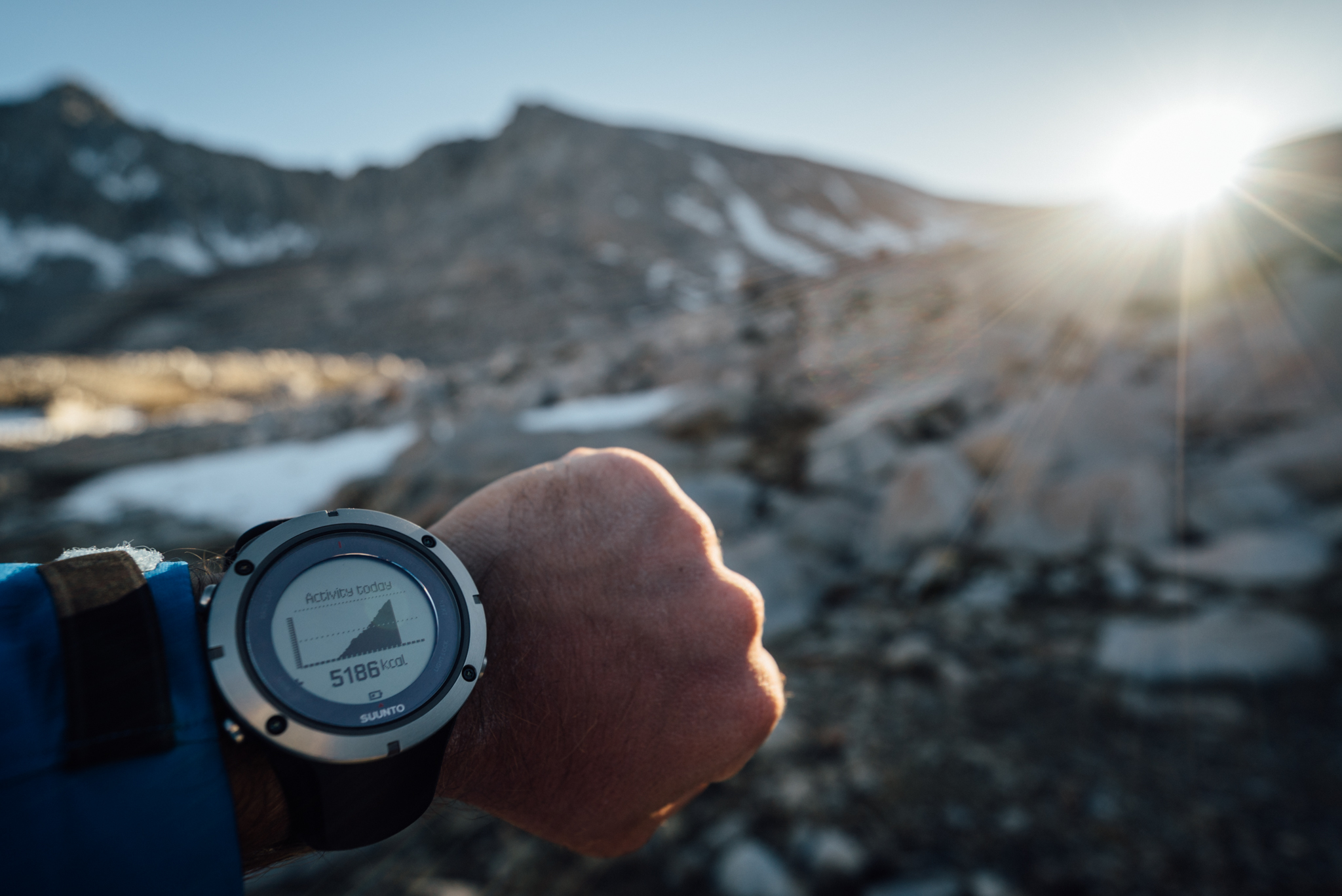
The Suunto Ambit3 Peak + HR Monitor ($US500) provided me with detailed, real-time metrics about the trip, and my body’s performance.
GPS. We carried an InReach Explorer ($US380) which Gil had pre-loaded with the route. We didn’t depend on it, instead relying on maps, a compass, and landmarks to navigate, but it allowed us to double-check our bearings during confusing sections of route finding. Also, if something were to have gone wrong along the way, we could’ve sent out an SOS.
I also carried the Suunto Ambit3 Peak GPS watch + heartrate monitor ($US500) which allowed me to track every single step of the trek. The watch provided real-time metrics on not just speed, elevation, and heart rate, but also calories burned, recovery time, and more. It also had a ton of other useful features like a compass, Bluetooth syncing, alarms, and more. If you’d like to see some more metrics from the trip, check out my Moves on Movescount.
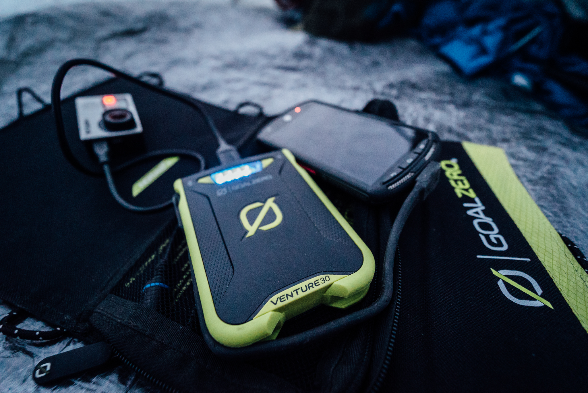
The Goal Zero Venture 30 ($US100) was invaluable for keeping my electronics charged.
Solar Charger. The Goal Zero Venture 30 Recharger ($US100) and Nomad 7 Panel ($US80) were invaluable for keeping my Sony A7S camera, Ambit3 GPS watch ($US500), InReach Explorer, GoPro Hero4 Black ($US500), and phone charged along the way, allowing me to bring this story back to you.
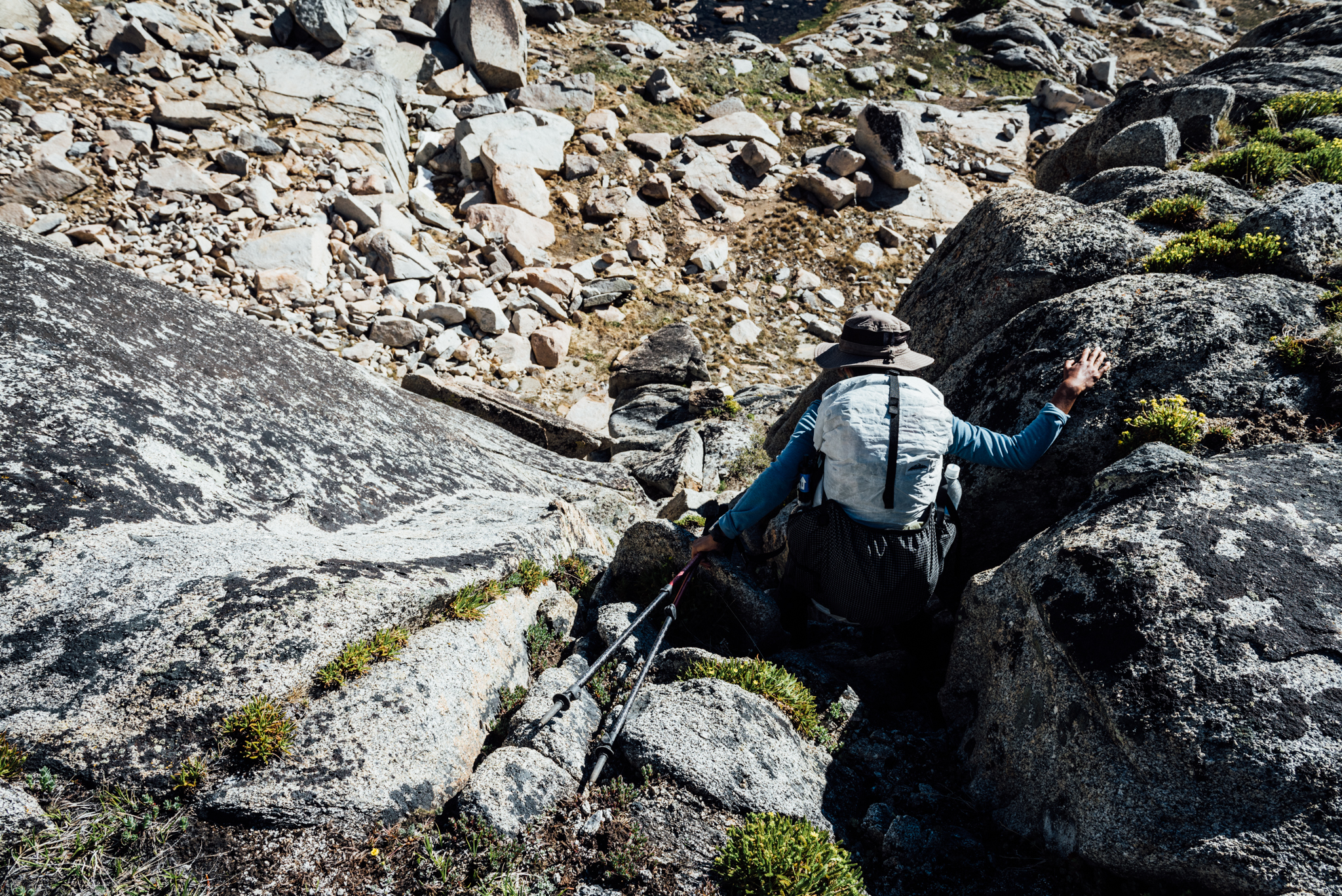
Many of the High Route passes required scrambling down steep sections of Class 2 & 3 rock.
Who Can Do This Adventure?
The Sierra High Route is not for the faint of heart. It was one of the most challenging adventures that I’ve ever embarked on. The level of difficulty for us was largely due to our overly-ambitious itinerary (having an additional four days would have been ideal in our case), but regardless, the terrain was often difficult and unstable. Those who embark on the SHR should be confident in climbing Class 2-3 sections of rock with packs.
As this is not a trail, expert route finding skills are necessary to safely navigate the many mountain passes encountered along the way. Go off-course and you may find yourself on the side of an unstable cliff.
Finally, a high degree of fitness is a must. Many of the passes were long and arduous and allowed few places for rest. The entire route is at a high altitude where the air is thinner. I was a bit out of shape starting out and paid for it through exertion. By the end however, I was flying up and down passes like a champ.
Our extraction route, Hwy 120, was visible from our high point above Granite Lakes. The Westcomb Nomad Jacket ($US170) provided protection from wind and abrasion while climbing. (Photo by Gilberto Gil)
How Do You Get There?
If travelling south to north, the route begins at Road’s End — a place defined by its name, deep in King’s Canyon National Park. The route ends at Mono Village on Upper Twin Lake, near Bridgeport, about an hour’s drive north from Tuolumne Meadows.
Your best bet is to get someone to drive you to the start point and pick you up from the end point. A second option would be to take two cars. Drive both to Mono Village; leave one there, and drive the other down to Road’s End. In that case, expect the drive to take an entire day.
In a pinch, it would be possible to take Amtrak to Visalia, then take a Sequoia Shuttle into the park, and hitchhike to Road’s End. For the exit, one could hike back down to Tuolumne Meadows, take the free Yosemite NPS shuttle back down to the Valley, and take Amtrak out.
Really, there’s no good way to get there and back.
About the Author:Chris Brinlee Jr.is an adventurer and storyteller who can’t stay put for more than a few weeks at a time. Follow his adventures on Instagram:@chrisbrinleejr.
Pictures: Chris Brinlee Jr, unless otherwise noted.