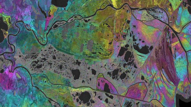
This so called interferogram was created by combining two Sentinel-1A radar scenes from over the Danube River Delta, which covers more than 4180 square kilometres in Romania.
European Space Agency’s Hydro-SAR project monitors wetlands, such as Danube Delta, playing an important role in sustainable water management with the help of satellite radar data. ESA explains how:
With many areas within the delta virtually inaccessible, satellites provide the means to map and monitor this biologically diverse wetland. In particular, radars — such as the one on the Sentinel-1 mission — can provide information on the present state of a wetland, hydrological interactions between the different types of reservoirs, and can help to refine current hydrological models dedicated to wetland management.
To do this, multiple images from synthetic aperture radars — or SARs — are combined to create ‘interferograms’ showing changes between the radar scans. The measurements are then analysed to show various hydrological parameters such as water surface extent, water level changes and the direction and gradients of water flow.
Here is the full image of this UNESCO World Heritage Site. Click on the top left corner to see the full size.
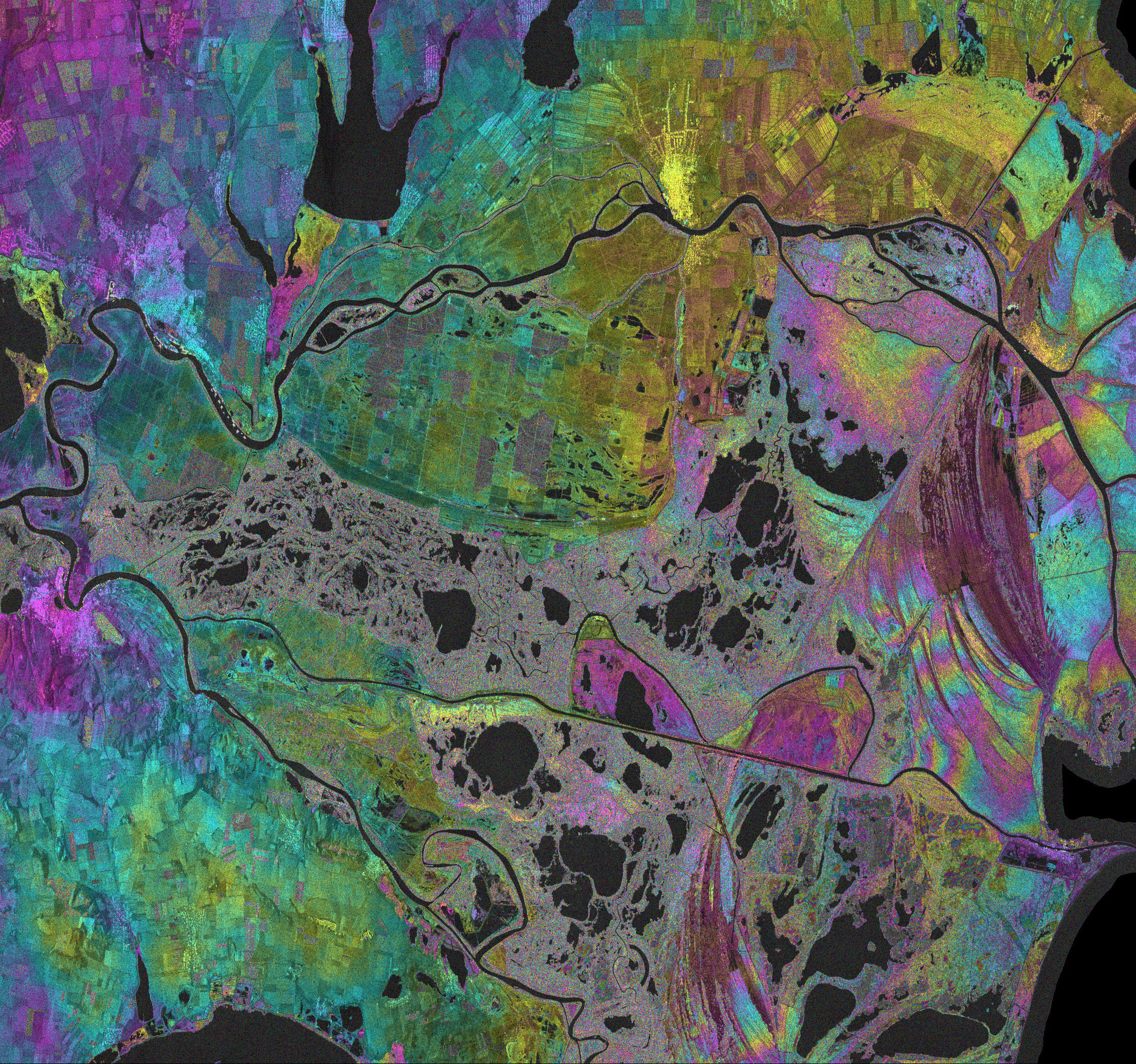
[Copernicus data (2015)/Terrasigna via ESA]