Some of the most haunting images of the US were captured from 1935 to 1945, as the country emerged from the depths of the Great Depression and rallied for World War II. A team from Yale has collaborated on one of the most visually stunning interpretations of the era, called Photogrammar: 170,000 photos from the period, plotted on a map of the country.
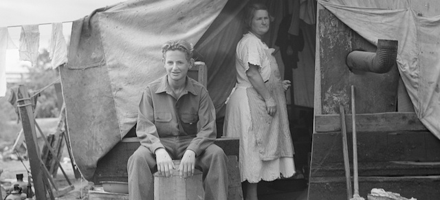
Picture: Part of migrant family of five, encamped near Porterville, California, while waiting for work in the orange groves, Dorothea Lange, 1936.
As part of FDR’s sweeping social policies of the New Deal, launched in 1935, photographers were dispatched to travel the nation, documenting the effects of the relief work. Most notable was the work of the Farm Security Administration — Office of War Information (FSA-OWI), which tapped now-legendary photographers to make most of the black-and-white photographs we’ve come to associate with the time. The archives were digitised and have now made accessible online by this group of historians, GIS experts, and data scientists.
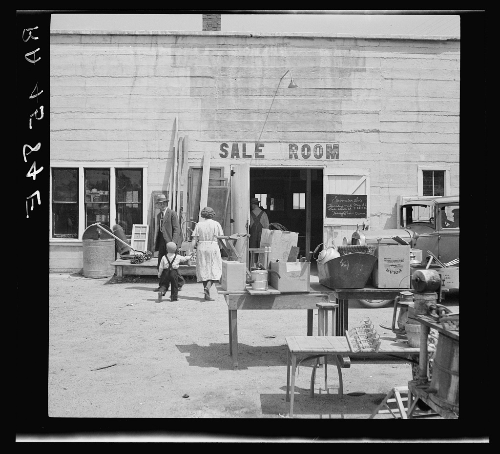
A “drought auction” in Kearney, Nebraska where a farmer was forced to sell his belongings, Arthur Rothstein, 1936
Photogrammar not only allows you to easily search for all these gorgeous historic images, it places each of them on a map, colour-coded by photographer. You can see how Dorothea Lange travelled throughout the rural South and then headed west to document the farmers of California’s Central Valley. I especially like how you can track Jack Delano’s path down Route 66. For historical relevance, you can add an overlay of a 1937 road map of the US, made by the Vico Motor Oil Company.
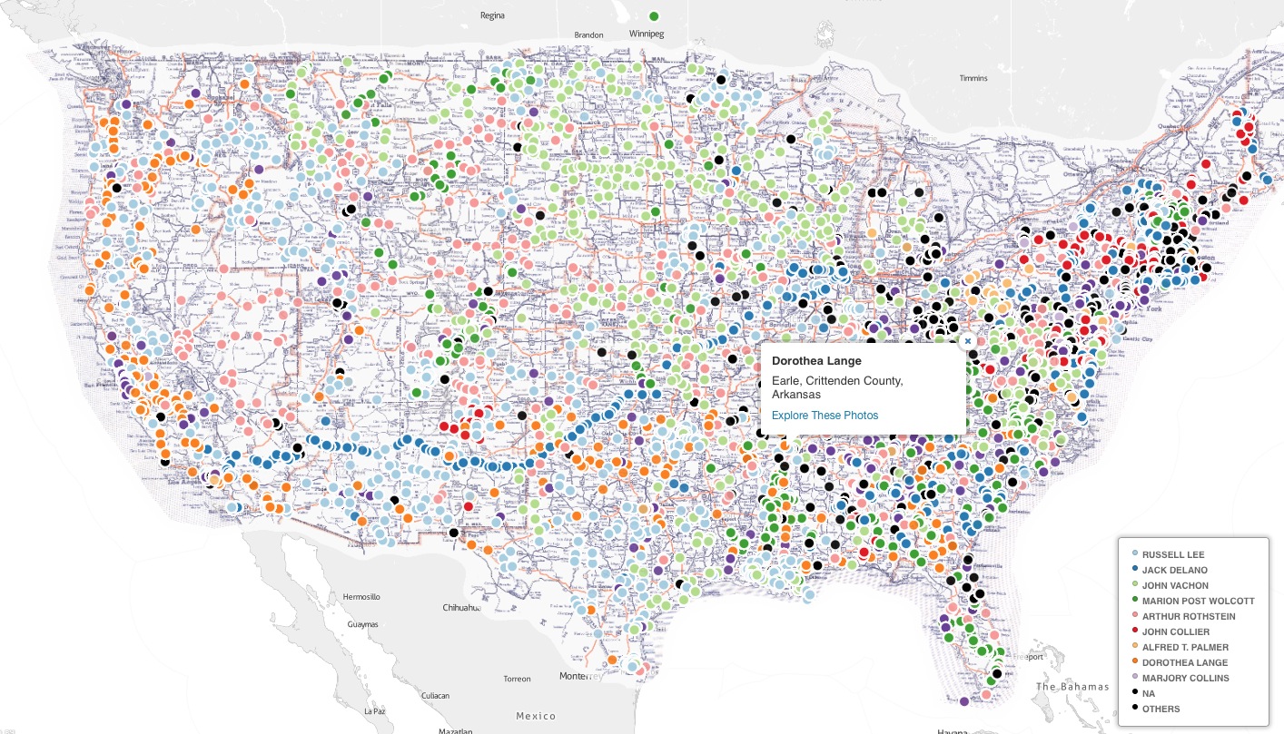
One of the most striking things about the image map is just how thoroughly the country was documented by this project. Photographers reached every state, and travelled through the most remote parts of the US.
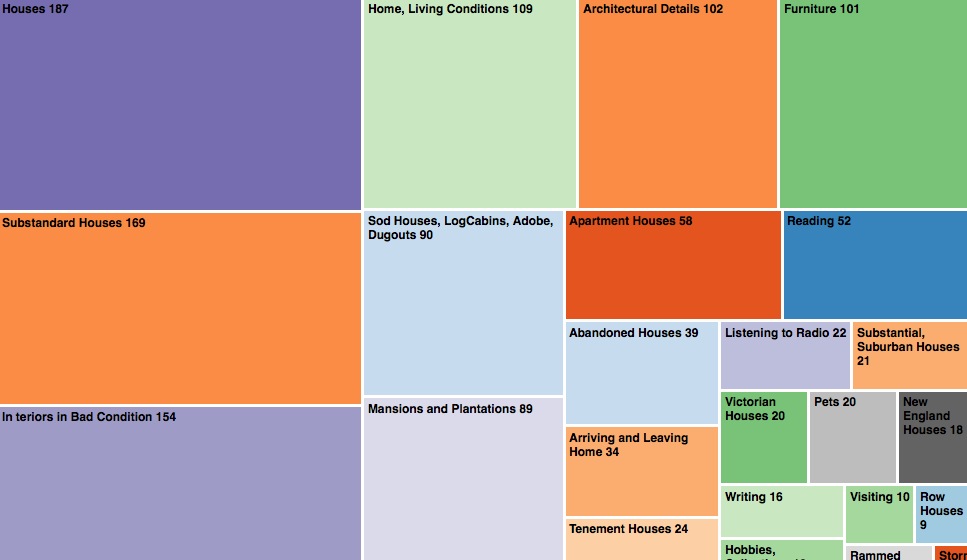
If just searching for photos isn’t enough to keep you occupied, Photogrammar is also creating visualisations that help to interpret and organise the photos, collecting them geographically but also by subject, photographer and year:
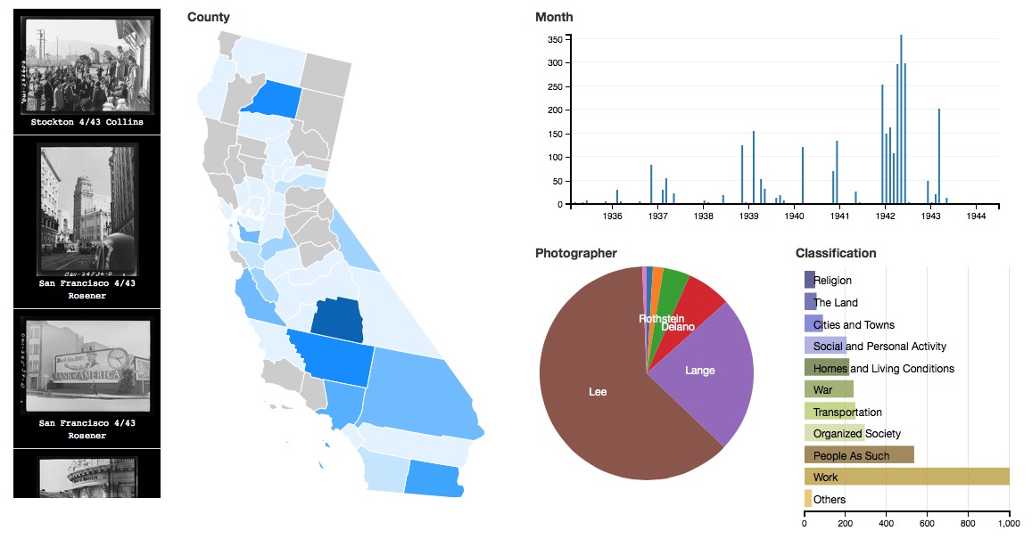
I especially love the “Treemap” function where you can click on colourful squares to get gradually more granular information about the photos taken in 1942:
Just the act of digitising these vast repositories of images is an important task, but finding relevant ways to search and use them is just as important. Thanks to the efforts of these scholars, one of the darkest moments for the country has been brought to light. [Photogrammar]