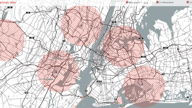
The Federal Aviation Administration has been dragging its heels on drafting drone regulations, lots of people are confused about, where it’s OK to fly their small aircraft. Using OpenStreetMap and government data, the wizards at MapBox created an interactive map to clear the air.
To be more concise, the map shows you exactly where the restricted airspace is. Even though the FAA still hasn’t finalised their own rules, other government agencies — namely the military and the National Park Service — have passed bans of their own. The FAA has said that drones must stay at least five miles away from major airports, though it remains debatable whether they actually have the authority to do so.
For now, the map is a work-in-progress as the bureaucrats decide exactly what to do. It’s still fun to explore in the meantime! Check out the interactive map here. [Mapbox via Wired]
Picture: Mapbox
