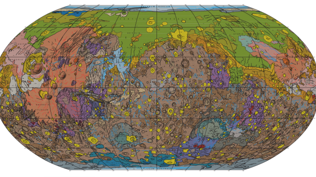
Ever wondered how you might navigate your way across the surface of Mars, if you ever find yourself there? Well, perhaps you could use this: the most detailed map of the Red Planet’s geology ever made.
The map compiles 16 years’ worth of observations from four orbiting spacecraft — Mars Global Surveyor, Mars Odyssey, Mars Express and Mars Reconnaissance Orbiter — into a single, super-detailed chart. In fact, it’s the first of its kind made since 1987. You can download a huge poster-sized version of it from the US Geological Survey website. [US Geological Survey via New Scientist]