Overhead satellite views are nothing special in this age of Google maps — but then, there’s Daily Overview. From brick-making kilns to Nepal to Danish suburbs, the site’s one image a day is consistently beautiful, weird and illuminating of a larger story of how the Earth came to look this way. Here are some of Daily Overview’s greatest hits.
Ben Grant started the Daily Overview last December, inspired by a video of astronauts describing the sensation of looking down on Earth from space. “That video has been tremendously influential in terms of how I think about our planet and the impact we all have had on it,” says Grant, who works at a brand strategy firm by day. He finds the views on Apple Maps and retouches to make the usually pallid colours of satellite photos pop.
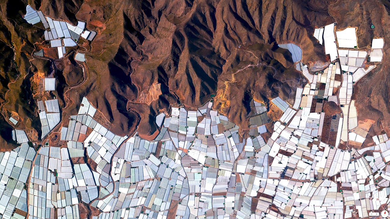
Plasticulture in Almeria, Spain
Grant discussed his project with us by email, and you can see some of our favourite overviews below. It was hard to pick just a few — you should really just look at them all at Daily Overview. You can also follow Daily Overview on Instagram.
Daily Overview had reminded me of NASA Earth Observatory‘s always interesting image of the day, but that usually focuses on geology and the natural world. Why did you decide to focus on the built environment?
Yes, we’re huge fans of NASA’s image of the day and follow along regularly. However, at the outset of the project, we decided that the Overviews would focus only on the areas where humans — for better or worse – have impacted the landscape. Unless you spend most of your time in an aeroplane, there’s no way to appreciate the beauty and intricacy of the things we’ve constructed, the complexity of the systems we’ve developed, or the irreversible impact that we’ve had on our planet.
Is there a reason you use Apple Maps when the rest of us often default to Google?
Google certainly dominates the maps space, but I think that’s based on our tendency to use this technology just to get from point A to point B. I favour the Apple Maps software because there are particular functionalities – such as the ability to control the orientation of the image or its superior image sharpness – that provide me with greater control when I create an Overview. If anyone out there from Apple is reading this, give us a call and let’s talk about ways that we can use your software to change the way people see the world!
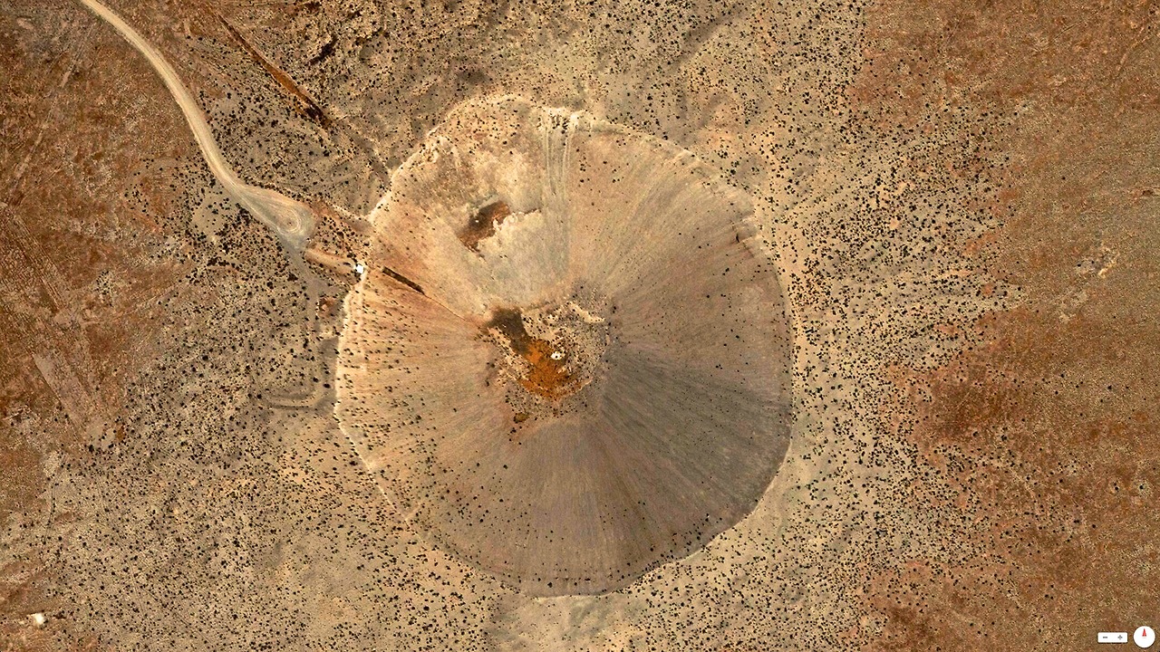
The Sedan Crater in Nevada was created by a 104-kiloton nuclear explosion that displaced 12 million tons of Earth on July 16, 1962.
Are you randomly exploring in satellite view or do you start with a structure in mind and then go looking for it?
Every Overview starts with a thought experiment. We consider the places where man has left his mark on the planet and then conduct the necessary research to identify locations (and the corresponding geo-coordinates) to convey that idea.
The upfront research is usually what requires the most time. Sometimes you get lucky and the location that you explore powerfully conveys the idea you had in mind. On the other hand, you can find yourself in the middle of a five-hour search to locate a sawmill or you look all day to find a palm oil plantation that’s not obscured by clouds (both true stories). Regardless, the moment when you discover a place that powerfully captures your idea, it’s worth it, no matter how long the search took.
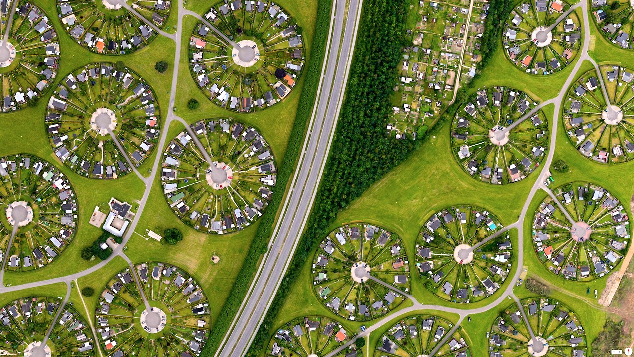
Brøndby Garden City in Copenhagen, Denmark
Whenever I encounter the strangeness of satellite view, I always think back to the first hot air ballooners and what it would have been like to be the first humans to see a familiar landscape made strange in an overhead view. Do you often find yourself looking at familiar places on satellite view? Or vice versa, now that you’ve been running the site for a few months, have you visited in person a place you first encountered in satellite view?
The project has become a vital part of my life and I often find myself envisioning my current surroundings from above. I’ve certainly received a number of sceptical looks from airline attendants after asking to be moved to the window seat. Whenever I drive by places I used to ignore on the ground such as a oil refinery or cargo terminal, I write down where it was and go back to check it out from above later. It’s a little bit ironic that these are the places people often look away from, or think are unsightly on the ground. Once you look down though, everything changes. There’s a powerful curiosity and mystery that you get from this perspective and I’m certainly not getting tired of it.
The Nardò Ring,a high speed, 7.8 mile long, circular test track in Italy.
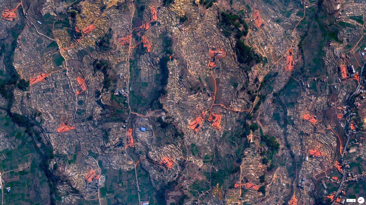
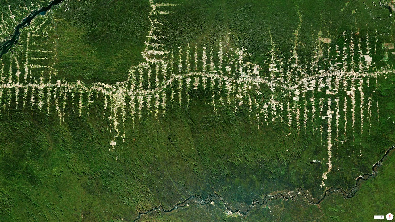
A network of orange kilns used to make bricks speckles the hills outside Bhaktapur, Nepal.
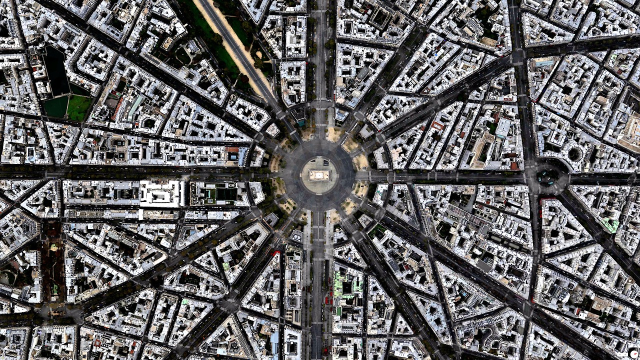
Arc de triomphe in Paris, France.
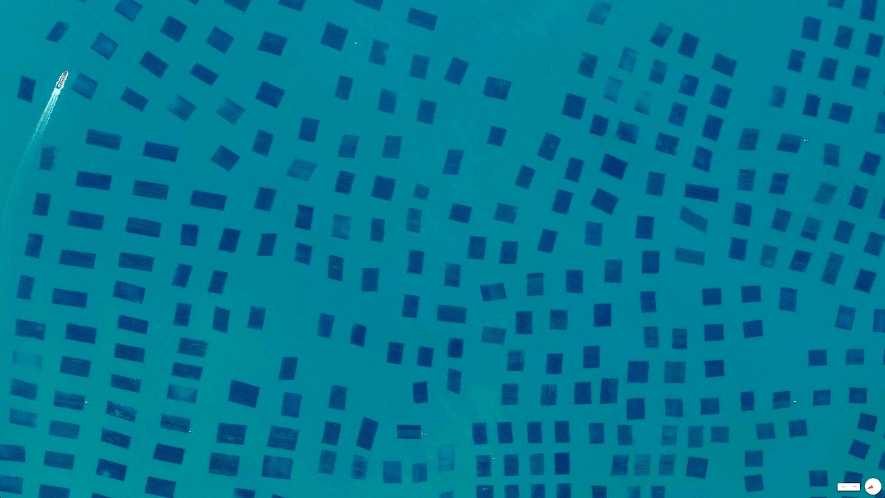
Fishing nets in Quanzhou, China
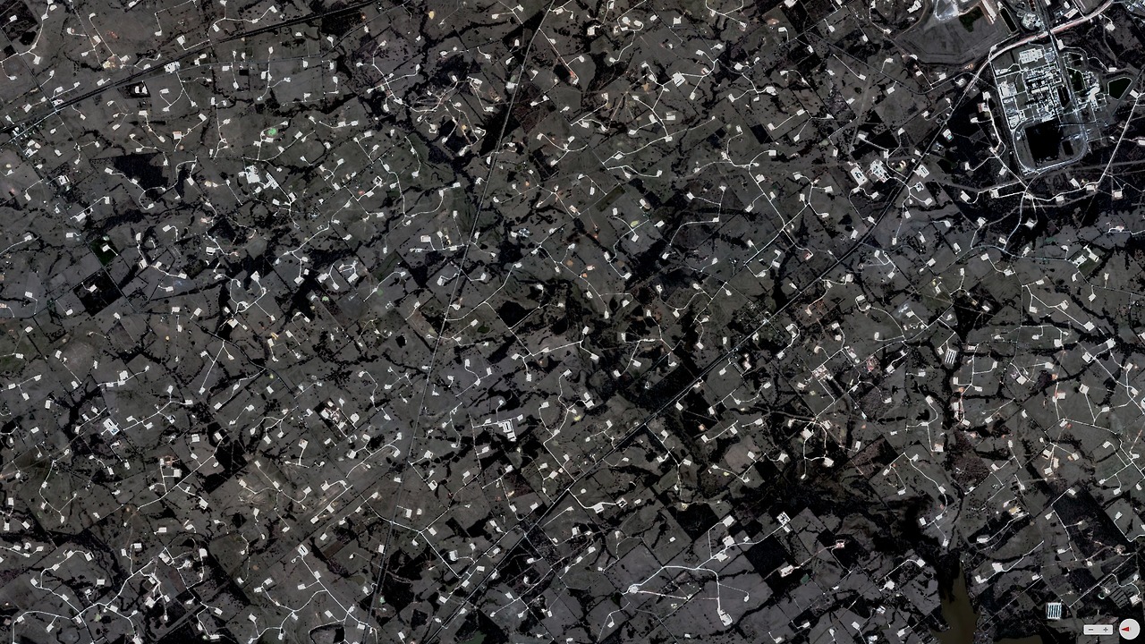
Oil extraction wells in Donie, Texas.
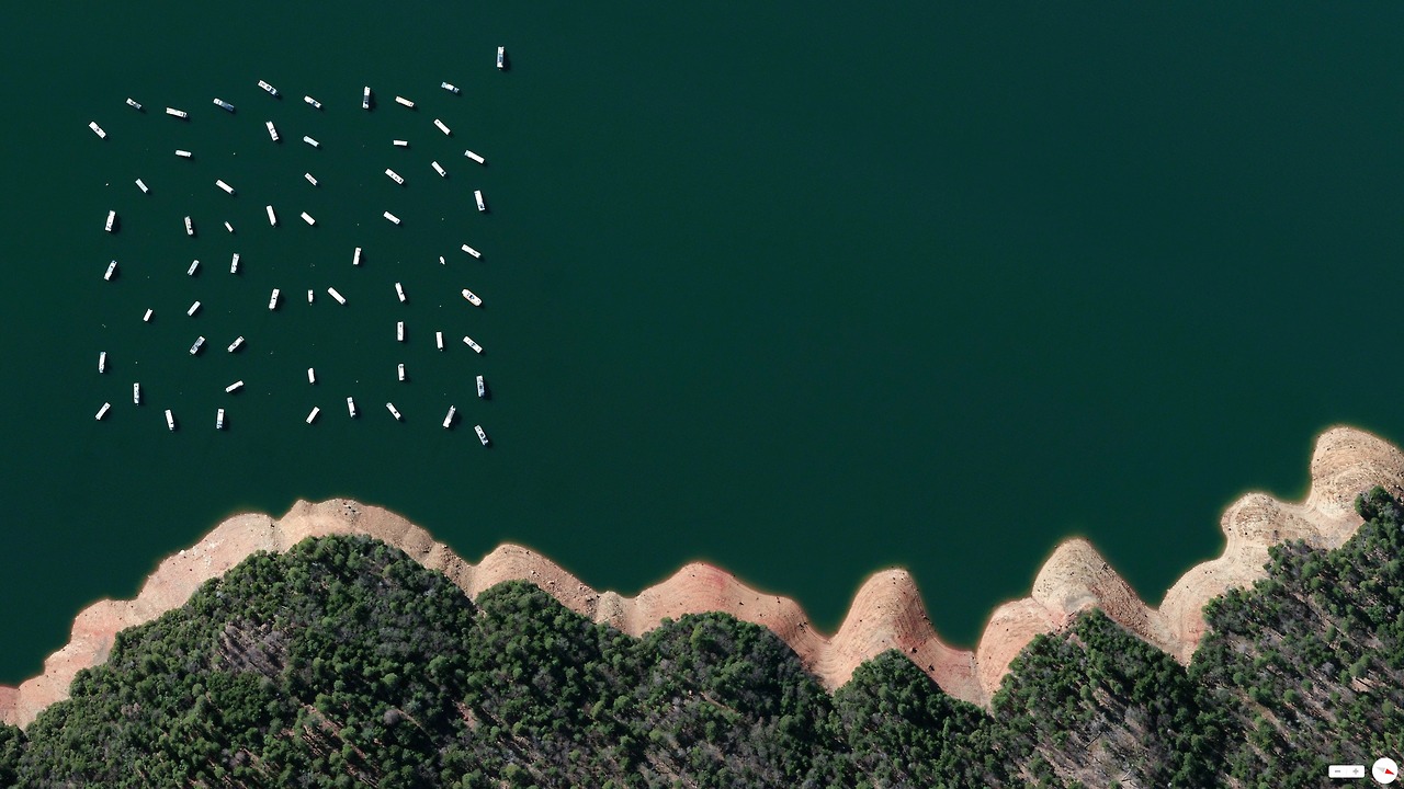
Moored boats float peacefully on the New Bullards Bar Reservoir 505 in Yuba County, California.
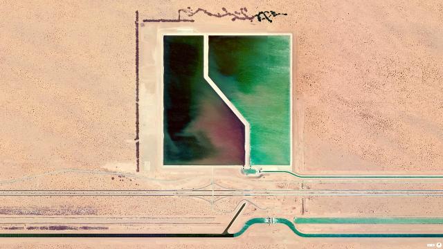
Picture: Brock Reservoir in Gordon Wells, California