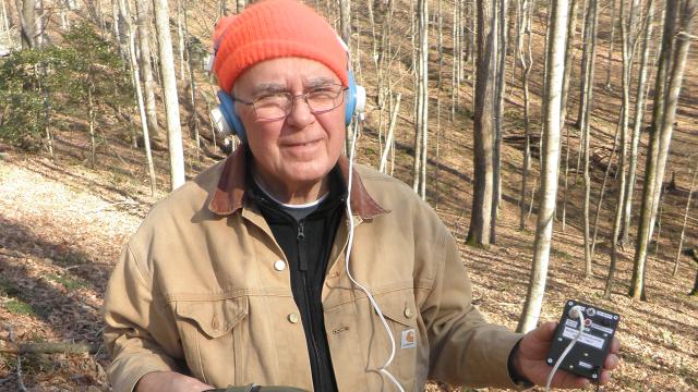
Underground, where this is no GPS and certainly no Wi-Fi, mapping caves requires a different kind of technical ingenuity. Thus, there is cave radio. To learn about the DIY world of cave radio and underground exploration, Gizmodo picked the brain of Stanley Sides, tinkerer and former president of the Cave Research Foundation.
In “real life”, as Sides himself puts it, he is a retired oncologist from Missouri. But on weekends and holidays, he drives several hours east to Kentucky’s Mammoth Cave, the longest known cave system in the world. There, he joins dozens of volunteers who descend into the caves for nonstop mapping trips that last well into the morning hours. He’s still doing this at age 70, although he admits it’s a little harder on his knees these days.
The world of cave mapping is dominated by volunteers who, like Sides, have a taste for adventure and dark spaces. Within this group is a subset of committed tinkerers who come up with better ways to explore caves. They publish their work in journals like Speleonics (a portmanteau of speleology, the study of caves, and electronics) or in the online bulletins of the Cave Radio and Electronics Group.
For the most part, these radios are not for communication but for radiolocation. “It all comes from mine safety literature,” Sides explained, pointing to the necessity of locating miners trapped underground. While the technology is pretty good for mapping caves in two dimensions, going underground entires a third dimension: depth. GPS can’t penetrate several hundred feet of rock, so we’re left with radio waves.
That loop Sides is holding in the photo below? It’s for figuring out how deep a cave is.
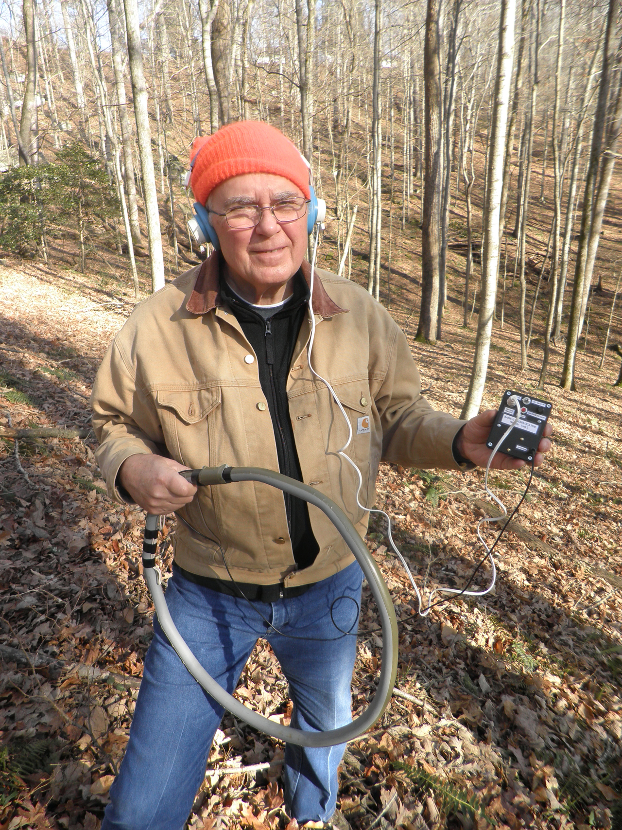
Here’s how it works. You carefully place the loop in the area of the cave whose depth you want to measure. Then you backtrack to the cave’s entrance, which could be miles depending on where you are; at this point you leave the cave and hike, above ground, back toward where you left the loop somewhere deep below. Finally, you take earphones out and you listen for the loop: it emits a constant magnetic field that can be detected by the receiver. If this sounds cumbersome compared to getting GPS on your phone, it is. Penetrating through solid rock is no piece of cake.
In the photo above, from December 2013, Sides was asked by the Park Service at Mammoth Cave to determine the cave depth near a small sinkhole opening. They used it at a depth of 37m, which set the depth record for radiolocation with that particular radio.
Sides, who is a tinkerer with a long affinity for ham radios, is making a more sophisticated version that will radiolocate to 200m or so. But he’ll be building on the work of fellow cave radio enthusiast Brian Pease, who designed the original Basic-2 radio Sides used. Pease has created multiple iterations of his cave radios, and he sells kits assembling the materials you need to make your own. It will set you back a hundred bucks or two, and maybe a full weekend. The instructions in gory technical details are all openly shared on Pease’s site.
The world of cave mapping and cave radio is full of amateurs, which I don’t mean even as the slightest pejorative. Rather, it’s heartening to see a such a community form around basic human curiosity about the unknown. Sides added, jokingly, that perfectly normal people should be willing to jump into sinkholes, and that, for the life of him, he doesn’t understand people who don’t.
Pictures: Stanley Sides