As the analytical tools of archaeology rapidly shift toward the use of non-invasive, digital visualisation — including such things as ground-penetrating radar and LiDAR — we’re seeing more and more examples of archaeologists setting off into distant landscapes, drones in hand.
A short news item posted by the University of Alabama in Huntsville this week is thus just one story among many: it describes the work of a team of University earth scientists who are heading down to Guatemala to map ruined buildings with a remote-control quadcopter. Their quadcopter, kitted out with a multi-spectral camera, will produce images “similar to those from Landsat but in much higher resolution,” they explain, as it drifts and hums above the canopy.
But what’s interesting is one tiny detail about how this is actually done. The scientists, we read, are not looking for huge, hulking blocks of masonry or previously unseen Mayan towers sticking out of the leaves; they’re on the lookout for sick vegetation.
It turns out that “trees growing over Maya ruins aren’t as lush because the stone blocks and lime plaster used by Maya builders prevent those plants from getting the nutrients and moisture” they need to thrive.
This means that slightly more anemic or leafless patches of forest might not be straggling behind the others due to some rare disease or an invasive beetle; it’s because they are growing on top of old buildings, their shallow roots struggling down through soil, desperately uncurling through small stone rooms and foundations, searching for something to keep them alive.
These lost rooms and structures down there — buildings crushed and ruined by the humid landscape — then leave an additional imprint on the landscape, not unlike a form of 3-dimensional photography: “The multi-spectral camera can see differences in plant cover and, when an area of stressed tree canopy has sharp linear edges or unnatural geometric shapes — such as a perfect square or rectangle — that could indicate the location of a Maya town or building.” In other words, the sick groves of trees are perfect squares or rectangles, deeply unnatural shapes for a rain forest, like architectural pixels materialised by trees and only visible from above.
Hunting for dead geometries amidst the roots and leaves, flying their remote control quadcopter through the jungle, this is what archaeology is increasingly becoming, it seems: a technologically enabled hunt through seemingly familiar but just slightly off landscapes, searching for uncanny artifacts and lost ruins without ever lifting a spade. [University of Alabama via Past Horizons]
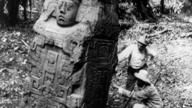
Image via U.S. Library of Congress.