A 1982 plan to build a nearly 640km long artificial river across Kansas — an infrastructural super-project that could cost as much as $US12 billion — is back on the table, according to the US Army Corps of Engineers.
Who said Big Government is bad — especially when it brings thirsty Red States their water? “We’ve got a tremendous amount of water in the east and only a small fraction of it is usable to Kansas at this point,” the executive director of the SW Kansas Groundwater Management District told the Salina Journal.
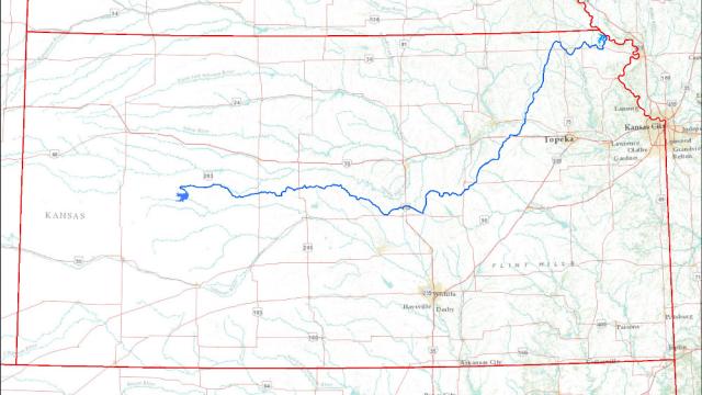
The water would be pumped from the Missouri River, and it would rise more than 550 vertical metres over the course of the aqueduct, cutting west through the Plains, two-thirds of the way to Colorado. Along the way, it would be impounded in “bank storage wells” and small reservoirs, and it would also be diverted to metropolitan regions, including Salina and Wichita. The ultimate goal, however, is agricultural.
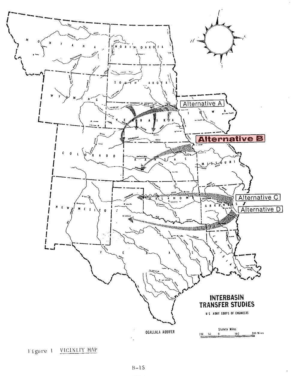
The plan, simply referred to as “Alternate Route B” in the original 1982 Army Corps report (available here as a PDF), would seek to guide the aqueduct along existing farmland and wildlife areas, snaking across the Great Plains. Alternate Routes, A, C and D, as you can see in the above map, would take very different routes, not even touching on Kansas state land but, instead, simply diverting water for agricultural irrigation in the greater west. The main issue is moving water out of the east, where there is “a tremendous amount of water,” and up — at extraordinary expense — to the Plains, where the farmers need it.
Of course, a great deal of the reason why this water is needed so badly in the region is because of unwise water-management practices that have lowered the water table consistently and dramatically over the past few generations. But that’s another story.
The delusional ambition of the project, meanwhile, and its wholesale redesign of the region’s watershed, on a near-continental scale, brings to mind another plan that always seems to reappear when long-term drought is on the horizon: a truly insane plan known as NAWAPA, or the North American Water and Power Alliance.
As Marc Reisner describes it in his book Cadillac Desert, NAWAPA would “solve at one stroke all the West’s problems with water”, but it would also take “a $US6 trillion economy” to pay for it, and “it might require taking Canada by force.” Reisner paints the scene for us:
Visualise, then, a series of towering dams in the deep river canyons of British Columbia — dams that are 800, 1,500, even 1,700 feet high. Visualise reservoirs backing up behind them for hundreds of miles — reservoirs among which Lake Mead would be merely regulation-size. Visualise the flow of the Susitna River, the Copper, the Tanana, and the upper Yukon running in reverse, pushed through the Saint Elias Mountains by million-horsepower pumps, then dumped into nature’s second-largest natural reservoir, the Rocky Mountain Trench. Humbled only by the Great Rift Valley of Africa, the trench would serve as the continent’s hydrologic switching yard, storing 400 million acre-feet of water in a reservoir 500 miles long.
In any case, the Kansas Aqueduct is absolutely tiny in comparison, meandering a mere 400 miles uphill through the center of the United States — but perhaps a sign of things to come when impossible water projects are voted to solve water shortages we all saw coming. [Circle of Blue]