Future versions of Grand Theft Auto — at least those set in Switzerland — could include a detailed and incredibly accurate 3D model of the Matterhorn for thrill-seeking gamers to explore, thanks to a swarm of drones that recently scanned, mapped, and photographed the iconic peak.
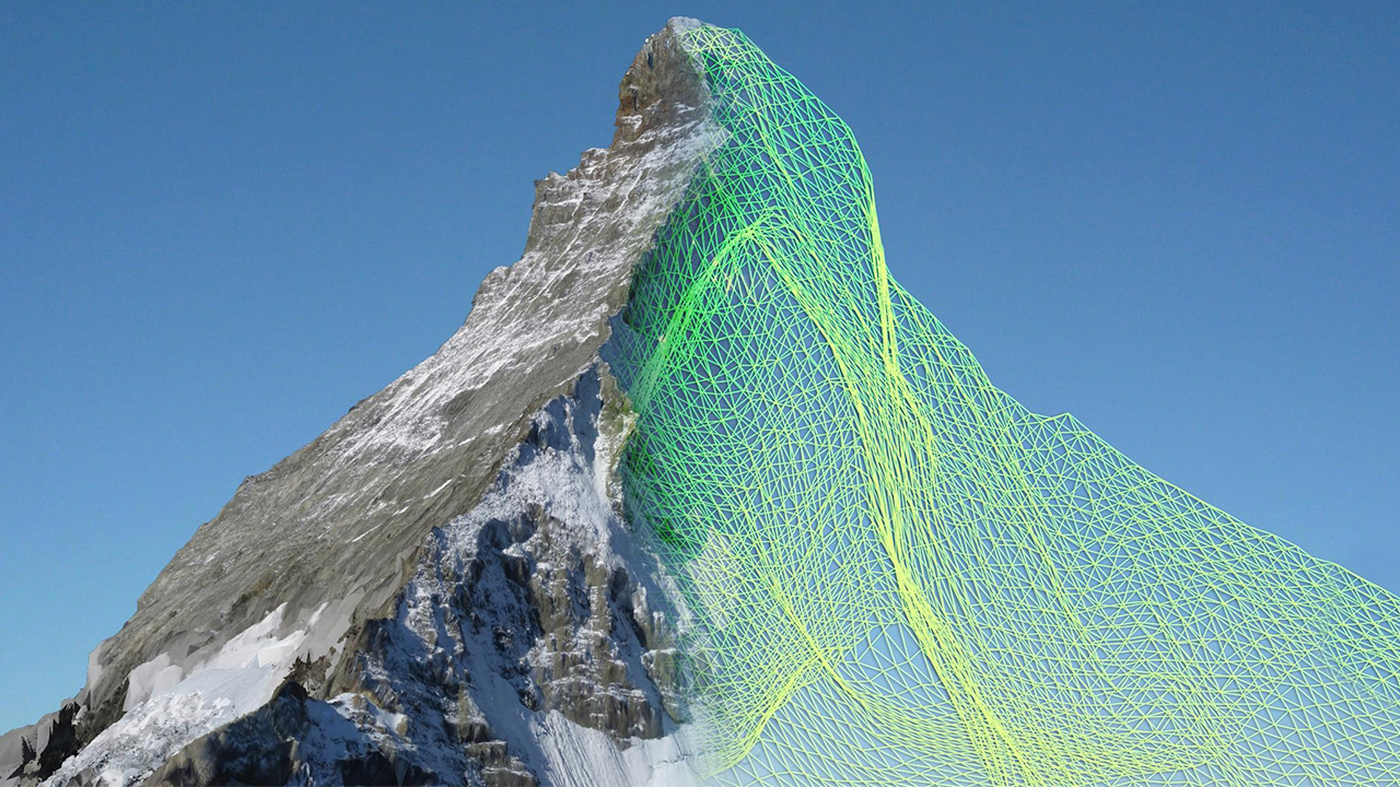
The lightweight autonomous ebees drones, developed by a company called senseFly, each spent about six hours circling the Matterhorn and photographing it from every possible angle. The fruits of their airborne labour was a collection of over 2000 high-res photographs that were then used by a company called Pix4D to analyse and construct an incredibly detailed model of the Matterhorn composed of over 300 million data points.
Even though the drones weren’t combing the surface of the mountain with surveyor’s tools, the 3D model that was created from their photos is claimed to be accurate to within about 10 centimetres. And that’s all the more impressive when you consider the mapping didn’t require a single human being to risk their lives by attempting to summit the Matterhorn. [EPFL]